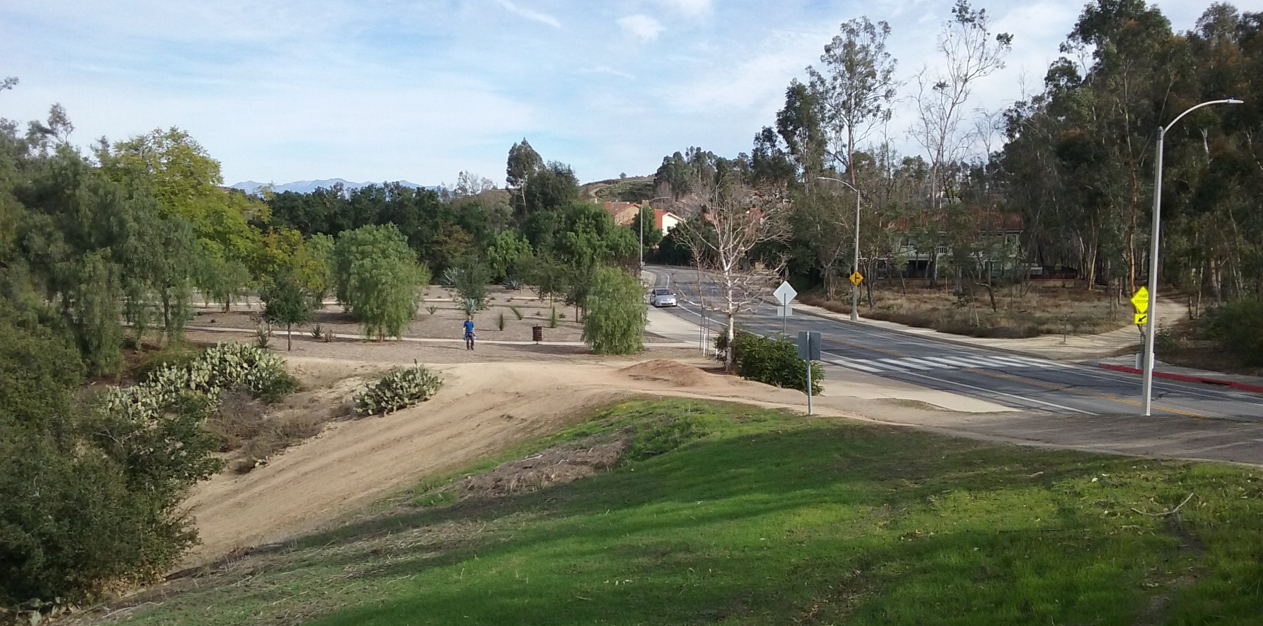
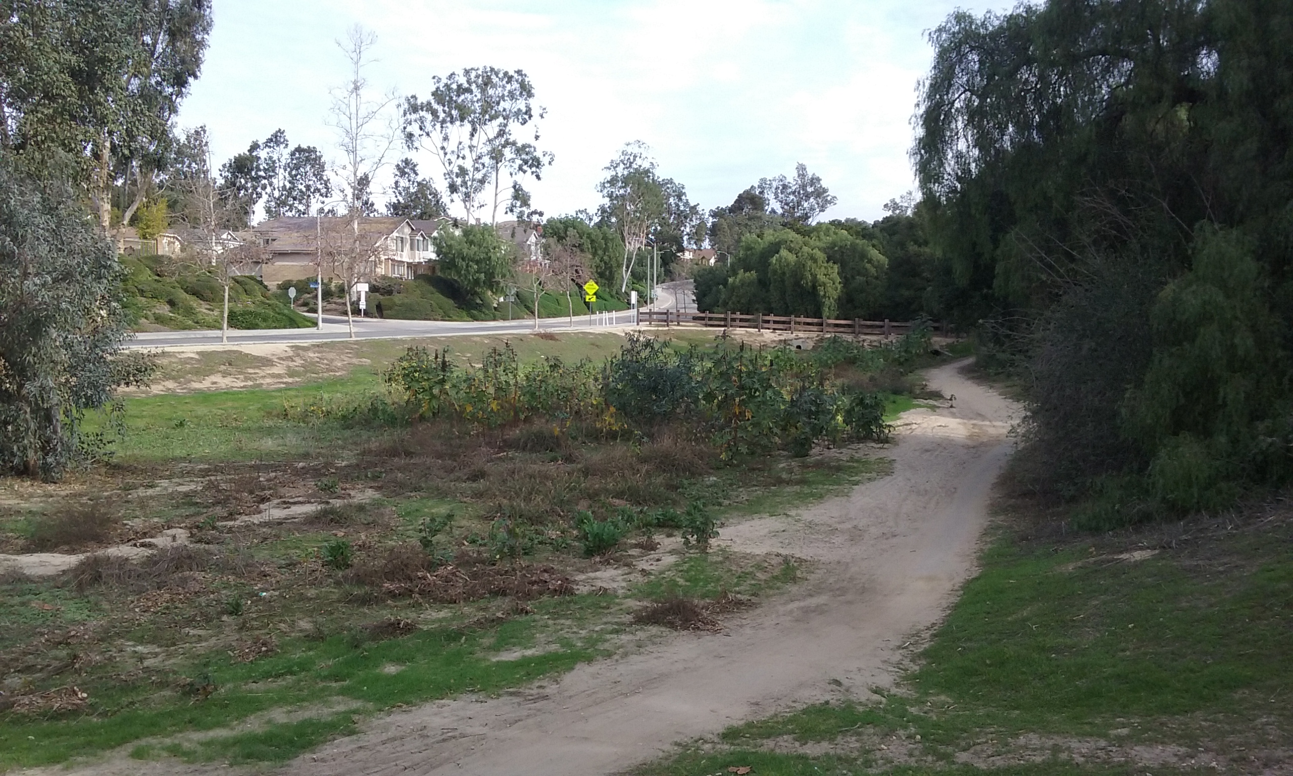
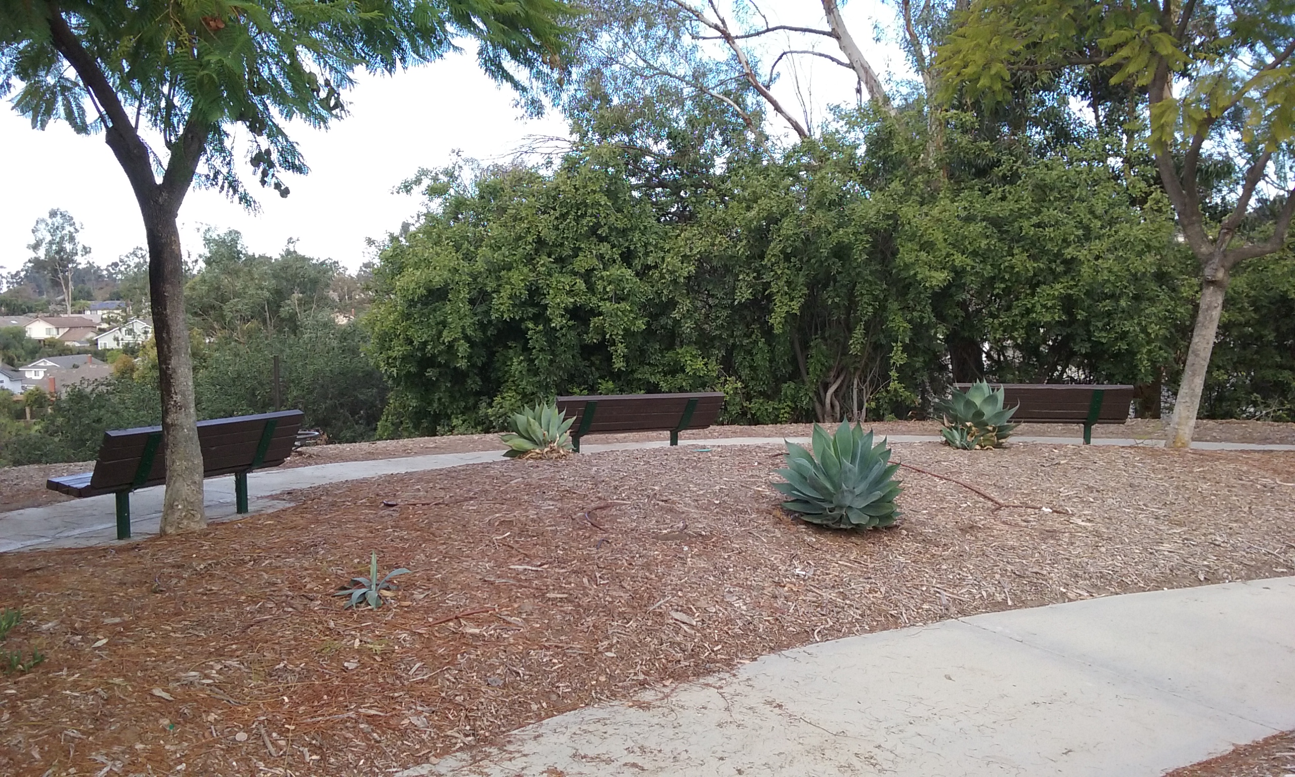
 Rosecrans Trail on the map includes the decomposed-granite sidewalk that goes for miles along side Rosecrans. But the most interesting part of the trail is just the part that is contained within Tree Park. It’s not very long but has the distinction of being one of the steepest trails that is shady the whole way down. The park has a Disneyland manicured east end (upper end) shown above. This is very visible as you drive by it on Parks Road, north of Rosecrans. And there’s room for dozens of cars on the side of the road. (It is 2 blocks north of Rosecrans on Parks Road. (Parks Road is 1/2 mile west of Euclid.) There’s even more parking on the other side of the street, to the right of the red curb in the picture above.The sign you can see from the road is simply “Tree Park.” But its official name is “West Coyote Hills Tree Park”. As described in detail later, there are a number of major trails that are available from this reference point. And because of the park benches, it is an excellent point for a group to gather before taking one of the several trails from here. (Castlewood, Rosecrans and Nora Kuttner)
_____The park is mostly unseen from Parks Road because it slopes down away from the road. It might be worth pointing out a bit of philosophy on parks. Like a golf course, they are usually in low parts of the landscape; flood basins where you can’t put a building. The upper part in this park, could have been a few homes but our Parks Department through the city council insisted developers leave some important (and expensive) space for what became the visible part of Tree Park. This is in addition to the lower part of the park where the developer couldn’t put houses on because it gets flooded. The city required the developer to put in a number of openings and culverts to the city’s storm drain network. Click here –>for more on trail philosophy.
The Up and Down Loop (1/2 mile)
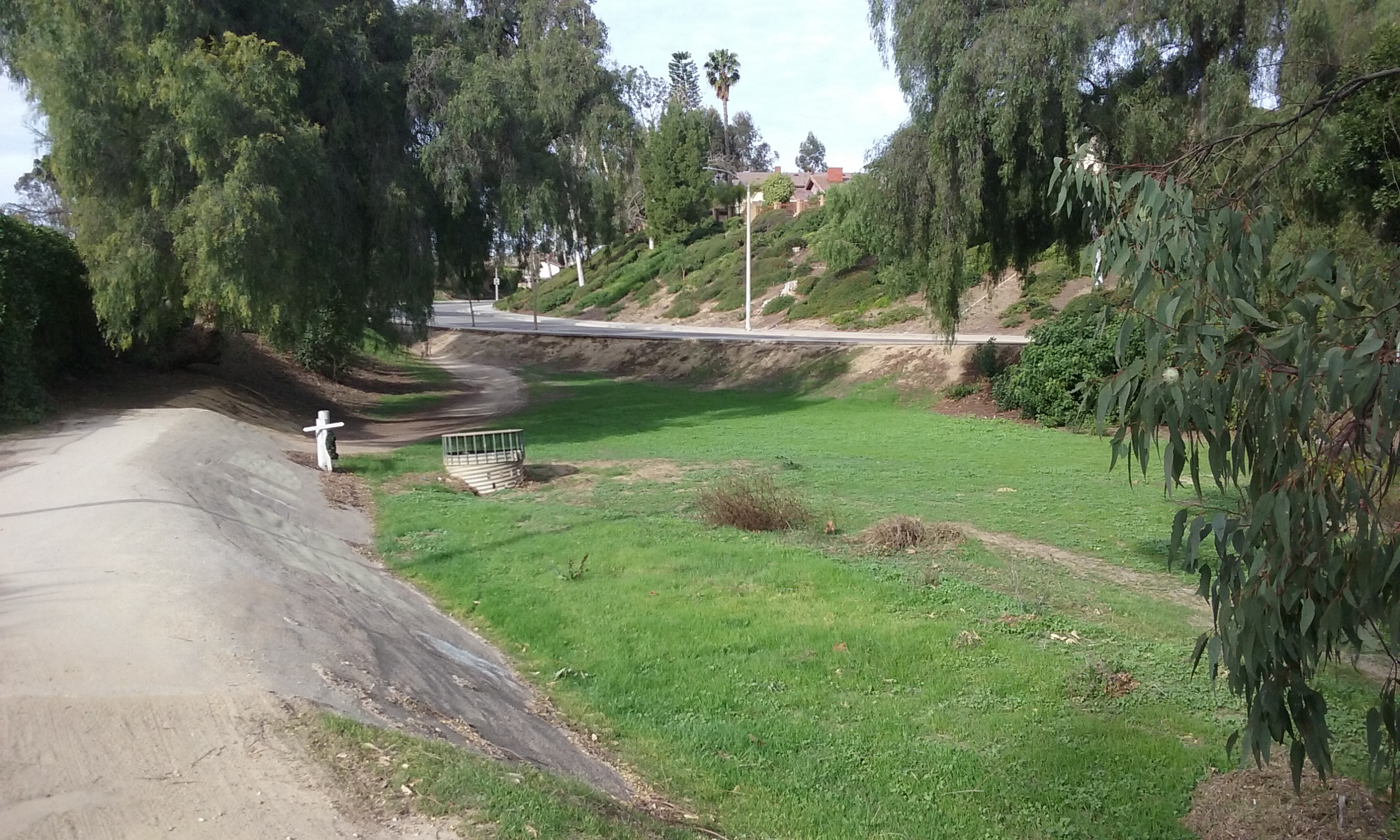
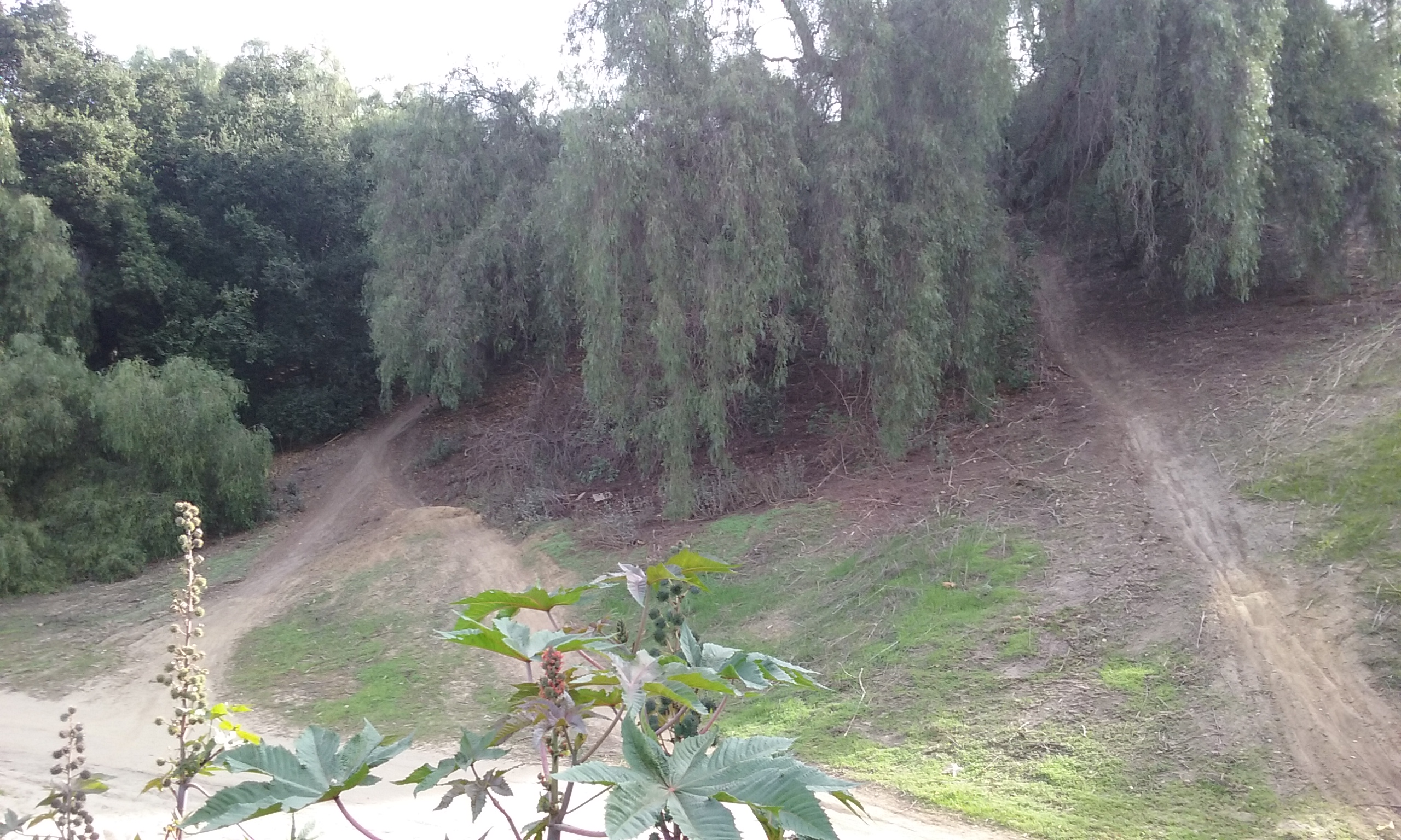
Starting at the top, there are actually two main trails down. There’s a wide one which is steep only at first. (The foreground of the photo at the top.) Then there’s one that starts further south and higher up. (It is gradual at first and then very steep at the bottom.)
____The wide one (photo at the top) is the safer one for bikers. Thirty feet down on the right is a less warn, very slender trail which the bikers avoid because of the low ceiling of the tree cover. It is really an ideal spot for a shaded picnic area.
The other main trail down, the one you to have climb up to (to start on) allows you to admire how well kept the grounds are. In particular the steep sides; the steepest sides of any park in Fullerton.
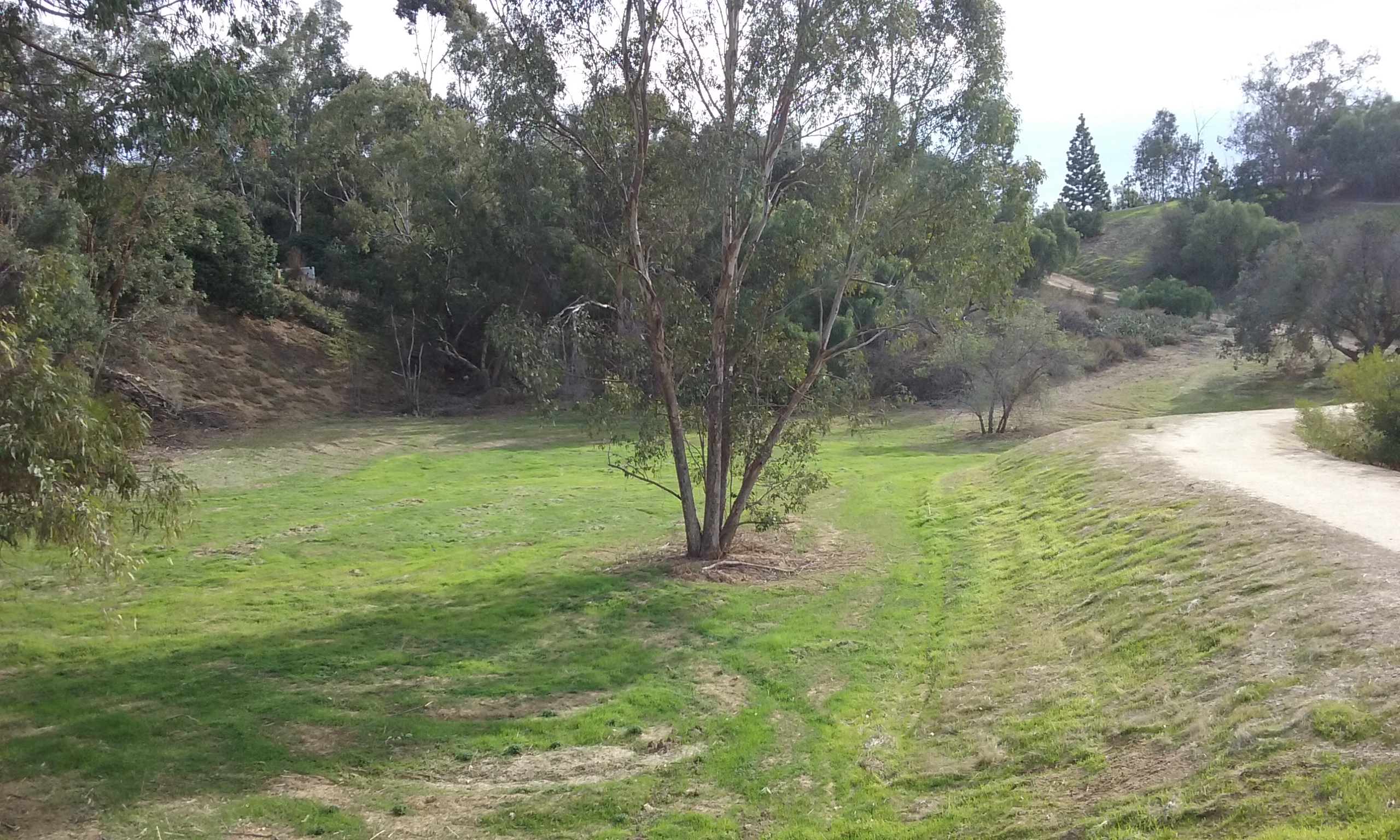
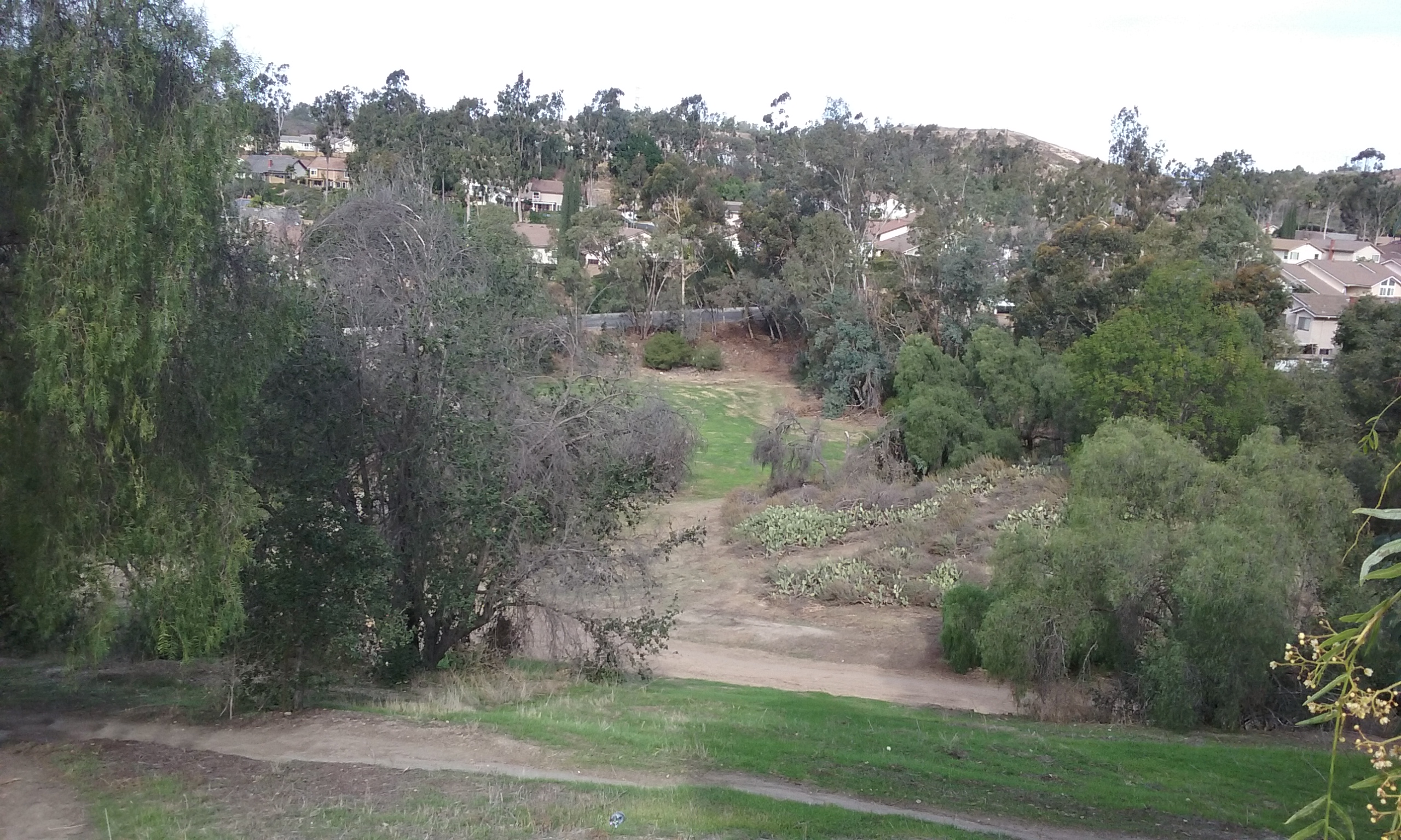
____Rosecrans Trail and the Tree Park that surrounds it, extends west to Coyote Hills Drive. The entire settling basin is dry (except during a storm) and the entire area is available to explore.
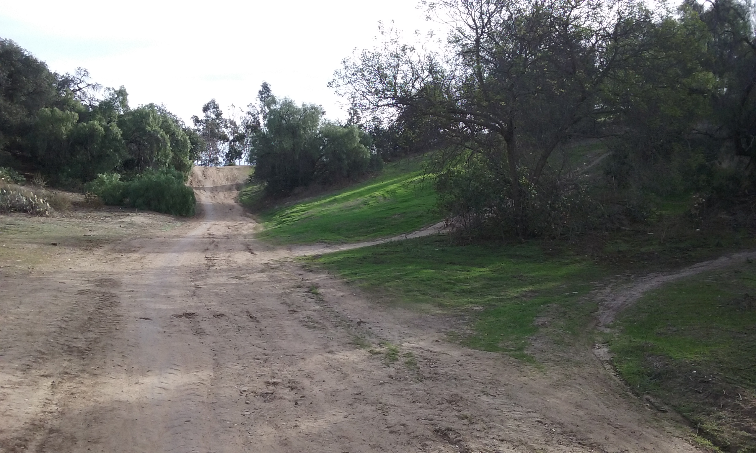
 The picture on the right shows how steep the higher starting trail is at the bottom. You have be careful even walking. Recently they added warning signs that prohibit bikers on this trail. But of course they seem to be misread by bikers to say “the ride really gets fun ahead.” At the bottom, if you walk north 400 feet you will encounter the bottom of the other wide trail. But in between are several bike trails that look like real fun. As a walker you will want to take the less-steep wide trail further on. That will make a loop of 1/2 mile. But the loop doesn’t encompass the whole park. The park goes another 800 feet north in what is obviously a flood basin. Click here to see the extent of –> Tree Park.
Out and Back to Rosecrans (.8 mi)
Described above was going north at the bottom. Going south at the bottom you will be merged onto a side walk along Coyote Hills Dr. The sidewalk later merges with a sidewalk that goes off to the left between houses to a wider sidewalk along Rosecrans Ave. But its a sidewalk path that leads to nothing really as a goal. (It is this wide sidewalk along Rosecrans Ave. that gives its name to the trail through Tree Park.) So stop right there before going on the noisy Rosecrans sidewalk. It’s .8 of a mile out and back . . . OK, it isn’t much of a walk, but there at the top do enjoy the excellent view south and east. It is of Buena Park cityscape; a view best seen on a morning walk.

East Side of Tree Park Loop (1 mile)
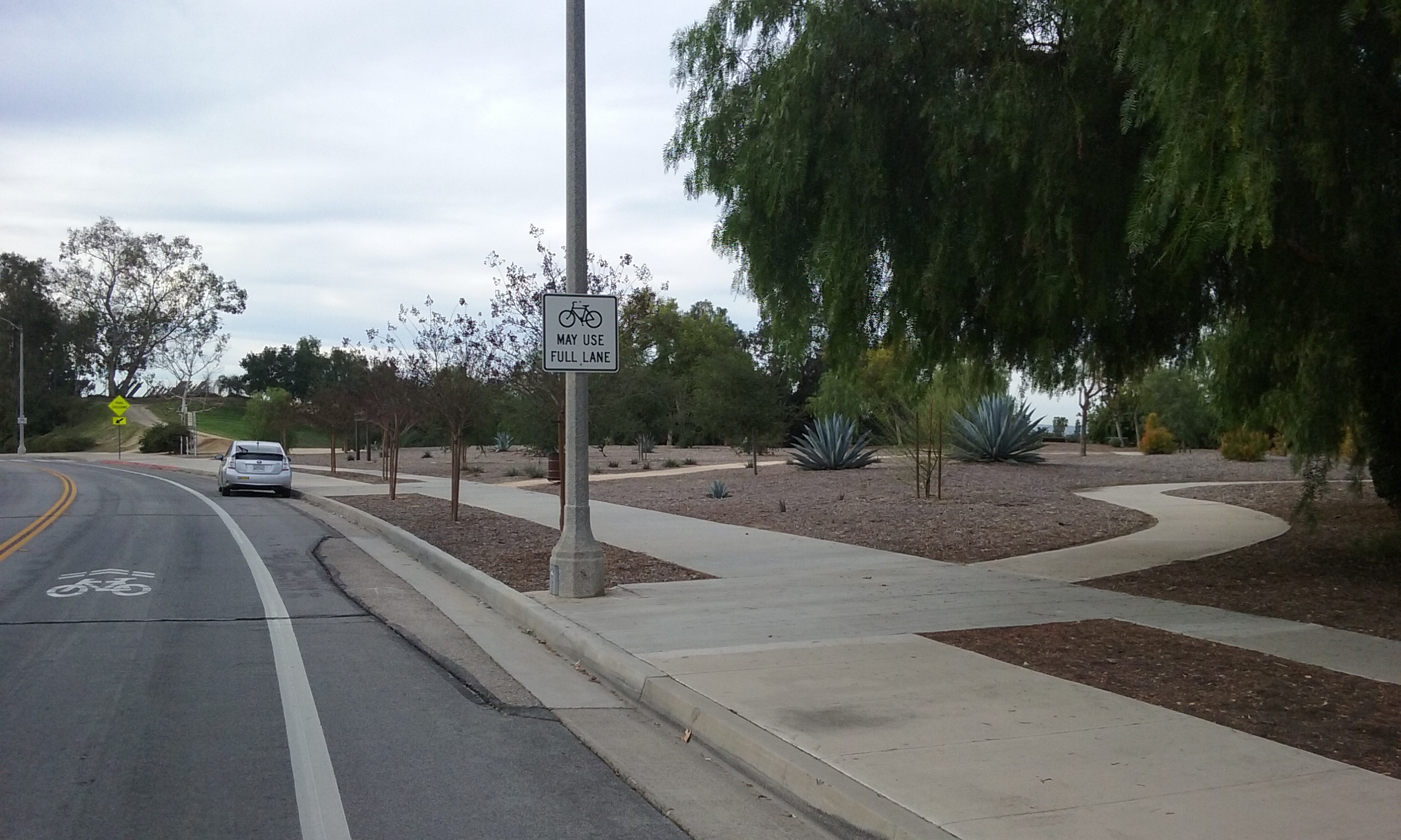
The above two descriptions are of out and back walks that are entirely west of Tree Park. Starting at Tree Park and going on the east side of Parks Rd. there’s a loop of about one mile. Starting again at Tree Park, cross Parks Rd. at the crosswalk. Here on the trail is called “Parks Road Trail.” It goes about 800 ft. north and east where it curves south to Camino Rey Street. You can see across the street the north end of Grissom Park. The trail there is a wider side of a water channel. It is somewhat uncomfortable because of its tilt. This goes the length of the Grissom Park; the longest park in the city. (The trail crosses Rosecrans and goes all the way to Bastanchury. The “Parks Road Trail” is covered in the webpage Astronaut Parks.) To make this loop only 1 mile don’t cross Rosecrans. Instead, walk west on the sidewalk of Rosecrans Blvd about a block to the sidewalk of Parks Rd. and then walk north back to where you parked. (Longer loops using this trail are described in the link above.)

A Loop that Goes Around Tree Park (1.6 miles) There is a larger loop of 1.6 miles that is more on dirt than sidewalk. The first half is like the loop described above. Cross Parks Rd. at the crosswalk and then go about 800 ft. north and east where it curves to the right to Camino Rey Street. Take Grissom Park Trail south. As before, walk west on Rosecrans but this time instead of walking back on Parks, continue on Rosecrans until you find on your right a curving sidewalk between the houses. That will put you on Coyote Hills Drive which you will take another block or so (north east) to a trail that leads to the bottom side (the bigger end of Tree Park). All dirt trails there lead up hill to where you left your car.

Tree Park as a Major Starting Point Tree Park is the starting point for Rosecrans Trail described above, but nearby are the starting points for three other trails. If you are going to walk in a group this park has the best parking and it has benches for early arrivals to wait on. Here are those trails:
1. Rosecrans Trail itself that goes down Tree Park.
2. The loops described above (the east side that goes through Grissom Park)
3. Nora Kuttner Trail is a thousand feet north
4. Castlewood Trail is an additional 1,500 feet west of the Nora Kuttner
Park Mystery
Most park mysteries have to do with some abandoned object like a pipe or a strange shape to the property. The mystery here has to do with admiring the work of the landscaping team. The hills associated with this park are almost like cliffs. Even the death defying bike trail goes down at an angle on the cliff face. So how in the heck do the landscaping guys do such an amazing job of clearing the weeks on the face of that almost-cliff?
Click on these pictures to see them as full screen versions.

Suggestions for Parks Department
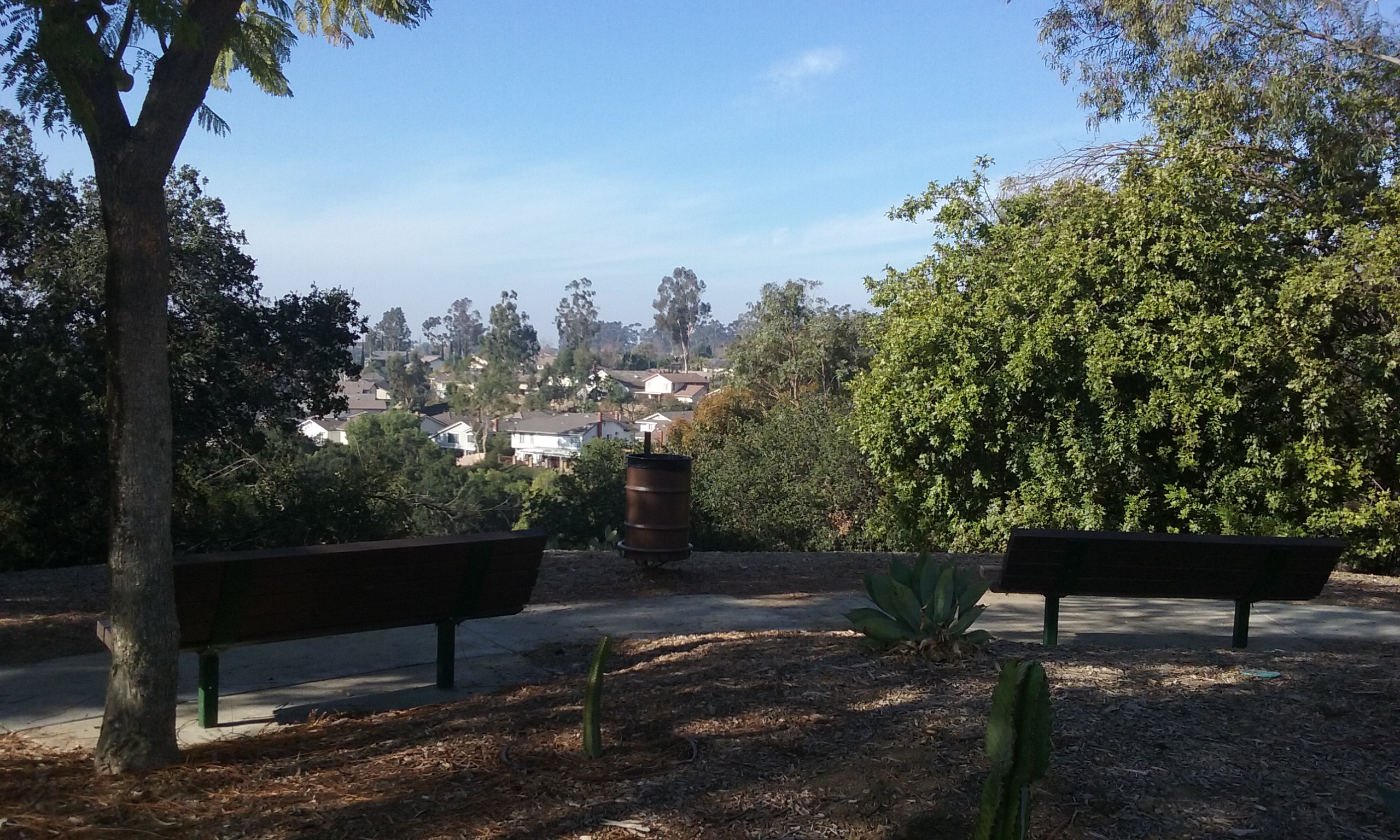
Trees have grown up to entirely block the view from the three benches that were bolted to concrete slabs 20 years earlier. The solution is to cut all the trees that block the view of the three benches. Or cut down at least one tree; the one in front of the south most bench. And then turn around the other two benches to face the park. It is good to remember that trees are to be maintained; views are to be treasured.
The name of this park, Tree Park, is because of a dense growth of trees between the main trail at the bottom of the park and Coyote Hills Drive. Unfortunately there’s decorative fence which appears to block entry. Homeless of course know about it. The picture on the left shows where the second fence stops at a natural entrance to this area. There should be made an opening in the first fence.
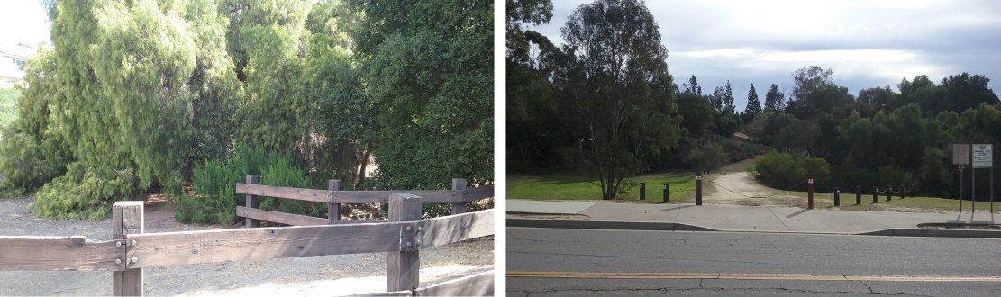
The other end of this grove of trees can be seen in the picture on the right. It is to the right of the main trail and there need be nothing done in the way of access to this end of the “real” Tree Park. On the left side of the trail (right photo) is .8 acres of just dirt. Trees planted here would continue the theme of “Tree Park”.