
That which unites the Grissom, the Chaffee and White Parks –the three astronaut parks– is a trail officially called “Parks Road Trail”. It is a very significant part of the famous 11 mile Fullerton Loop. Famous anyway among Southern California bikers. At one end Park Road Trail becomes Rosecrans Trail. This happens at Tree Park (the top red arrow). Tree Park is an important reference point for several other trails. It has plenty of parking, benches and a view. The other end of Park Road Trail, alas, doesn’t turn into another trail, there’s no view and no park there either. (The lower red arrow.) For the bikers, this lower part of the trail goes onto roads for a while. In fact this is the most confusing section of the 11 mile Fullerton Loop for them. Although there’s nothing of interest to walkers, just a block north parking is excellent right along the street, so this end as a starting point is pretty good. And it allows Tree Park with its great view south and west to be a worthy goal.
What is about to be described is a 2.2 mile walking journey through a section of the 11 mile loop for bikers.
After that there is a rather large photo gallery where the focus of attention is the three astronaut parks rather than the walk.
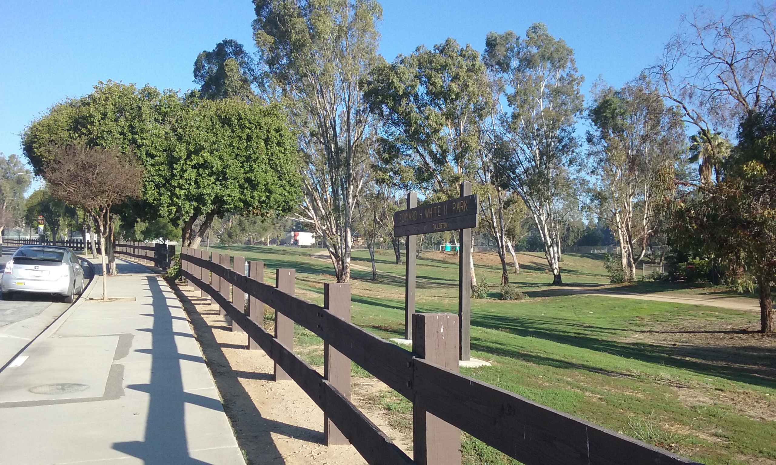
Starting at the south end of Park Road Trail, the goal is Tree Park 1.1 miles away. (For an out-and-back journey of 2.2 miles.) As for parking at the south end; find your way to Parks Road and Bastanchury. Go north a few blocks to where the Edward White Park sign is. Park anywhere on the park side of the street. Parks Jr High is your back up parking on weekends. (The official end of Park Road Trail is that confusing end near Bastanchury. If you are familiar with that neighborhood you can park on Peacock and Pheasant and enter the official start of that trail, picture below.)

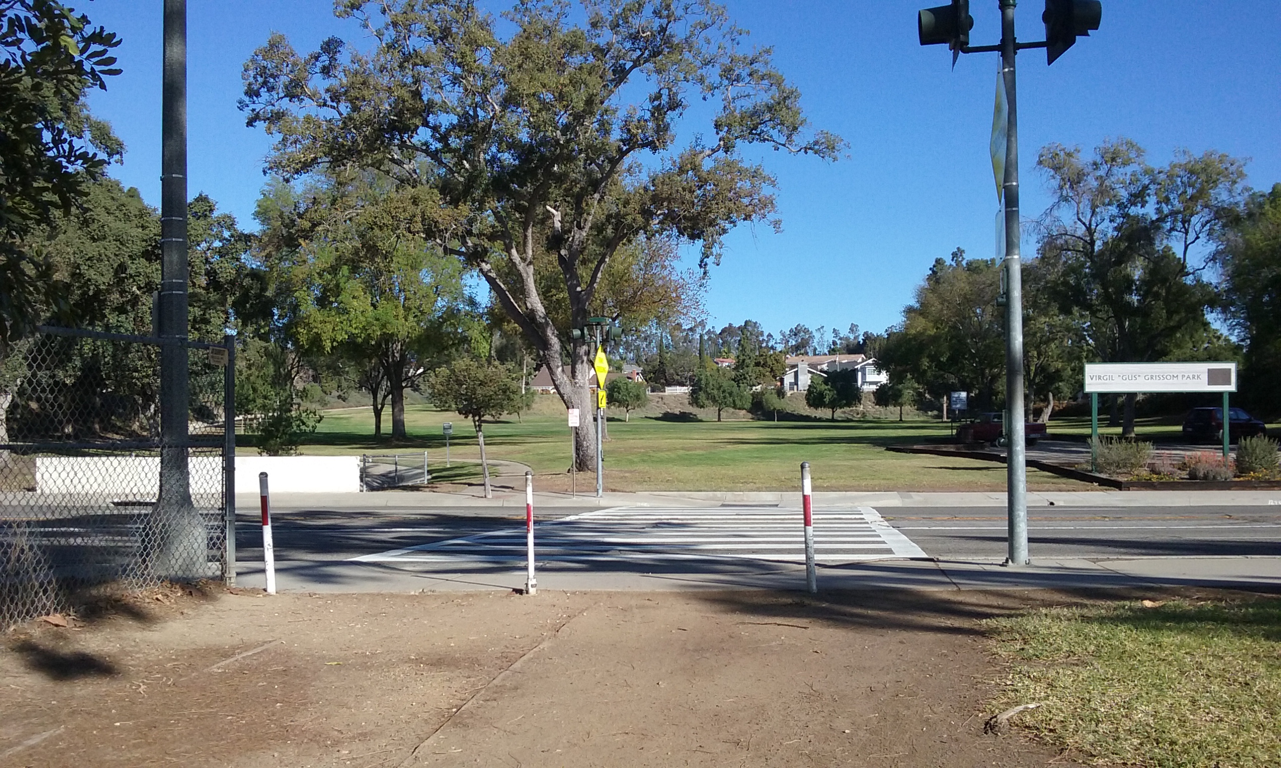
The official start of the trail (shown to the left) is very wide and marked with a decorative wood railing. The railing ends, or opens up to the Edward White Park and from there, there is only the path worn in the ground to guide you up to the east of the school grounds. You will then walk on a path guided by the schoolyard fence. The large lawn area on your left is Parks Jr High School’s soccer field. Before long you will see an opening in the trail on your right to another of the Astronaut parks; Roger B Chaffee Park. Chaffee Park is the smallest of the three but has the distinction of being the greenest and least used of the three. It is a pleasant blast of green to drivers on Rosecrans but because it slopes away from the road, they see very little of it. The trail uphill north is interrupted by Rosecrans. Crossing there, you enter Grissom Park which is the largest of the three. (Chaffee, White and Grissom Parks were named after the three astronauts that lost their lives in Apollo 1. Click here –> for a picture essay about Apollo 1.)
Just as a philosophical reminder, in case it occurred to you that having three parks near each other in one end of town seems dumb . . . parks and trails are left-over property. Cities could never afford that much land if it wasn’t in someway of little value to developers. Parks and trails may seem like the purpose of life to us, but it only takes a second’s observation to see how few people occupy so much land to realize that the highest purpose of a park is just knowing it’s there. And that can be appreciated by just driving by it. And those that drive by it, are for the most part the tax payer who pays for its upkeep. Click here –> for more on trail philosophy.
 Invisible Trail Park (a bit of philosophy you can skip)
Grissom Park is the longest “lawn” park in Fullerton. There’s two trails that go uphill within the park. They are only inches apart so it begs an explanation. One is a very narrow dirt trail that is hard packed by thousands of bikers and walkers. It is right next to an expensive asphalt trail that no one ever uses. (Park architects are famous for not knowing how they look from the ground many years later. And they only see the park they are designing from the equivalent of 1,000 feet high. They can’t resist making it look good with concrete. This–> example of dumbness you will be glad to know is not in Fullerton.) Bikers don’t use the architect’s trail on Grissom Park because they complain that the tilted asphalt tears up their tires. Walkers don’t like it also because it is tilted.
____There’s a fascinating third alternative; walk on the grass anywhere on the full width of the park, like the mom and daughter in the picture above. This is what happens automatically on a golf course. Golfers walk to the random places where their balls land. This would result in a park with an invisible trail. This is unlikely going to happen but it is presented here to illustrate what the Sierra Club advises hikers to do in areas they are exploring that doesn’t have a trail. Normally having no trail can be very disconcerting; not knowing which way to go. But here it is clear which way to go because the park width is less than its length. The park gets narrower where it can’t helped but to have a trail. At that point, every effort should be to get on a trail.
The 2.2 Mile Walk Continues
Just before leaving Grissom Park is a rather steep climb. The trail continues across a street still going up. Now it becomes a real trail, with dirt and ruts that makes the walk real. The trail curves to the left a lot, eventually heading south and west. You will emerge at Camino Del Sol. You could jaywalk from there across Parks Road to Tree Park, but instead stay on the east side of Camino Dell Sol and continue on the trail past one more house where there’s a crosswalk across Rosecrans. Cross there and find your way to the park benches that used to have an incredible view. They had a fabulous view when the park was new, but the trees were watered there and now entirely block the view. Three benches, cast in concrete with no view whatsoever. Not even the sky is seen unless you tilt your head back. There are other trees that block the view of the rest of the park. In fact most of Tree Park can’t be seen until you are well along the walk down there. The trail down is named Rosecrans Trail. There’s now two trails down, thanks to the pioneering effort of the bikers. The one maintained by the city is wide and steep at first. The other starts higher up (to the south) and gets steeper at the end. Tree park is a low spot that naturally catches rain so the shrubs and trees are amazing there. Wander about as much as you like. The official path of Rosecrans Trail continues on as sidewalk, but there’s nothing as interesting as Tree Park. So if you turn around at the bottom of Tree Park it’s 2.2 miles out-and-back.
Click on the pictures below to see them full screen.
First, Edward White Park


Roger Chaffee Park


Gus Grissom Park


Suggestions For Parks Department
There’s a decorative wood fence at right angles to the trail at the south east corner of Parks Jr. High. It is an excellent definer of space for the trail and quite visible from a long way off because there’s no trees blocking the view of it. But that decorative fence also brings attention to a triangular space that is dying to have something there. 33°53’24.3″N 117°57’03.9″W. That would give the decorative fence a reason to be there. How about large decorative rock or a plaque which tells the origin of the three park names.
There is a kind of grand entrance to the Park Road Trail where N. Peacock Lane crosses Parks. A block or so farther up is a divide in the trail with no advice whatsoever. 33°53’12.8″N 117°57’04.0″W. This is a major trail divide which kind of demands some attention. How about a sign that says something like “Left to Pioneer Ave Trail, Right to continue Parks Road Trail”.
Please find a better name for the trail besides Parks. There’s too many things called parks. Let’s see, a trail that goes through all three Astronaut Parks. Gee I wonder what we can call it.
The asphalt trail that goes the length of Grissom Trail is an excellent example of what never to do. Never tilt rough asphalt expecting it to be used by people. When asked of a biker why you don’t use it, they all say the same thing. Tilted asphalt tears up the tires. People who walk much prefer dirt or grass. The problem is the constant angle of tilt. Rough ground may have greater tilt angles, but it doesn’t put the load only on one side.
This park might be the best candidate to be a “Park with an Invisible Trail.” We could put up a sign similar to the signs the Sierra Club puts up on wilderness areas; that say
“Note To Walkers: Try to walk the length of the park
avoiding any place where a trail seems to be forming.”
Edward H. White Park is the least developed of the Astronaut parks. It is free of weeds, which takes some maintenance, but appears to be an uncared for park. It has potential for being the most beautiful park because of all the tall trees. When it comes to judging what park can have its green grass restored it should be realized that not only is this park seen by commuters on Parks, but the trail through this park is part of the Fullerton Loop. . . several hundred bikers per day. But in the mean time, can the park while it is just dirt, be used for people to play Frisbee Golf?
Just south of Parks Jr. High running track is a very flat area that is in the Edward White Park. Its flatness just begs something be done with it. How about a public use putting green? I interviewed the general manager of Fullerton Golf Course and he said putting greens are terrible for maintenance and regular grass doesn’t roll right. He said there is an artificial putting green material used by miniature golf courses.
I think having decorative entrances to trails are very important. A decorative fence, visible from the road that marks the start of a trail is all you really need. It needs to be only a few dozen feet long. This much fence works better than a sign. There’s a perfect example of that across from Tree Park where Parks Trail ends or begins. 33 53 53.0154 -117 57 8.2836 Alas it is buried behind brush. I think the brush should be removed and bark laid down to keep it bare. Again. No need for a sigh. Just make the short length of railings visible.
Above Grissom Park, a hundred feet or so above Camino Rey (geo location 33 53 54.8556 -117 57 3.9715) is a section of trail where the U-channel is above the trail. The trail has of course become the conduit of water forming a meandering of ruts. But instead of getting several tons of dirt to raise the trail up, how about instead remove about 20 feet of the U-channel where it is above the trail and direct the rut that exists there now to empty into where the U-channel is lower than the trail. This improvement is not really necessary from the standpoint of safety, but it is something of an embarrassment to have such a terrible mistake in design so visibly obvious. What we have no is a concrete sign that says “a dumb shit made this.”
The main entrance to Grissom Park on Rosecrans, is something of a designated place and not just a sign along a trail. There’s a parking lot there which make it look like a “place.” After a long walk from either direction one is disappointed to find nothing to sit on. It sure would be a wonderful and welcoming sight (even if not used) to see a park bench there.