 This webpage is mostly about the park. Hit the Page Down key four times to get to the description of the walks.
____This park, Tri-City Park, Clark Park and Carbon Canyon Park are county parks in the Fullerton end of the county. You can tell in an instant that there’s a bigger budget for maintenance. It is full of sidewalks and it is so carefully manicured. City parks are this well groomed only if they are small. The large areas under the city Parks Department are more in the way of preserves. The kind of parks this website celebrates are the preserves and parks that are the beginning of trails that are dirt and rough. Not this kind. Orange County parks all have an educational aspect to them in that there are signs which teach and there’s at least one park ranger in each county park. A park ranger has college degrees in one of the natural sciences and are eager to answer questions on the flora and fauna of their park and the surrounding area. I have found though, that guys in county trucks who maintain the parks are pretty knowledgeable too.
____Most county parks have events or science lessons. This park has concerts and movies in the summer. (For science lessons click here–> Clark Park to see what’s available there.) All county parks charge $5 ($3 on week days) to come into the park with your car but no charge for those who walk in. They don’t even care if you walk in before the park officially opens. The $5 charge is not just for parking though. You can drive around in the park to the various sport venues or any of a dozen places to picnic. Bringing your car in allows you to bring picnic stuff or play equipment.
Hours
There’s no closing of gates for those who walk in, but since this park has staff, they would like even hikers to be observant of hours they are open. In the summer, 7:00 AM to 9:00 PM. To be sure–> http://www.ocparks.com/parks/ted.
____For walkers, the list of sports facilities may be of little interest. (It’s a lot, by the way; check this out . . . http://www.ocparks.com/parks/ted/amenities) There’s a mix of dirt and concrete trails, so this park is pretty good for those in an electric wheel chair.) Described here for Craig Park are a couple of interesting walks for those of us into dirt trails.
First, parking…
Parking
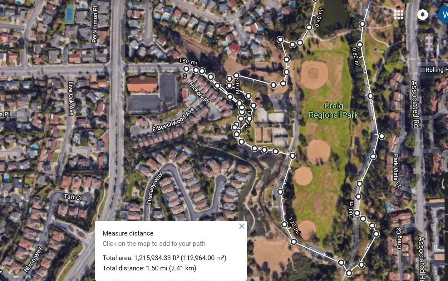
The $5 per car entrance is on State College Blvd about a block south of Imperial. But walking in through that same entrance is free and the most popular parking for that way of entering is alongside State College. It fills up fast but there is also parking north of the entrance in the lot behind Cocos on Imperial. A quieter way in which also has street parking is Rolling Hills Drive on the other side of the park. It begins at Associated Road a 1/2 mile south of Imperial. But for parking that includes something of an adventure read the following…

Making the Walk From the Parking Lot Part of the Experience
For those who find the walk the main experience, parking far from the park adds to the fun. There’s two interesting ways in. You can walk between houses into Craig Park from a cul-de-sac of Rolling Hills Drive (off of State College). From State College and Bastanchury go north on State College to the second right. The No Parking signs are kind of tricky. Be sure to read the time they are good for. The trail into the park is concrete but leads to a Native Plants Habitat display. The labels even describe how natives used them.
There’s an even longer trail into Craig Park starting at the Summit House Restaurant. Their parking is shared with the Parks Department. (The restaurant is actually on Parks Department land; they rent it from the city.) You can get there from either Bastanchury or State College. Park in the back lot. Find your way walking down hill (north) to the sidewalk on Bastanchury. Walk up (east) to the corner of State College and Bastanchury. First cross Bastanchury to check out view from Mountain View Park. Cross State College to the gravel trail that goes down (north) along State College the equivalent of a block and a half. You can’t miss the trail that leads into Craig Park. It is another block or so where the trail becomes dirt as it enter the park.
Walking in Craig Park
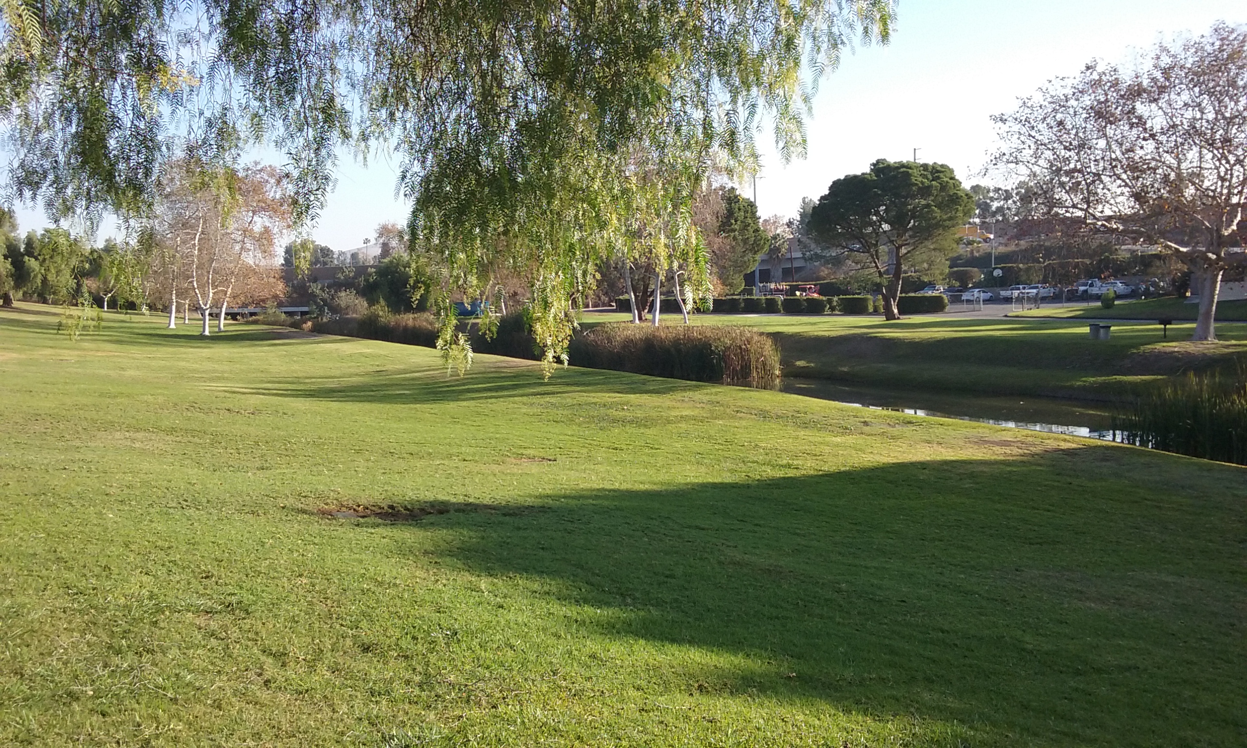
The walk continues to the right but describing where to go next is difficult to explain because there are so many choices. If your goal is to make a large loop, choose the path that is furthest from the center of the park. Other paths will take you closer to the duck pond or further south to a large grass field that in the winter is host to hundreds of geese.
____There’s a phone operated nature walk. It starts near the main entrance where the trail going south starts. You phone the number given, listen to a recording and put yourself on hold (the pound sign) between markers. Of course, on your own you can appreciate the ducks and the geese and the grass. There is always flowing water into and out of the lake.
The Lake
A three-acre lake is stocked as are the lakes in the other two county parks (Clark Park and Tri-City Park). Fishing for catfish and bluegill is allowed with a California Fish and Game License. For more information on fishing licenses click here. Launching of model radio-controlled sailboats is also permitted.
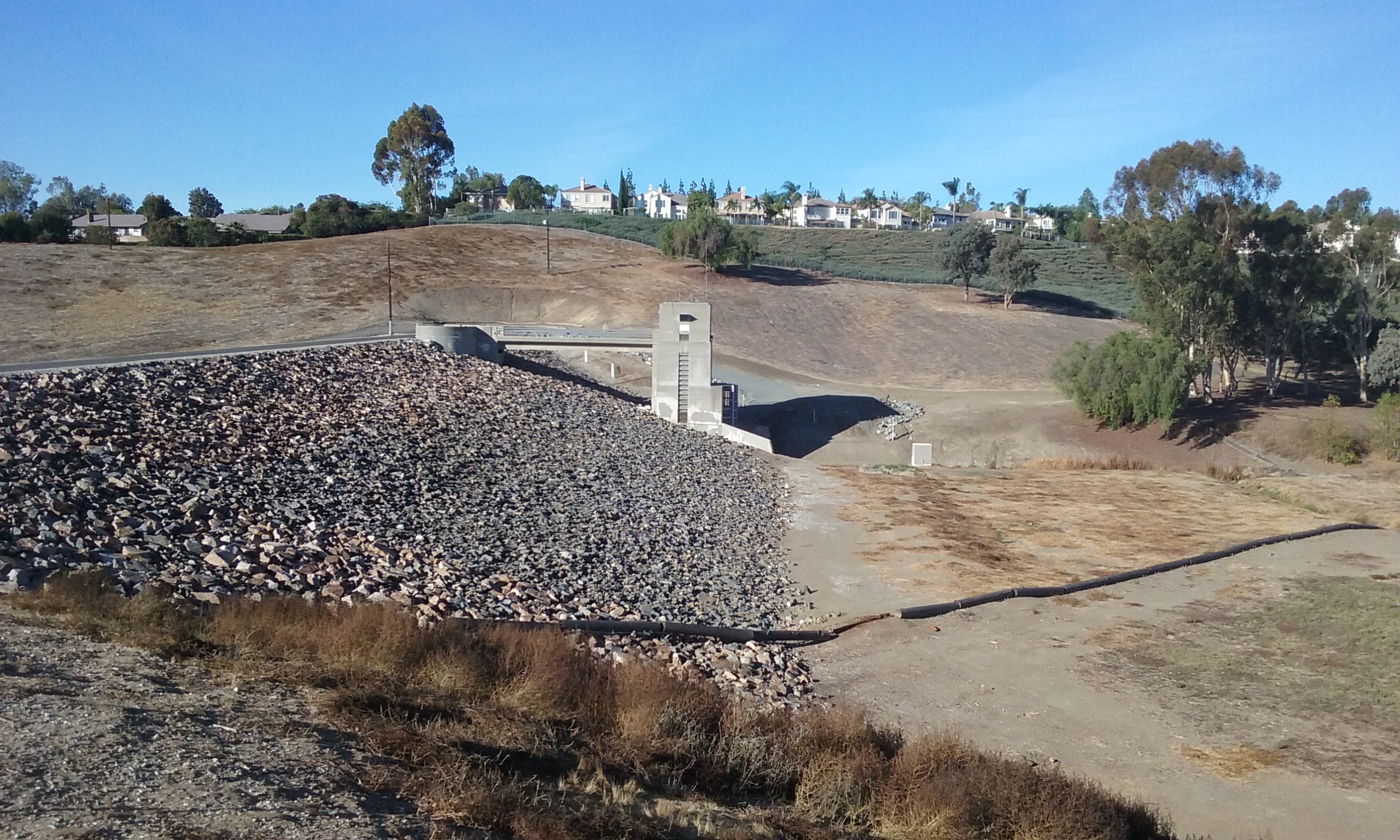
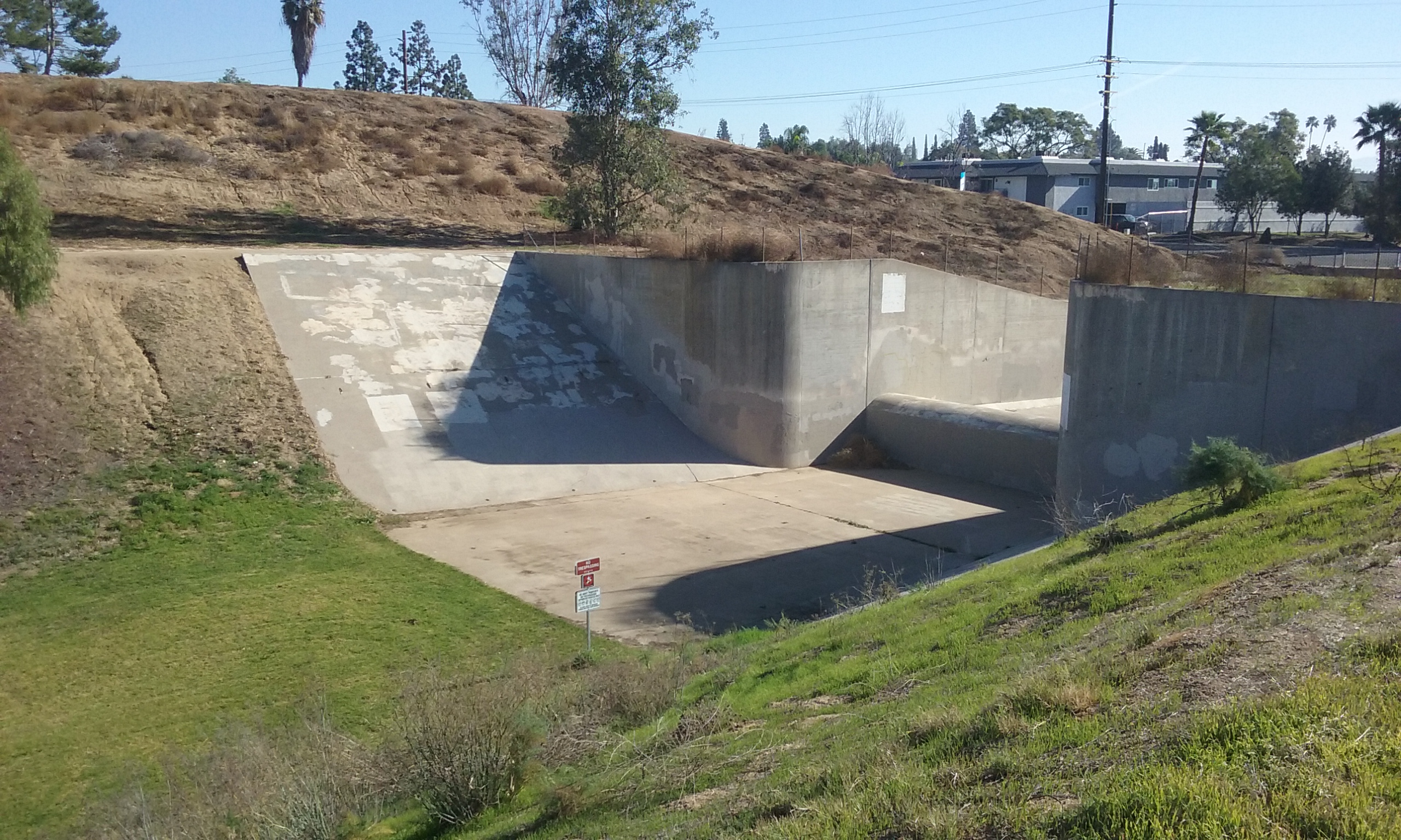
What Keeps the Lake at a Constant Level
On the south east end of the lake there is a small building which makes a constant drone noise. That’s the pump in a kind of processing plant to keep the water clean and circulating. When the water level gets low water from the Fullerton water district goes in. There is water coming in from the north on two streams. Normally there is more than enough coming in to keep up with evaporation from the northern neighbors runoff. That excess goes over the dam that is next to the pump house. The most interesting part of the lake (for an engineer anyway) is that small dam, not the pump house. That is an example of a type of dam; the weir dam. The purpose of a weir dam is to keep the lake at a constant height. The most noticeable thing about a weir dam is how wide it is and how shallow the flow over it is. A wide and very flat flow can be hundreds of gallons an hour when the flow over the dam is only one inch thick. The free board is said to be one inch. When the flow doubles, the free board is only one inch thicker. That way the height of the lake is constant (+/- an inch) no matter what the flow. Historically weir dams established the usefulness of “mill creeks” where that flow had to be the same all year long for all the grist mills downstream. The water over the weir dam was variable and thus not used by the mills. The streams that tap from that constant level lake are the ones that went to the mills below the lake.
Animals in the Park
The ducks and geese and fish . . . all the friendly animals you see in the park are actually wild animals. Nature of course takes its course, so sometimes the animals do get eaten by predators. However some of the biggest threats these animal residents face is often a result of human visitors. Park staff makes an effort to protect these animals from human interference such as getting caught in fishing line, eating human food, and being injured by dogs off leash. All visitors are encouraged to admire and photograph the wildlife they see from a distance. Many visitors like to feed birds, but it is bad for them to eat human snacks, including bread. They have plenty of worms, fish, and grass to eat in the park. Even when making an effort to feed birds food that is healthy for them, it can still stop migration, cause overpopulation, spread of disease, and make the birds so comfortable around humans and vehicles that they are more vulnerable to people who would intentionally wish them harm.
Your Animals In the Park
Everyone is good about keeping their dog on a leash so as not to chase and possibly cause injury to the wild animals in the park. It is also important to remember not to leave behind any trash, food, or fishing line. People also often try to drop off unwanted pets in the park. This can be dangerous to the pets and also detrimental to the ecosystem in the park. The California native western pond turtle has become vulnerable to extinction due in part to competition from red eared sliders that have been dropped off in most local lakes. Domestic rabbits are often released into the park by people who think they are setting them free. However these rabbits stand out to predators and do not hide as well as native rabbits. If park staff are unable to catch them, it is unlikely they will survive more than a few days.
Cottonwood Loop
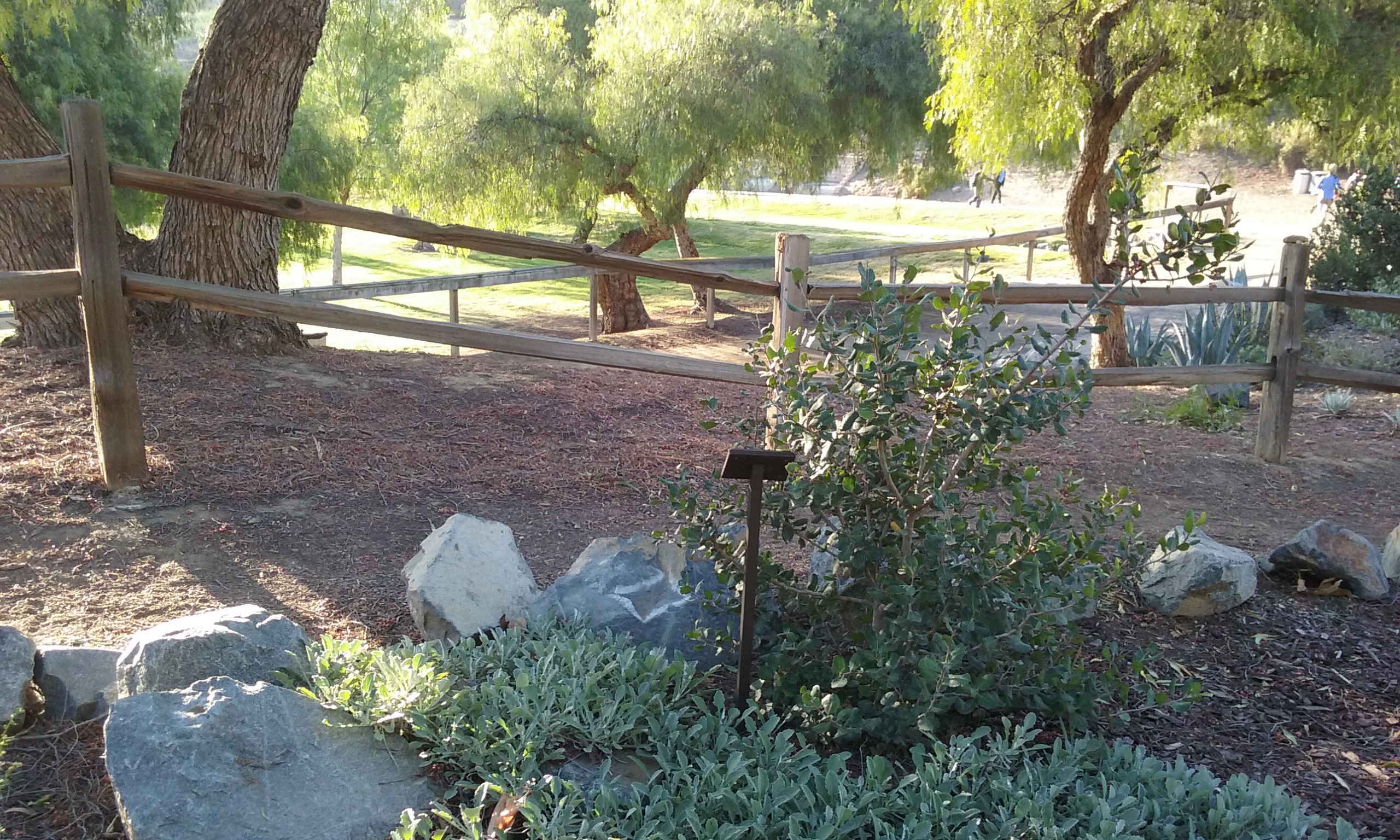
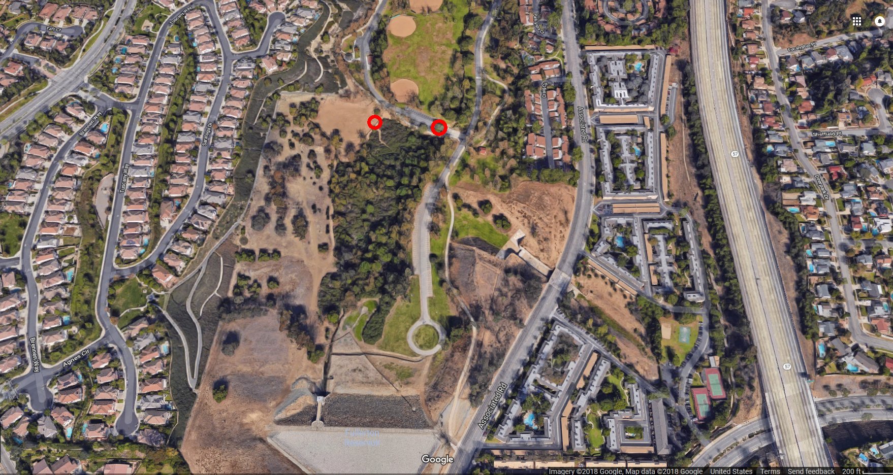
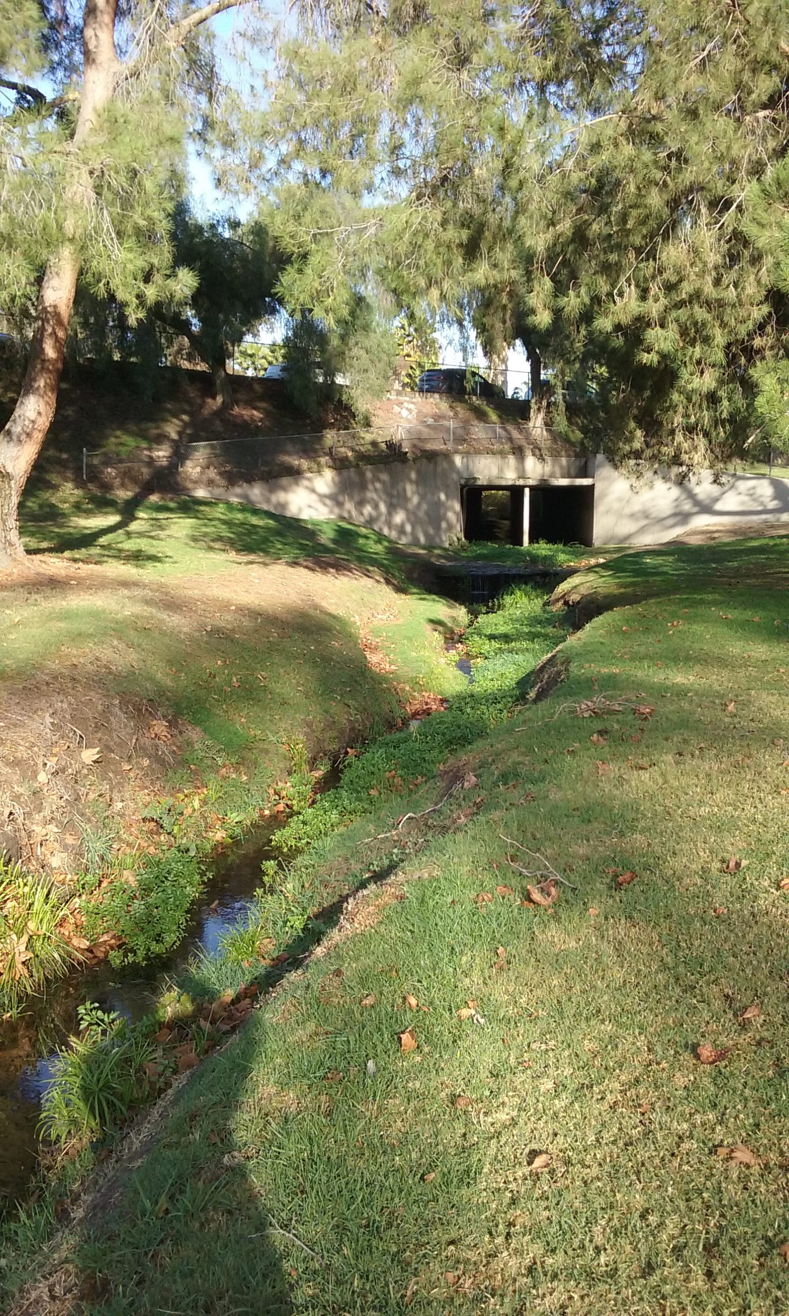
For walkers, this small journey will make your day. It is way into the most bottom point of the park where in the summer runoff water from Brea homes gathers and barely makes it to the dam. It is something of a grotto in that you are under a canopy of foliage. The sign to enter can be seen where the park’s main road goes farthest south before turning back. The right red circle in the aerial photograph is the entry to “Cottonwood Loop.” Once inside the grotto, the loop is very hard to follow because people have made exploratory journeys throughout. What makes it especially hard to follow is also what makes it so charming; it is so overgrown with vegetation that you cannot see out to get your bearings. Even the sun angle is hard to ascertain. Use the trick mentioned above; choose the path that is farthest from the center for the longest journey. Fullerton Creek flows through this overgrown area and even in the driest times of the year, it is a babbling brook.
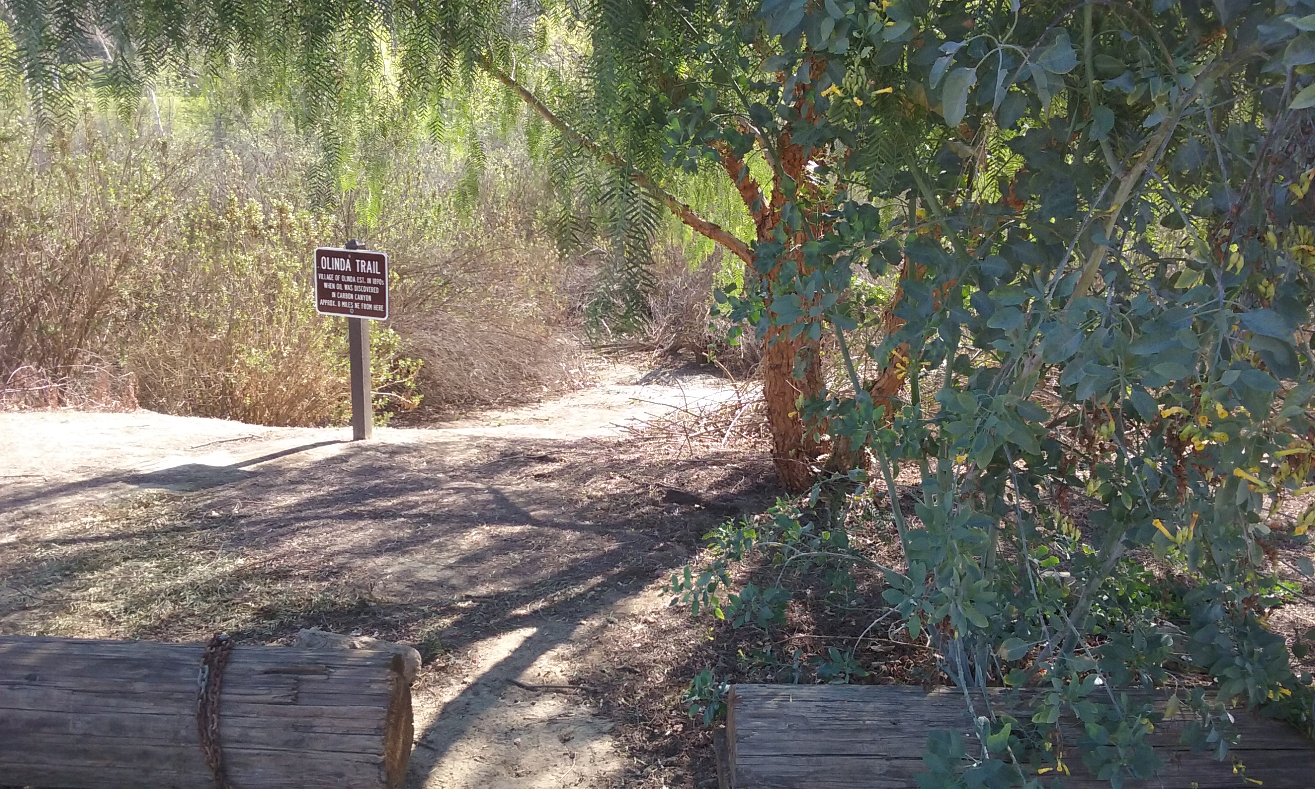 Olinda Trail
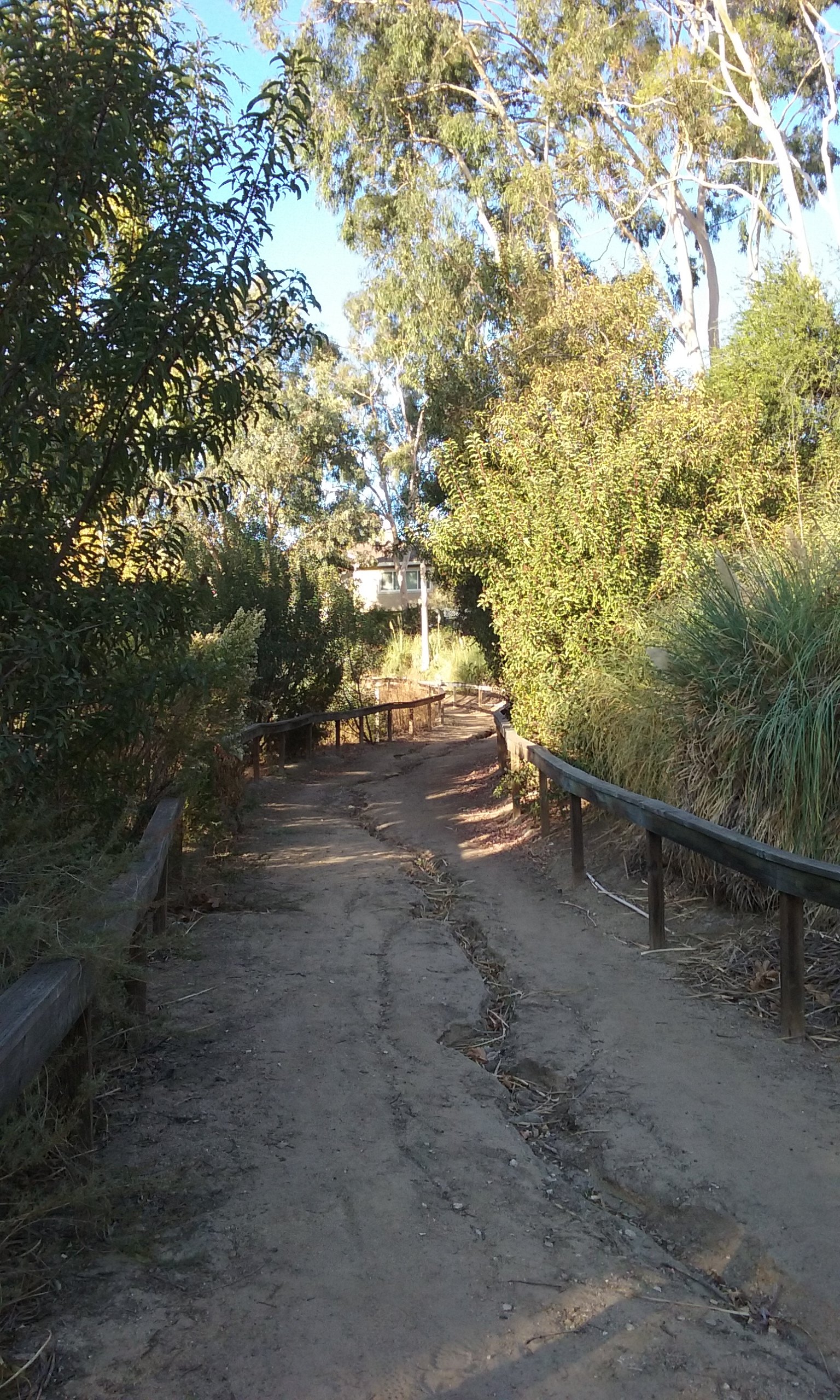
Another trail that is well worth the trip into the park is a dirt trail named Olinda Trail. (The left red circle in the above aerial photograph.) It is in the same low spot in front of the dam as the Cottonwood Loop but the growth is more all around you and less on top of you. If you like to not have your horizon or the sky blocked, you would prefer this one over the Cottonwood Loop. It is certainly different foliage and the trail is dirt instead of a layer of dead leaves. The ground is extremely porous; soft like a sponge. Because of the type of soil and being so close to the water table, the entire length of this trail will be muddy for even weeks after a rain. But heck, that’s part of the experience.

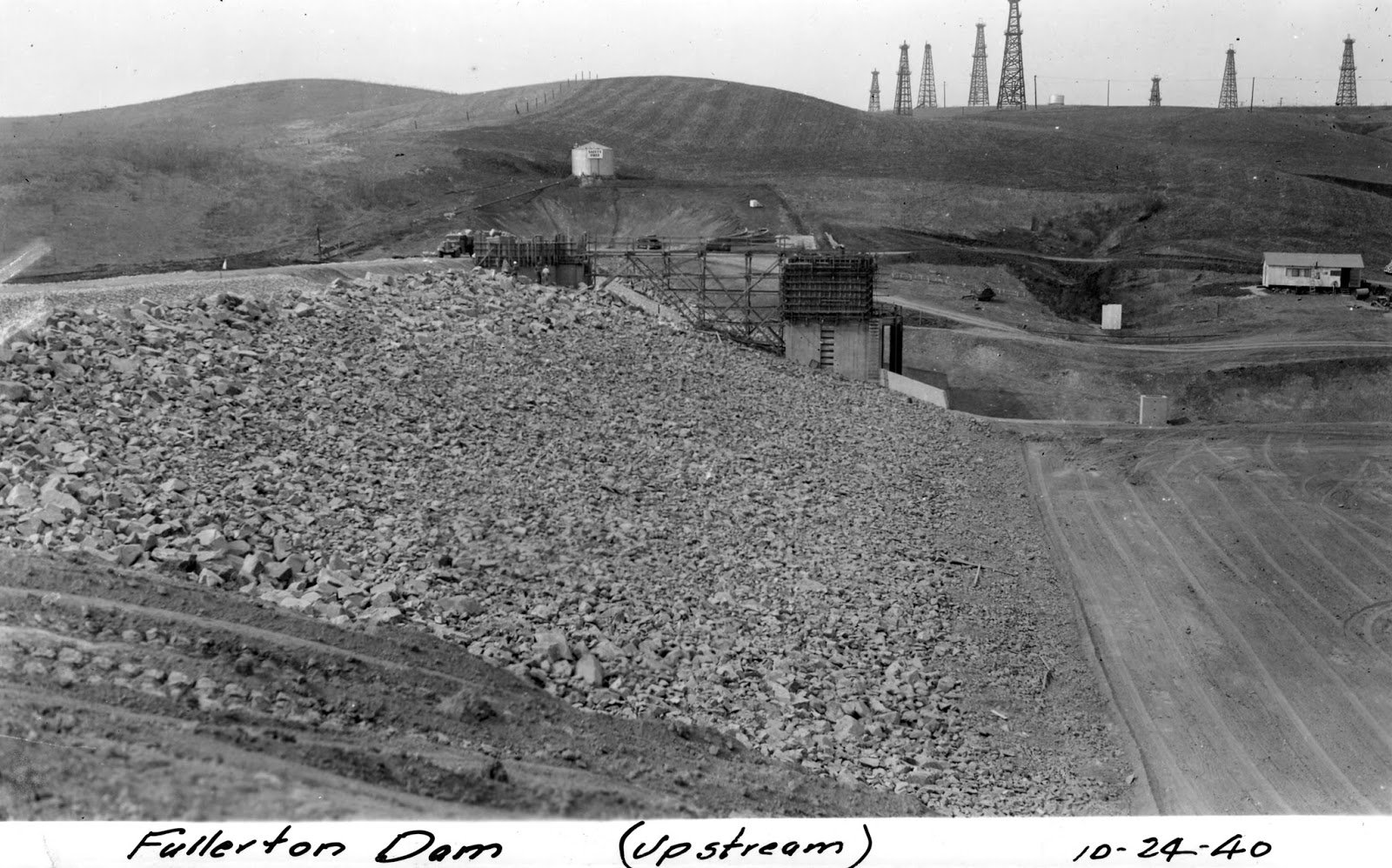
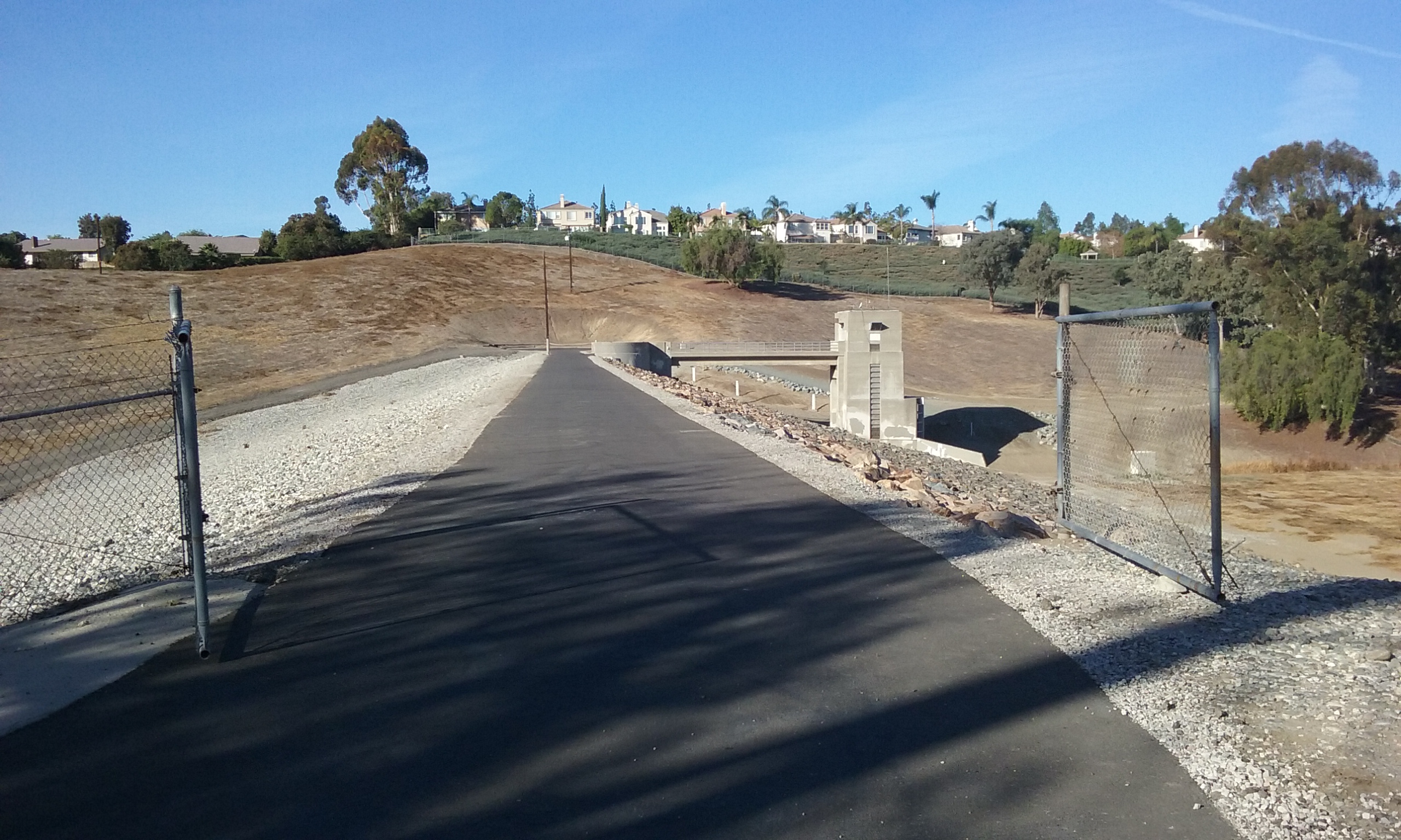
The Dam
Every square foot of that dam seems to be available to explore. To get to it can be readily discovered because of how visible it is; how free of foliage it is; how carefully groomed by the Army Corp of Engineers, it is. For more on how dams work see the webpage Dams and Spillways of Fullerton.
Instead of walking to its face which is kind of boring, there’s more to see toward the east where the trail up to that place is dirt again. You can find your way to the very crest of the dam and even walk across it. In the photo gallery below, there is an image of the dam taken in 1940 which you can compare to a picture taken from the exact same place 78 years later.
Click on the pictures to see them in full screen.
List of questions
- There’s what sounds like a pump next to the bridge at the south end of the lake. Is the water in the lake Craig Park recirculated and filtered?
- How many miles of sidewalk trails altogether?
- Are the ducks and geese there all year?
- One of the creeks is Fullerton Creek. Does the other ones have names? Or just storm drain water?
- The city boundaries show that it is mostly in Fullerton except for a strange zig zag that seems only to encompass a parking lot. Is there something interesting about that zig zag?
Suggestions
- The deep ruts in the trail down from State College could be a real neat opportunity for merit badge projects for boy scouts. Let them figure out the best way to use mattocks and hoes to move the rut to one side.
- I think it should be recognized that hikers like dirt to walk on. One opportunity for that is a narrow undeveloped peninsula of land within Craig Park between E Rosalia Dr and Hickory Pl. A perimeter trail could add 1,400 feet of trail.