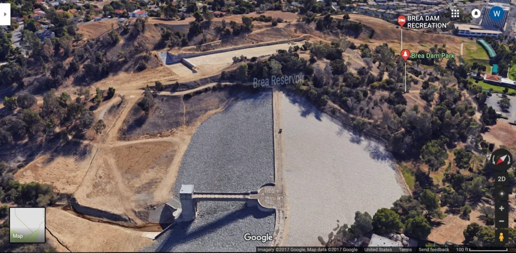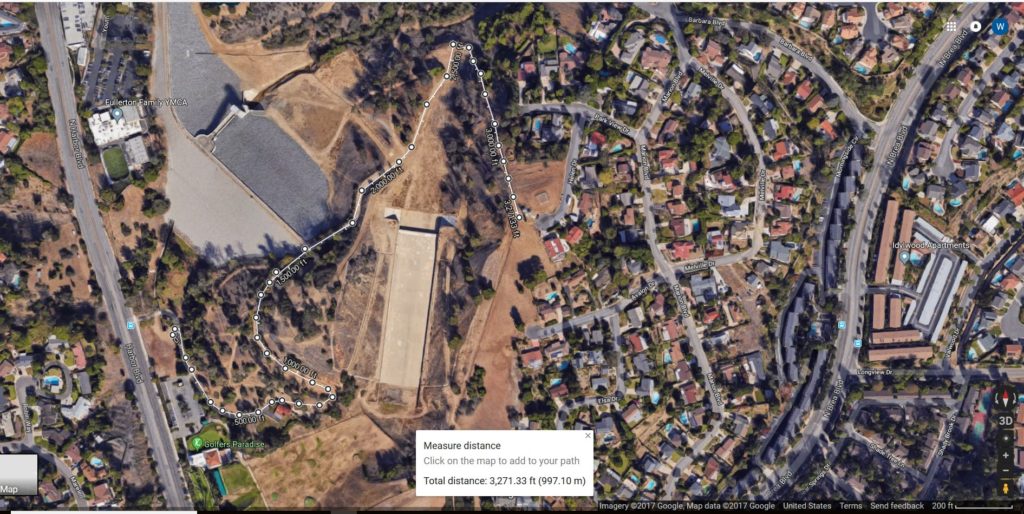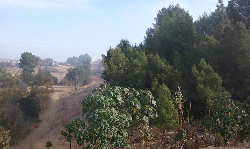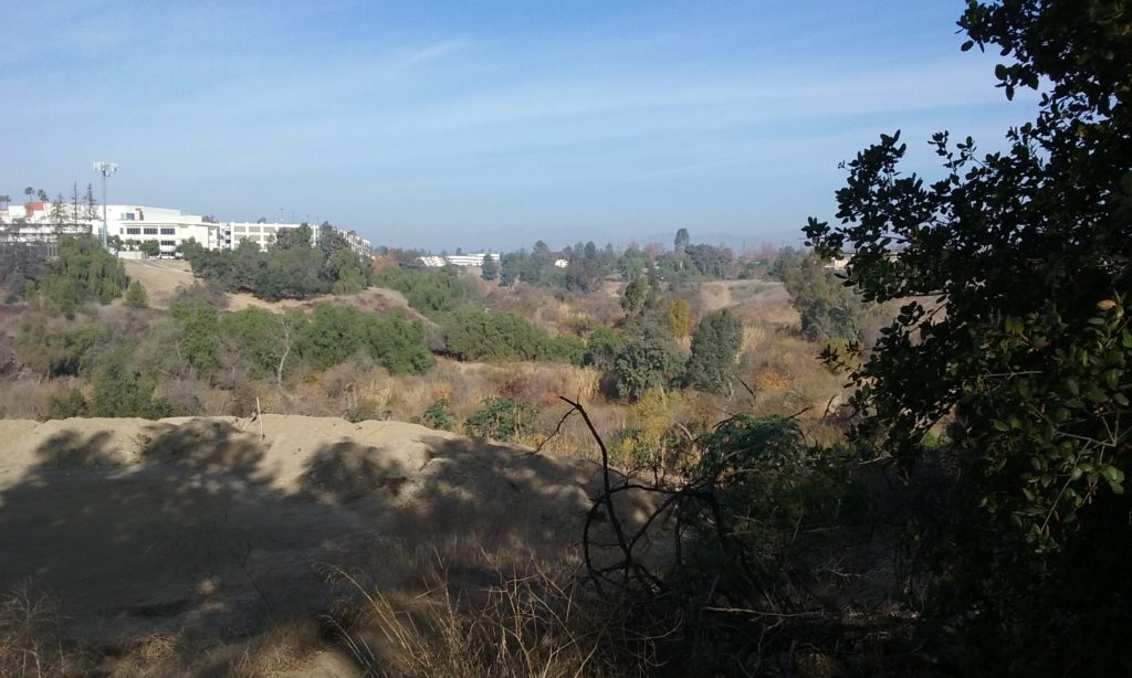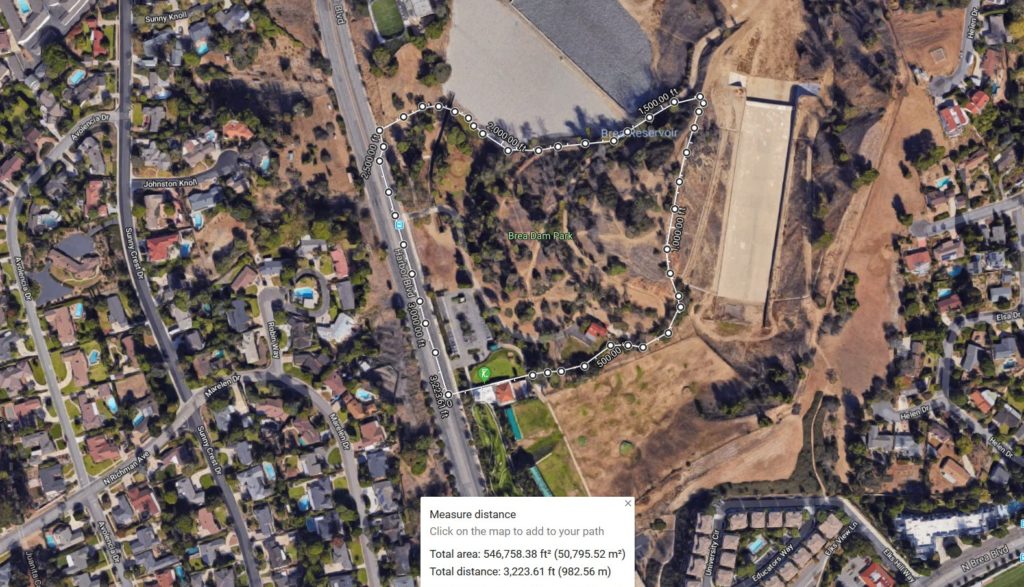
Brea Dam Park has the potential of being the second most popular park in Fullerton (after Hillcrest). It is very accessible with plenty of parking and yet still in town. Note in the area defined by the white line in the map to the right, that it is distinct from the much larger area upstream (north) of the dam. That larger area is leased to the city of Fullerton from the Army Corp of Engineers. The Brea Dam Park is wholly owned by the City of Fullerton; not a lease. The park is by rather large area between the dam and the spillway but the public only knows the tiny picnic area as the full extent of it. The reason it is something of a secret is that it is a very steep hill and thus not a lawn which we normally think of as a park.
____The picnic area at the foot of the dam below the hill is an acre of lawn, with picnic tables, drinking fountain and restrooms. There is a huge dirt parking lot which is just the right size if the rest of the park was ever utilized to its fullest potential. The hill above the picnic area –which is most of the park– is fairly steep which is ideal for off-road biking. There are gradual ascending and descending trails for walking but some of the descending trails created by bikers are too steep for walkers. (These steep trails are why this park could become so popular; it could be Fullerton’s premier Bike Park, perhaps the best BMX park in the county.) Bikers can pedal up on a smooth newly paved road to a wide rest area before going down a dozen different ways. Some are very steep; and some are almost dangerous. What could be cooler than that? And of course those are not the ones hikers want to walk up or down on. The trails for walking lead out of the park; not so much within it.
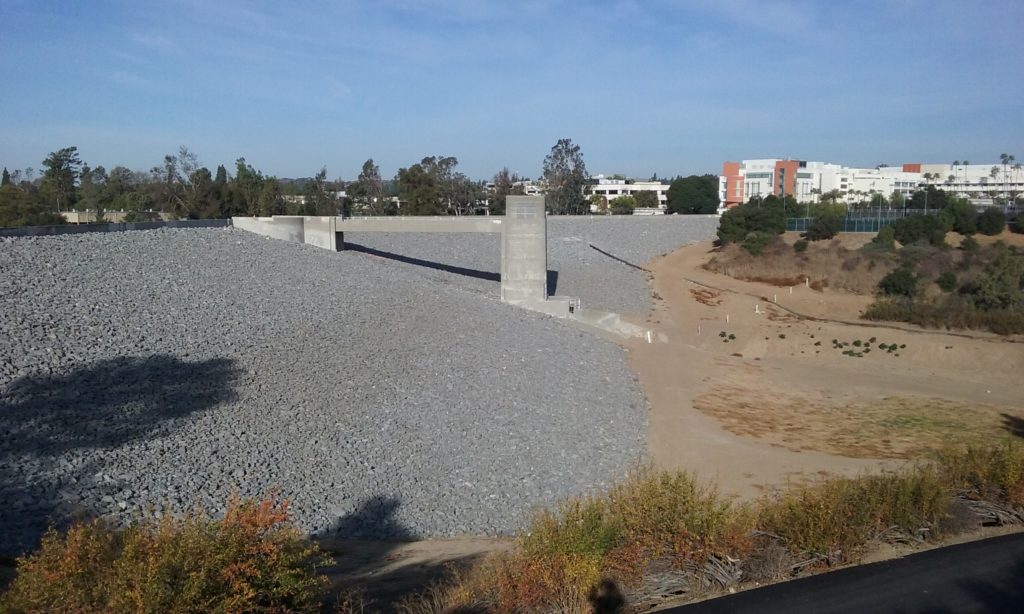
___Like most trails associated with parks, they extend beyond the boundary of the park. One of the trails described in this webpage goes on the other side of the spillway and south through Hillcrest Park. (The spillway is that large concrete rectangle in the picture above.) Another trail described here goes down into the flood basin (out of the picture at the top) where it can join other trails for an uninterrupted dirt ride all the way to Imperial. There’s another webpage that describes the trails within the flood basin. Click here –> Brea Dam Recreational Area for a description of much longer and more numerous hikes.
Tiny Loop (.5 mi)
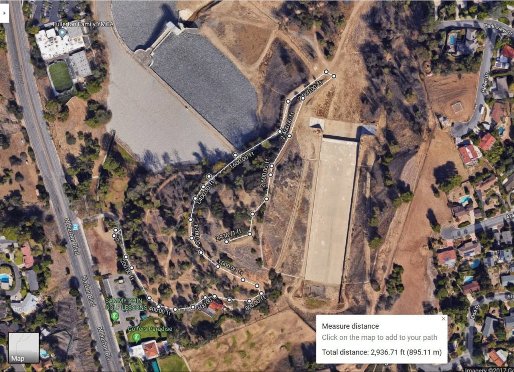
An easy place to park is the part of Brea Dam Park which can be seen from Harbor Blvd. It is a half a mile north of Hillcrest Park (Brea Blvd). There’s plenty of parking there. In the north-east corner of the grass picnic area is a fun trail that goes up toward the east end of the dam. South of where you parked you may have noticed a road that goes south at first, and then east up the hill. You can walk along that road south or you can take trail north that actually starts in the picnic area. They meet at the level that is the crest of the dam to form a short loop of half a mile. At that level you are only half way up to the top of the park’s highest point. The hike to the highest point is described below.
The Dam Tender’s Family Home; Now a Hostel
If you take the paved road south from the picnic area you will go past what looks like a 1930s style house. It is now a $55 a night hostel. Hostels are associated with young people because the accommodations are fairly Spartan in that there’s several strangers to a room. Here’s their website: https://www.hiusa.org/hostels/california/los-angeles/fullerton. The hostel was indeed a house once. It was where the dam tender and his family lived when the dam was built in 1942. It was eventually abandoned because there’s not that much activity for them in this one place. For more on the profession of dam tender and some engineering aspects of the Brea Park dam click here –> Dams and Spillways of Fullerton. In the winter, the Hostel is closed and to keep vandals from doing damage the road mentioned above is gated in two places. You can go around the part that is gated off by noting what the bikers have done to circumvent the closing.
____You might be interested to know how the hostel, with that low rent, keeps out homeless. The caretaker that lives there asks for their passport or license. They look to make sure they are students and are out of state. Until 2019 the hill around the hostel was a gathering place for homeless. From time to time police do a sweep followed by City Public Works clearing out the nests. Part of the problem is that that hill (encircled by a white line in the picture above) is not occupied enough by normal park goers. An example of how increased attendance works to rid the place of homeless, is the 2017 updating of Hillcrest park. It became so well attended, during the day, there was no place a homeless could hide his stuff. The one thing the homeless don’t like is people near their stuff. It reduced the homeless problem from worst in the city to zero. You can report homeless nests by using the MyFullerton App on your cellphone. For information on the MyFullerton App. and some tips on picking up trash as part of your walking experience click–> here.
The Fullerton hostel is visible on any map, but a better reference to all the trails
Hikes Out from a Reference Point: “End of Asphalt”


The half-mile loop described above brings you close to the dam itself; the east end of the dam where the road is, is easy to find on a map. From there you can walk across the crest of the dam to Fullerton Tennis Courts and from there down into the flood basin and on to the golf course. A better reference point than the east end of the dam itself is further down the road where the asphalt comes to an abrupt end. This end of asphalt reference is important not only because it is easy to find but it can be a kind of hub for hikes in five directions. If you have Google Earth loaded on your computer, enter this lat/long into the search window and click on maps… 33°53’26.5″N 117°55’26.5″W. If that is unfamiliar to you, click here –> on loading and using Google Earth. From the parking lot of the Harbor entrance to this reference point is about 2,000 feet. And remember there’s two ways to this reference point; the trail northeast from the picnic area or the road that starts south of the picnic area.
The Hike to the Spillway Flat (out and back, ¼ mi)
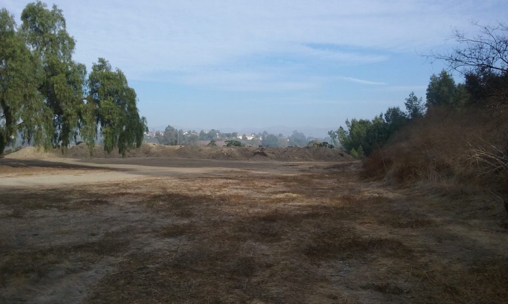
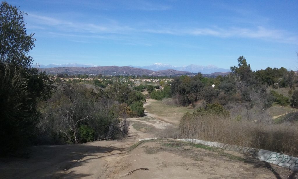
From this reference point, (end of asphalt) off to the right you will see what looks like another dam with a large concrete flat area in front of it. This is called a spillway. Spillways are often as expensive as the dam itself because they use so much concrete. And yet they rarely go into action, usually “never” in the history of the dam. Its only purpose is to save the dam in the once in 400 year storm conditions predicted for that region. Notice that the flat area of dirt has been extended several hundred feet north. Walk north from the reference point (end of asphalt) along side the lovely trees all the way to where the dirt has been piled up on the north end of this flat area. Scamper up that soft dirt pile and take in the best view north into the flood basin. On the left end of this dirt pile you will be able to see the San Gabriel Mountains from Mt. Lowe on the left to Mt. Baldy on the right. Out to that scenic view spot and back to the reference point is ¼ mile and from the Harbor entrance is a half mile.
A Bit More About that Spillway
Hydrologists and flood control architects call the 220 acre recreational area (which we rent from the Army Corp of Engineers, the “impoundment area.” That’s where the water is stored during a storm. There is also the “catchment area” from which the water is gathered, and for this dam it is 234 square miles. (The Fullerton Dam in contrast has a catchment area of only 5 square miles.) For more on the engineering aspect of our dams click on–> Dams and Spillways of Fullerton. Notice while you are up there how much this flat area looks like a park. All that’s missing is the grass and people. It’s 2.5 acres of weed free flatness next to an asphalt road, yet not a house or building in sight; the ideal spot for a park.

The Hike Down Into the Basin
Described above was a walk from the reference straight north. Another walk from that reference point (end of asphalt) is slightly to the left of north. It is a trail that goes down into the reservoir (flood basin). You can go all the way to the tunnels (1 mile out and back) or to the Coyote Hills Horse Ranch (about a half a mile). Details about those destinations and the trails that lead out from them are available in the webpage –> Lost Trail
The Hike to The Highest Point in the Park
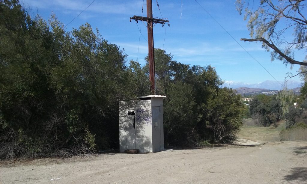
From the same reference point (end of asphalt) make a hairpin turn to the right up a wide dirt trail to the highest part of the park. Yes the park. The city owns this hill, not the Army Corp of Engineers. At the top is an abandoned radio repeater station. Before that it was where Edison strung a power line over to the penstock tower of the dam. (This was in addition to the emergency generators. Since the 1960s, that tower is completely self-contained in power and the power lines removed.)
____There are many homeless nests inside caves cut into the dense brush and in one place, there’s actually a looping tunnel through the shady brush. So cool. This place is a continuing problem with the homeless. This is also the highest point for off-road bikers to begin the harrowing ride down from there. For hikers, the purpose of the climb is the view available from up there. There is a habit that Fullerton Landscaping has to encourage bush growth to where the bushes prevent seeing in all directions from up there. You can understand why. For landscaping they are outside all the time; they don’t care about views.
Fortunately the paths are wide enough that bikers can go around us. But if you see or hear them coming, they would sure appreciate you stepping off the fast part of the path. Click here –> for more on biker/hiker etiquette. To this highest point and back to the reference point is a quarter of a mile and including the trip from Harbor to the reference, 1/2 mile.
Other Side of the Spillway (out and back, 1.2 mi)
Across the spillway the views are of the dam itself rather than the San Gabriel Mountains. Once again, starting at the reference, walk north several hundred feet where the soft dirt is piled. Then walk to the right where there is a very long but not too steep climb that goes back to the south. (You may have spotted near the spillway crest a steeper a trail up –something of a shortcut– but as you might guess it is a downhill run for bikers.) All the trails on the east side of the flat area are formed by bikers. You will also note that when the trails are steep, ruts can form from the rains. That actually makes the climb easier because the ruts meander which gives good foot-holds. When you get near the highest portion of the trail you will be alongside a fence which marks the back of the backyards of some Fullerton homes. At the highest elevation there’s a cellphone tower and some older looking shortwave antennas. (Usually antennas like that are repeaters for police and fire.) At this point, if you returned, the round trip is 1.2 miles (to the Harbor entrance). The trail on the east side of the spillway continues quite a ways south alongside the fence. In fact it emerges on Elks Way where you can walk across Brea Blvd to Hillcrest Park. For more detail on the walk between Hillcrest Park and the dam, see the webpage–> Hillcrest Park.
Click on the pictures to see them as full screen.
Questions:
Who in the heck extended the flat area upstream of the spillway and why?
That flat area and the reference point which is the end of the asphalt should be a premier part, the focus, of the Brea Dam Park. So who owns that newly paved road to that most valuable point? It’s as if there’s a conspiracy a foot working to someday make this a park accessible by a road with parking and the best off-road bike facility.
Suggestions
Premier Off-Road Bike Park
The boundary on Google Maps of “Brea Dam Park” exactly marks what I think is the ideal park for off-road bikes. It is as if they –whoever determined the park boundaries– had that in mind. There’s a paved road that goes most of the way uphill. The pavement ends at a reference point. To its right there’s a wide dirt road that continues to the very top of the park where it falls away steeply on all sides. That wide dirt road up the back of the hill, I think, should best be left unpaved but annually graded to make it free of ruts. (It’s not clear why it is so wide.) The reason for clearing it is to make it safe yet fun downhill run. The landing for that speed run is very wide and safe. (The only other speed run is Nora Kuttner and it has no landing area! )
From the very top there’s only two trails that go down to the level were the paved road is. There could be one or two more with maybe a few days of weed cutting and some hoeing. Otherwise I think this off-road bike park could be maintained with a whole lot less work than any grass park with people-trails. And about a hundred times the use.
Website of the best mountain bike park experience: http://bike.whistlerblackcomb.com/
Future of the 2.5 acre Spillway Flat
One suggestion a mountain biker friend of mine had for the area north of the spillway is a contoured area for BMX where hills and dales are carved into the dirt of a dimension that just right for 22” bike wheels of children. I’m sure he’d be available to advise you if you write a grant to obtain that land from the Army Corp.
Trashcans
Only after a major cleanup of the homeless nests in this park, should trashcan mounts be installed. It is my experience with picking up trash for exercise, it doesn’t matter where the trashcan is, just as long as I know there’s one at some identifiable place on my way; like at the top or the bottom or some noticeable place in the middle. What I’d really like are signs that say,
“next trashcan; top of hill”
or
“next trashcan; ½ mile”
My suggestion for the hill above Brea Dam Park is where the asphalt road ends at: 33°53’26.5″N 117°55’26.7″W The reason is that this spot –I feel– is perfect as a reference for all walking activities at this end of the flood basin, for the dam as well as the Brea Dam Park itself.
Signs
No signs are really needed in this park, except to indicate where the trashcan is. But if you want one, my vote is to promote an underappreciated walk (I think) from the Tennis Courts to the golf course for lunch. All it needs is a sign on the trail visible from the north end of the tennis court (33°53’37.4″N 117°55’32.4″W) that says:
“Take the dirt trail further into the park and follow it 1 mile north to the golf course clubhouse for lunch.”
And maybe one at the club house that points west and says . . .
“There’s a nice picnic area (San Juan Park) a hundred yards further north along the railroad tracks where you can see it on your left.”
Views
There’s a number of trails in the Park System which have leaning bars or benches placed where there was once a view. But alas, bushes and trees have grown up to completely block that view. The top of Brea Dam Park has a remarkable potential for a view except that bushes have grown up to block the view in the north and north east directions. All such view spots should not be spoiled by holding thick brush is if they were sacred objects. Start with the brush at the top of Brea Dam Park. It would also remove the caves used by the homeless.
