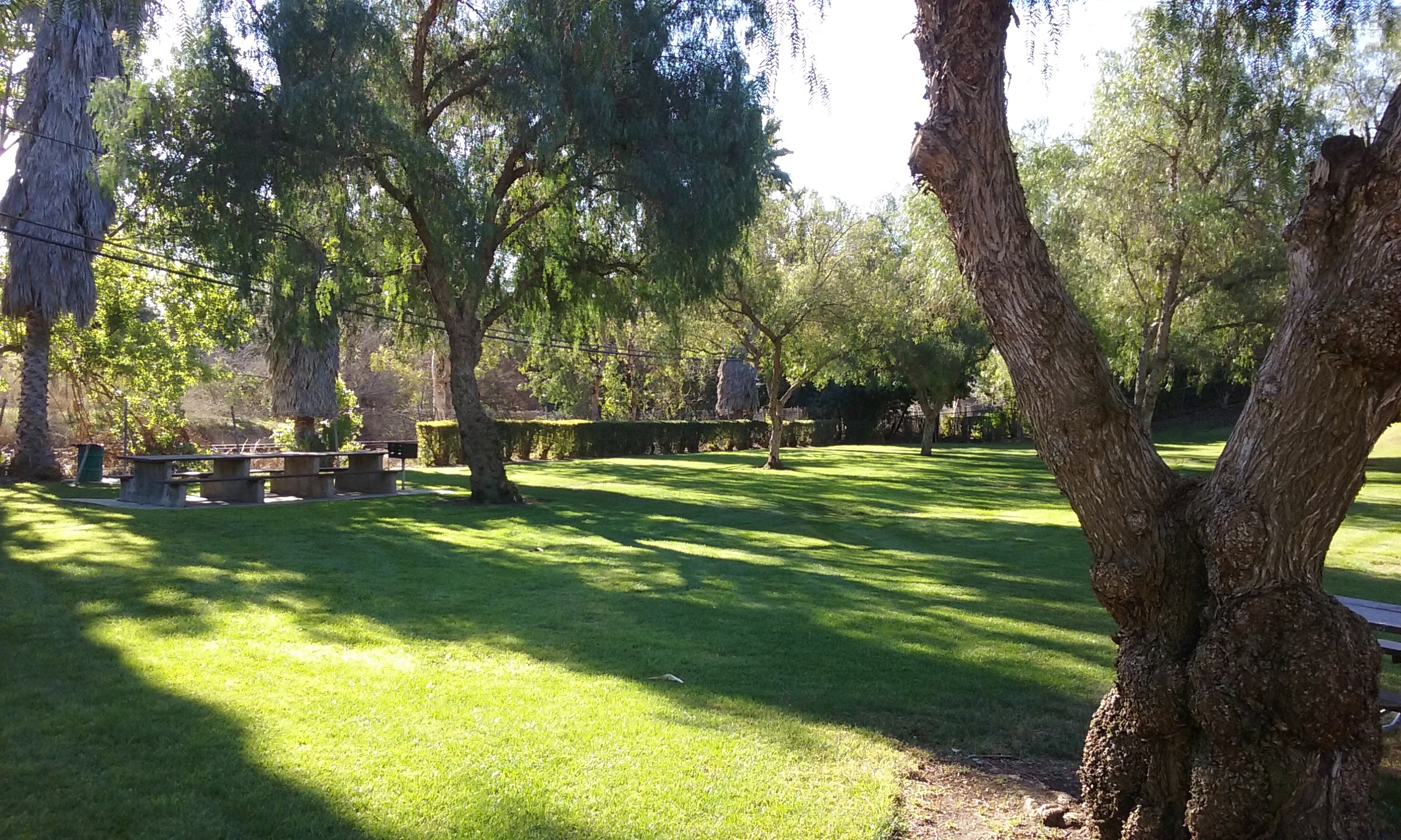
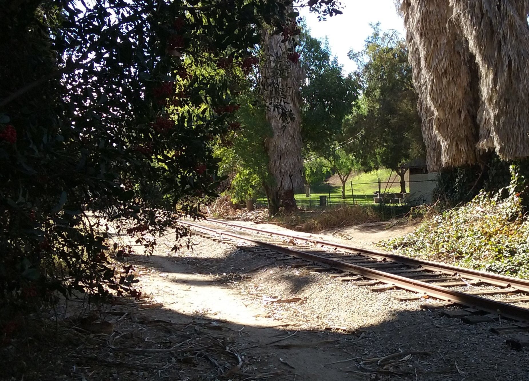
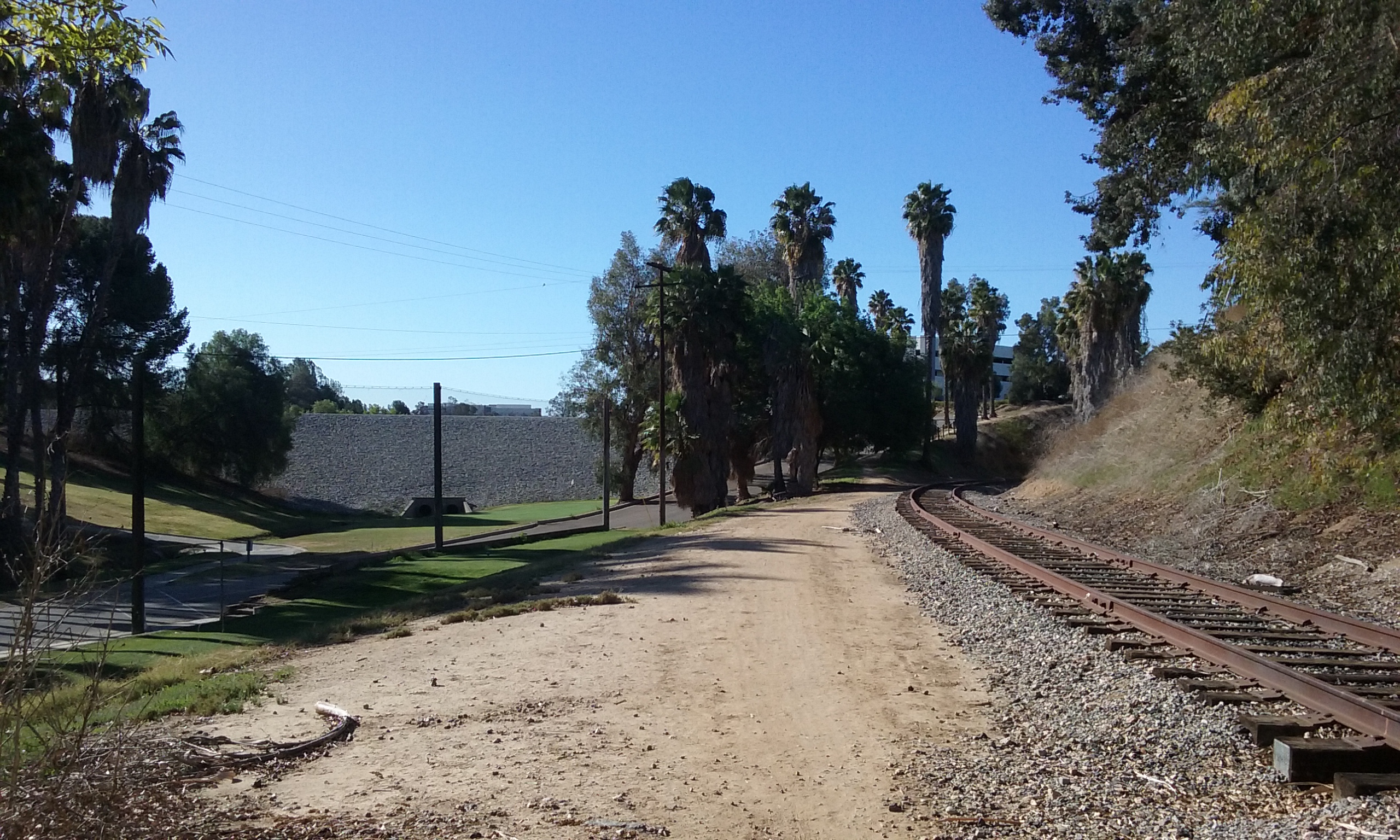
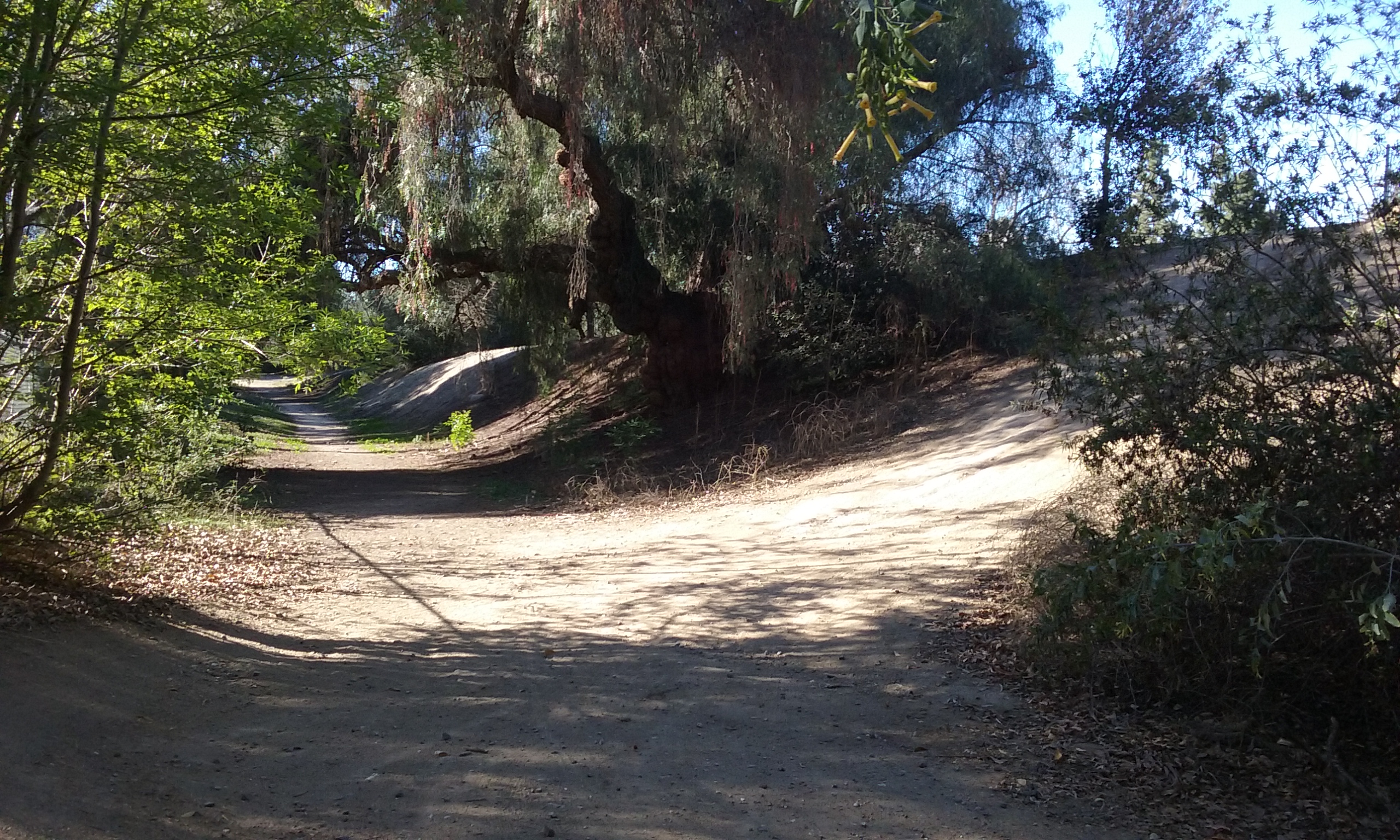
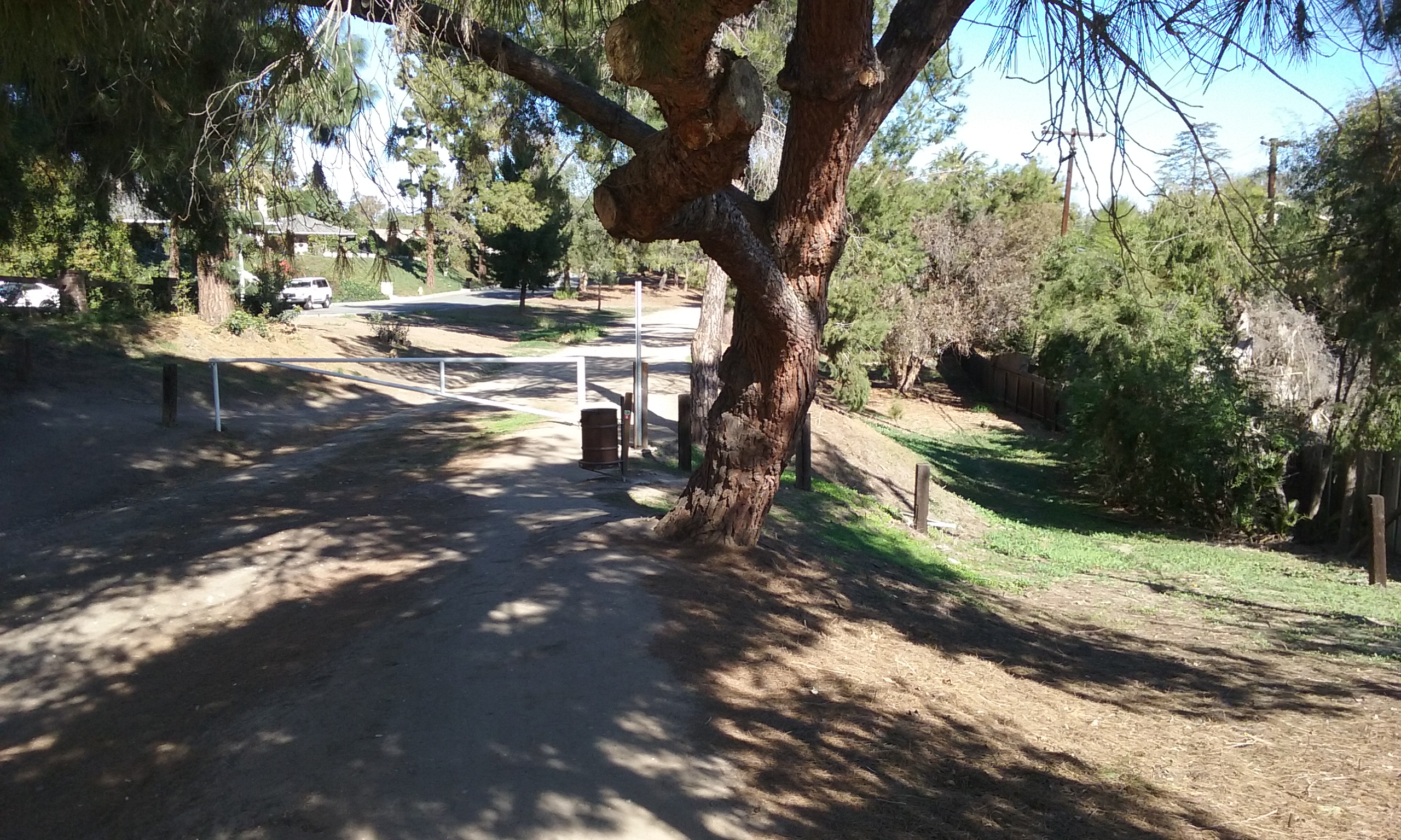
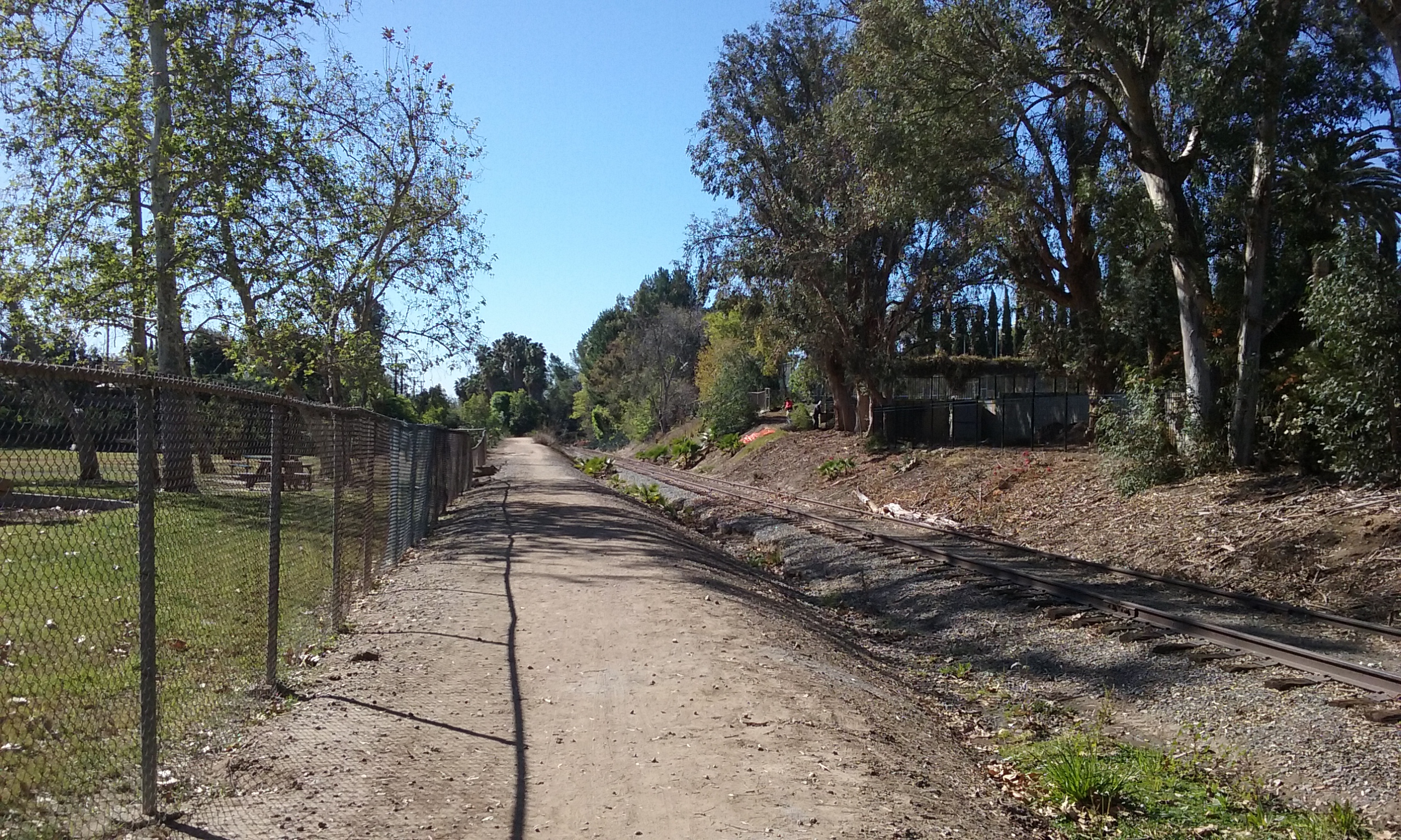
 The picture above is of the park from the point of view of the neighbors. The picture on the right is what San Juan Park looks like from the trail it is next to. The park is primarily to serve the neighbors in the form of just looking nice and perhaps flipping the Frisbee. There is a picnic table and next to it a BBQ which only needs charcoal and lighter fluid. The restroom was closed because of a homeless problem. The neighbors say that calling the Parks Department the restroom can be opened for parties there. The park can also serve the inhabitants of the whole city in that it can be a staging area for at least four interesting walks as described below. The park looks new because the grass has been recently replanted but the towering eucalyptus trees reveals its 60 year heritage. To get to San Juan Park, take Harbor (3/4 mi) north of Bastanchury to La Entrada (right). Right on San Juan Drive to the end. It is easy to find the openings in the fence to the trail which you can take either north or south. The openings are tight but available on each corner of the back fence of the park.

Nameless Trail
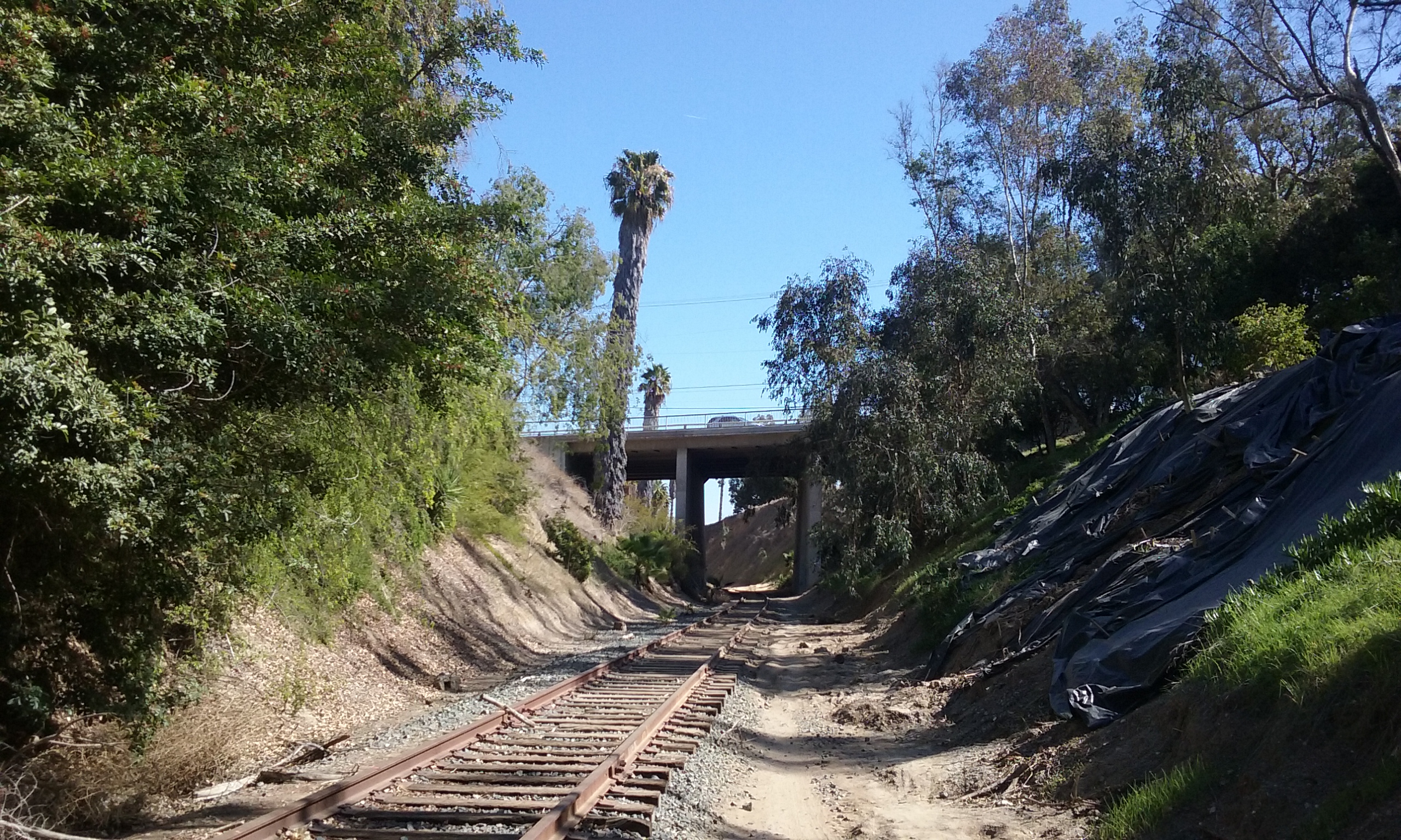
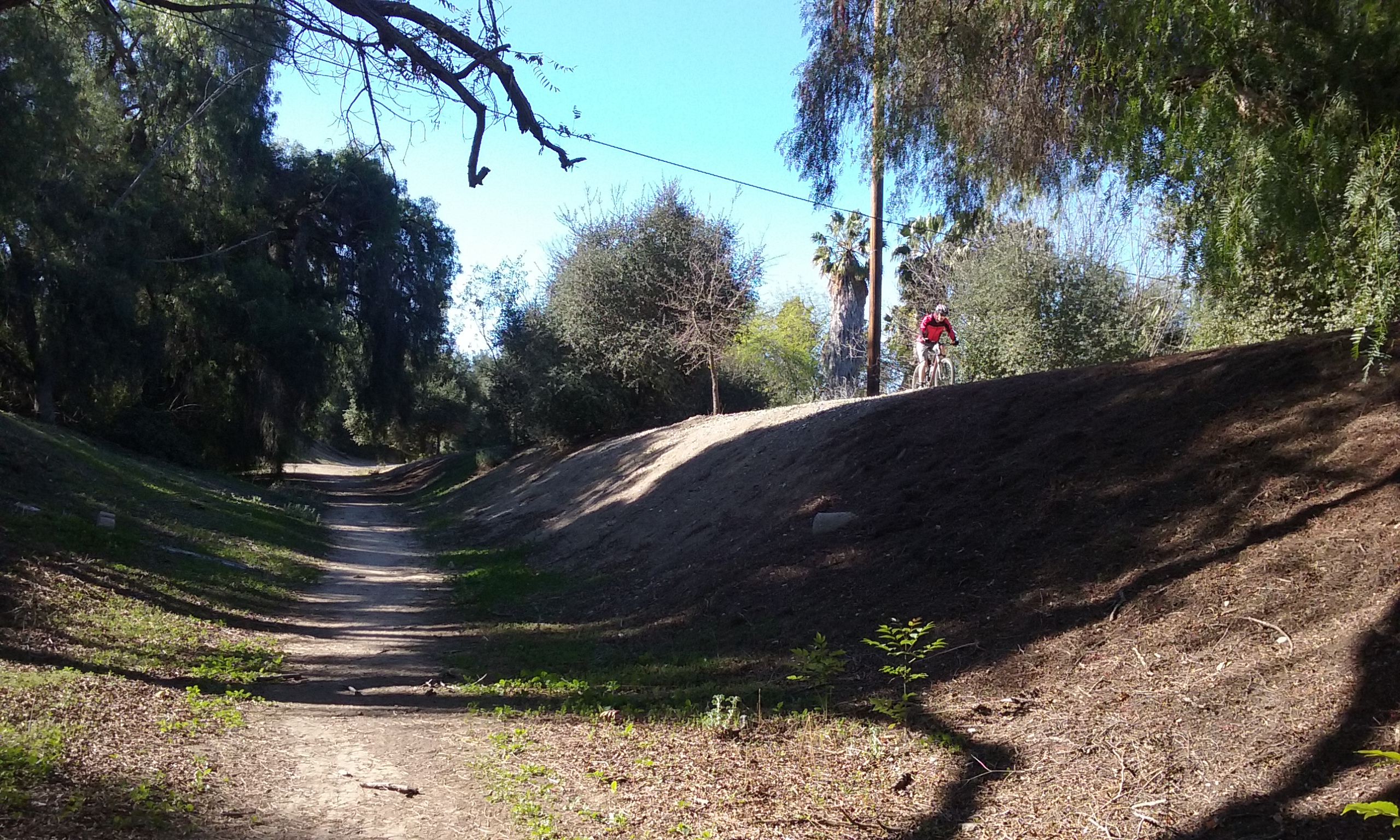
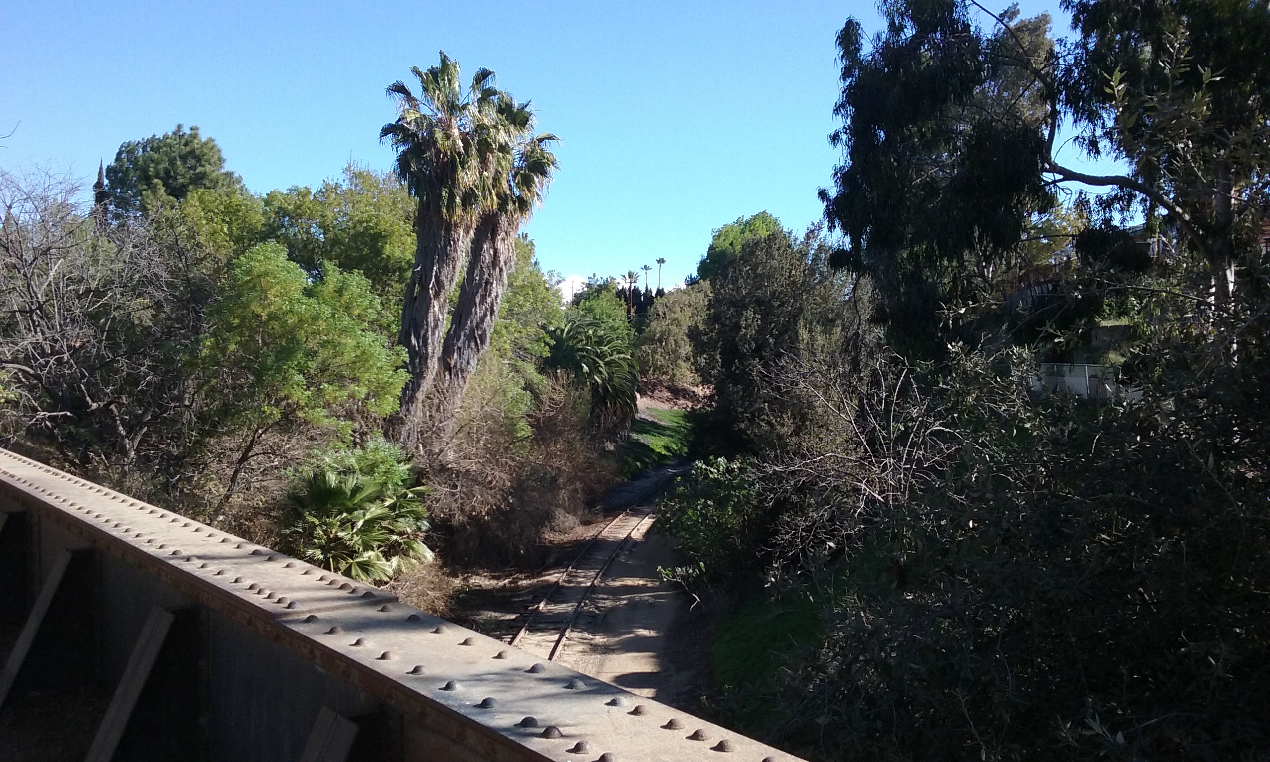
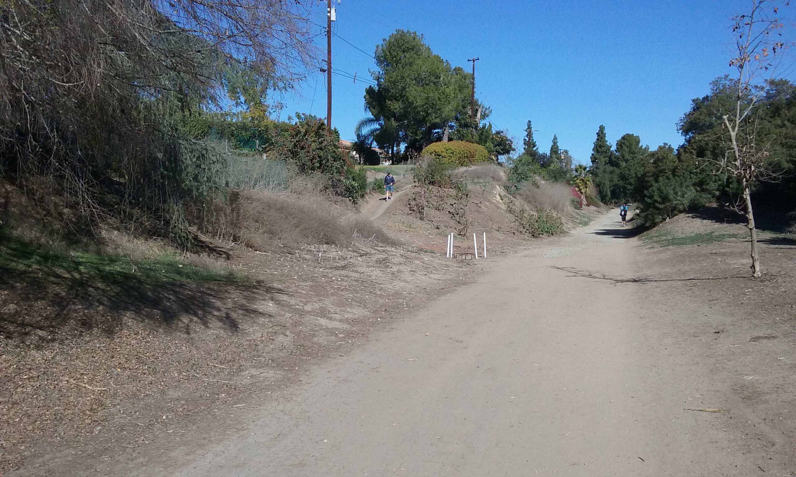
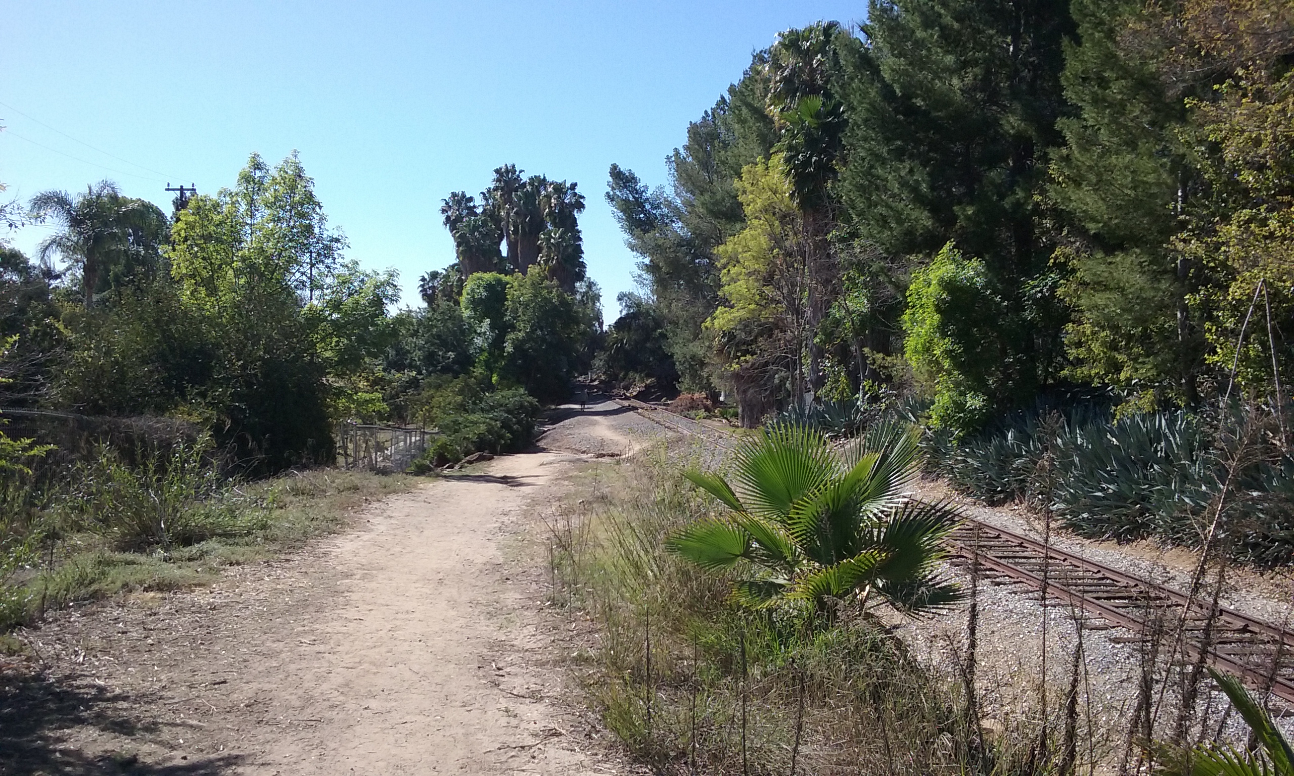
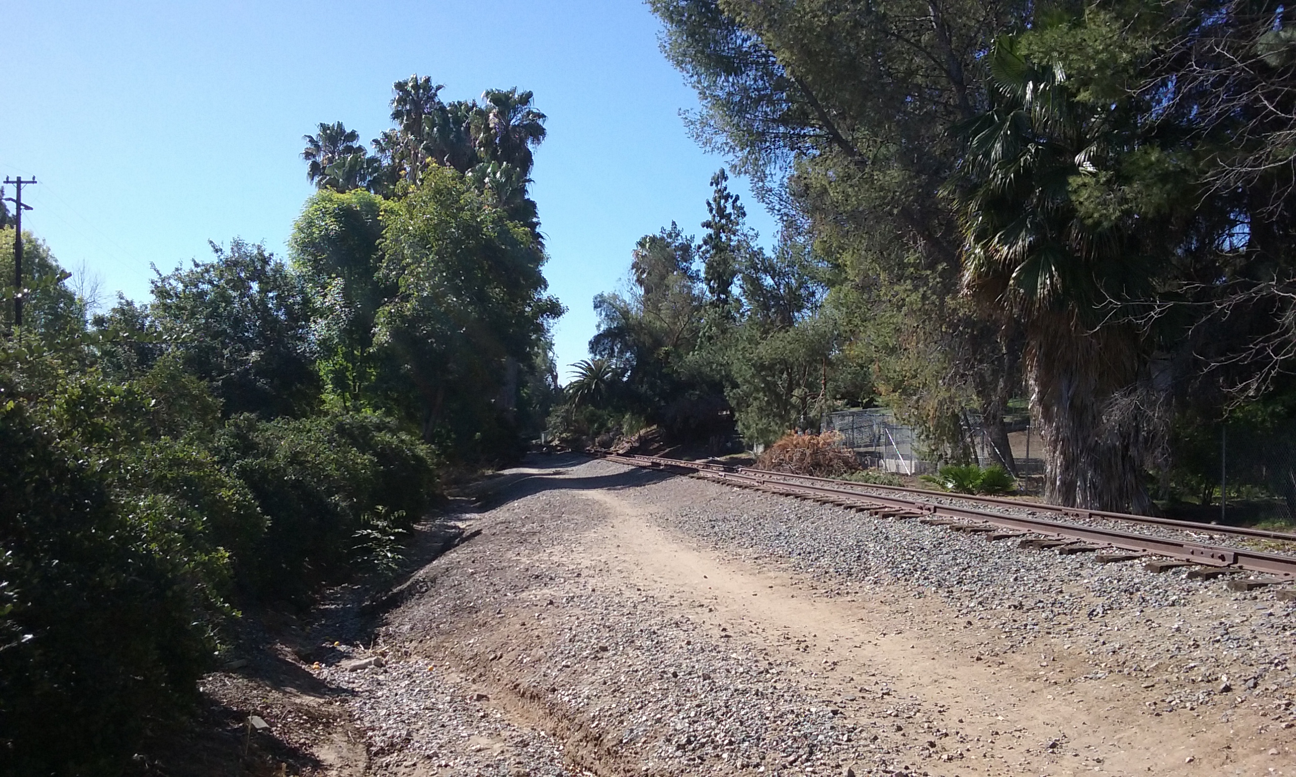
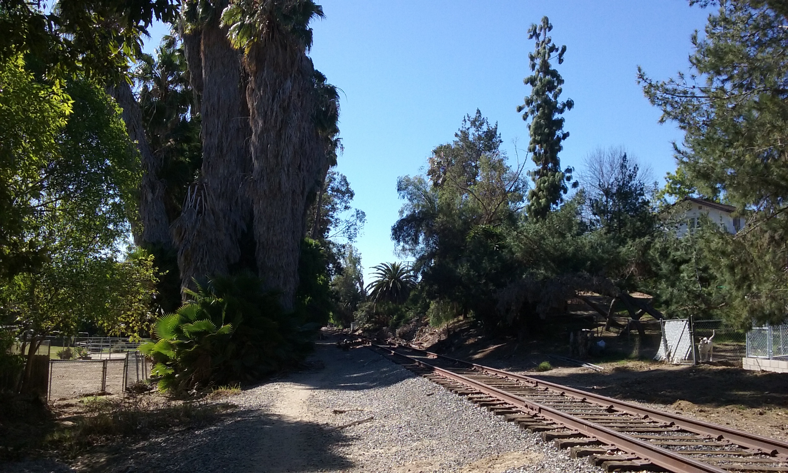
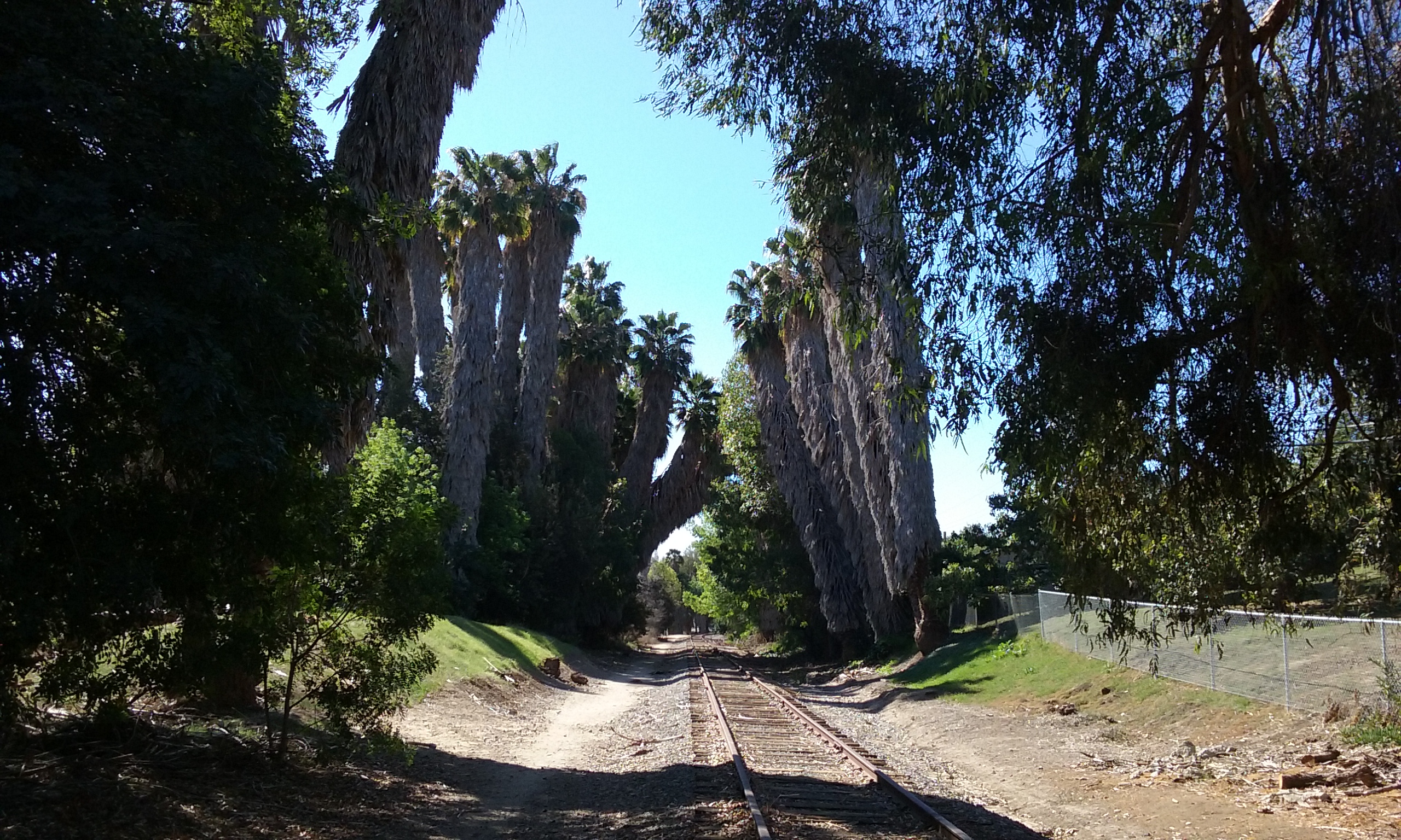
The trail that goes right by San Juan Park and extends in both directions for miles is officially nameless. That’s because it really doesn’t belong to the city. It is a Union Pacific line that up until the late 1980s carried tank cars of vegetable oil to the Hunt Wesson factory (Malvern and Bastanchury) for their tomato sauce. For some 70 years; one customer, once a day. That’s all it takes to keep a line open. When that one customer converted to trucks, Union Pacific turned their signal lights on the streets around. Abandoned is not quite the right word. But they certainly have no means to stop us from using it. This officially unnamed trail goes mostly north and south through Fullerton. Before you get your hopes up about converting it from Rail-to-Trail, note that the EPA will step in during the transfer and insist on a clean up that costs about 4 million dollars a mile. It naturally maintains itself so there’s almost zero incentive to rock the boat. Besides as it is, the tall trees that grow on the slopes are wonderful. Brea’s newly opened “The Tracks” trail has nothing on the beauty of our walk. Ours costs nothing; their “The Tracks” walk, their only walk, a mere 4 miles . . . was $17 million. With that kind of money we could buy the Coyote Hills and stop all the gawd amm fighting. There is really no reason to change anything about this trail. (Well . . . it would be nice if the rocks could be raked out of the way.)

Starting North from San Juan Park (1.9 mi loop)
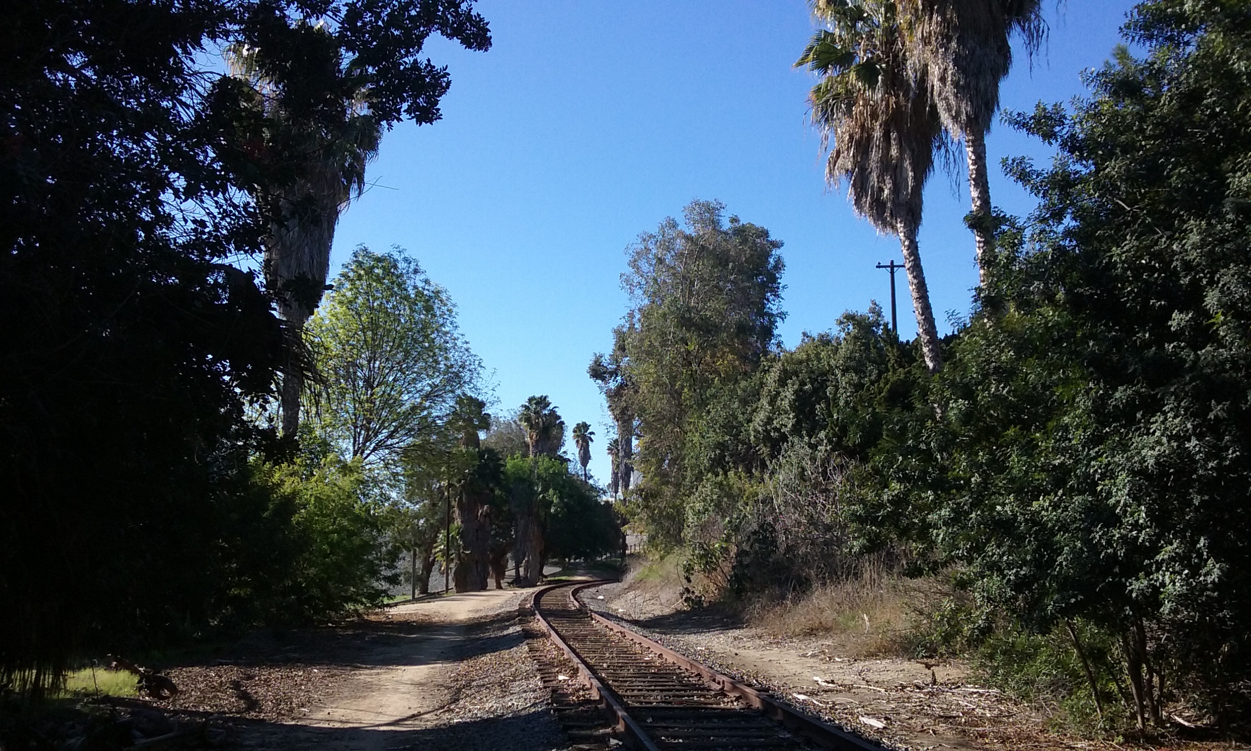
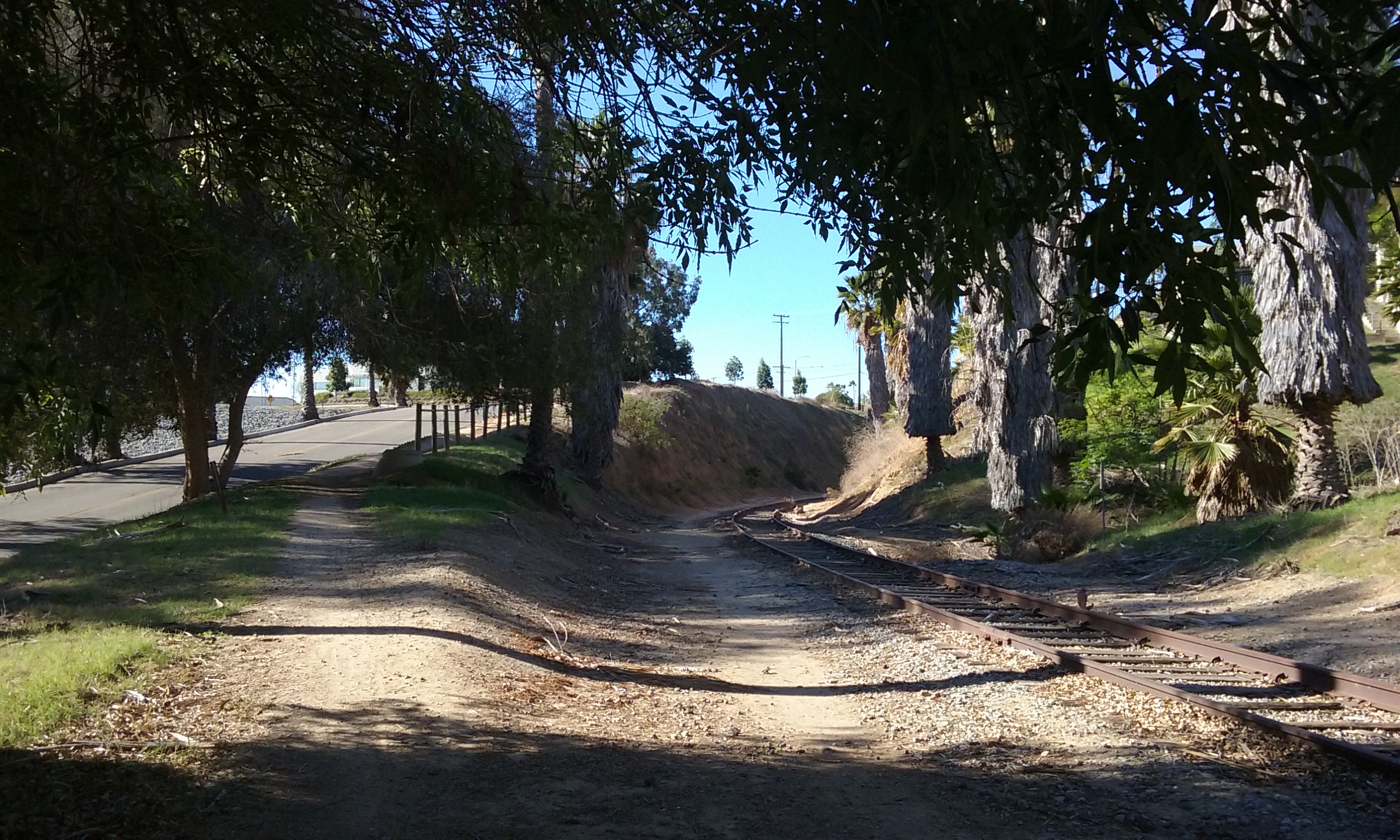
Perhaps this loop should be called “railroad loop” since it almost entirely on abandoned tracks. To walk the loop starting north you will be immediately impressed by the tall trees and dense vegetation that the neighbors are also able to enjoy. (So dense you can’t see the neighbors from the trail.) It is very lush even in the summer. (Morning hikes are better if you want to be in the shade of those trees.) Those trees surround an unnamed creek that parallels the tracks. There’s virtually no slope there, so there’s a lot of standing water from yard runoff. Assuming you left San Juan Park going north, about a third of a mile along, you will come to Hermosa Drive where you will turn left and walk on the street. (If you instead continued along the tracks beyond Hermosa the trail becomes narrow, rocky and very littered.) Walking on Hermosa (west), you will find the street to be free of traffic which makes the off-trail part of the walk, not so bad. After several blocks you will cross Harbor and then you will see Laguna Lake. But to make the loop don’t go the lake. Instead enjoy the small shady park on this side of the lake called Cooke’s Corner. Through that small park is the most famous trail in Fullerton; the Juanita Cooke Greenbelt Trail.

Halfway Done
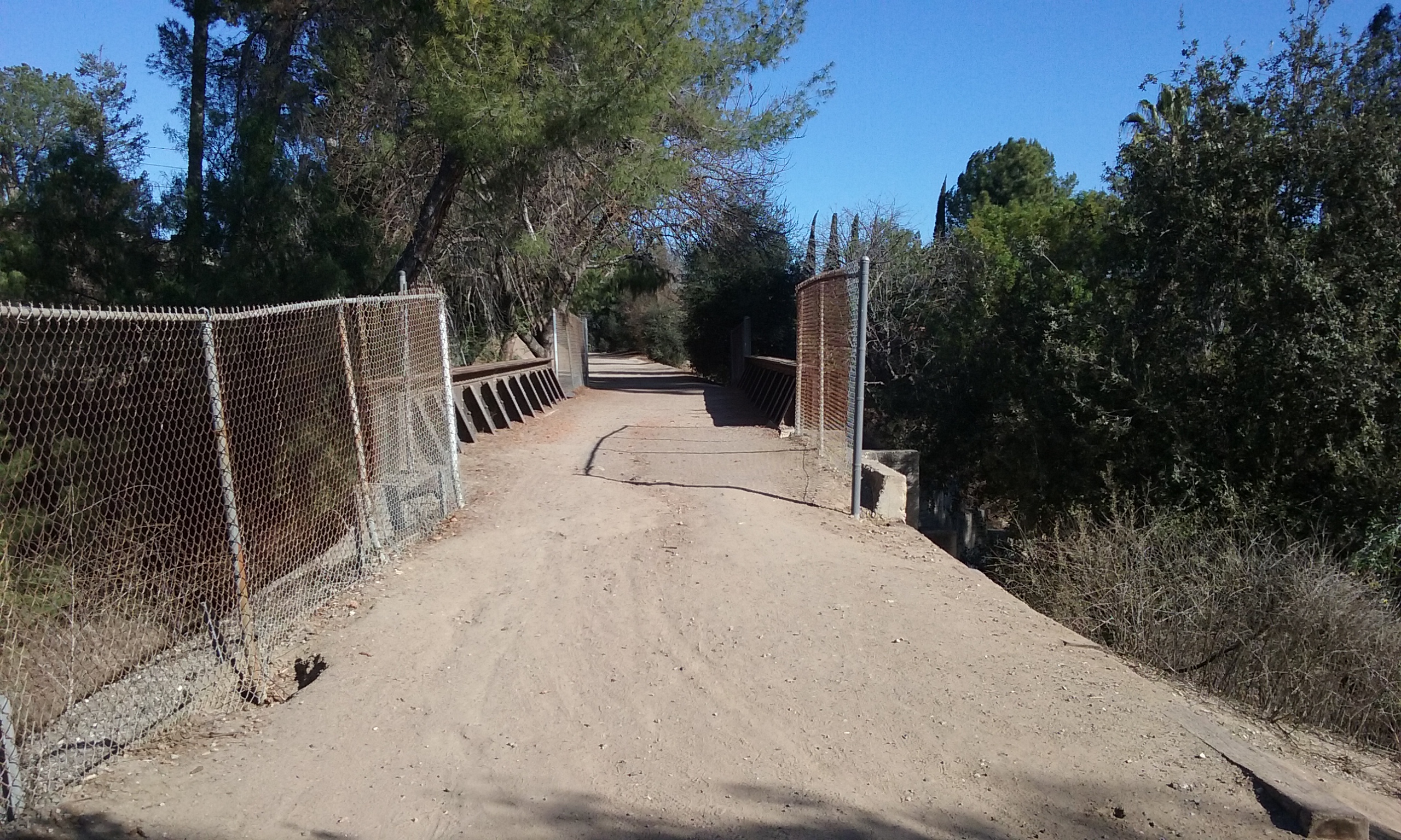
You are going to follow the Juanita Cooke Trail south. It is a dead straight path because it was once railroad tracks. (This was from 1918 to the late 1950s. The rails, the ties and the rock were removed in the 1960s which makes this part of the walk most comfortable.) You can’t miss where one train track crossed over the other. The lower track is the one you started on and need to get back onto. (The path down, is on the south end of the bridge.) When you are down there walk back (north) and in only .4 miles you will be back where you started.
On your way back, yes that’s Harbor you will be walking under. Then you will pass a small portion of the Fullerton Golf Course. Continue north following the tracks. You will see San Juan Park on your left in about a hundred yards. Notice before leaving closest contact to the golf course that a trail goes up hill behind you. If you were to follow it, you will be on the west end of a small dam. It’s not really a dam, its a dike. The difference is that the water on one side of a dam is useful because its flow is controlled. A dike blocks water. But this dike, actually a satellite dike, is unique in that there are one way valves on it. For more on this structure go to this webpage: Dams and Spillways of Fullerton. The trail that goes south past the dike, goes more than a mile further to the biggest dam in Fullerton; the Brea Dam. The dam and the trails associated with it are described in Brea Dam Recreation Area.
When you were at Cooke’s corner, next to the lake, you were halfway done. If you gave into the temptation to go around the lake while you were there, you will have added 3/4 mile (20 minutes) to the total path.
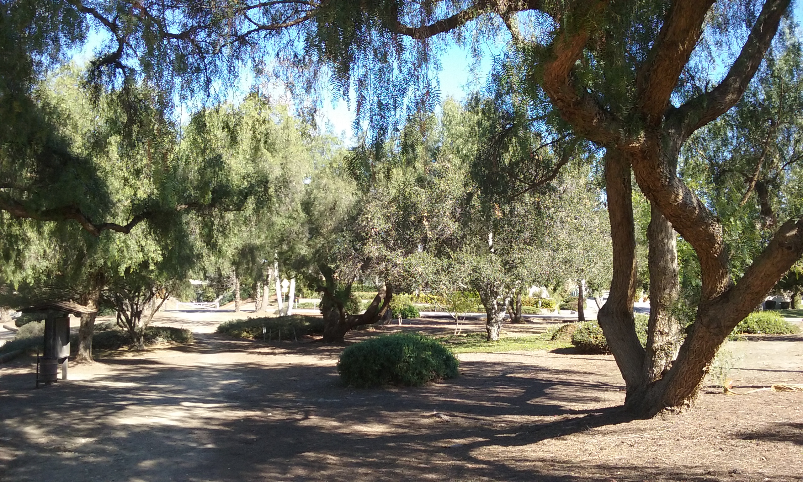
 More about Cooke’s Corner
That shady park where you were “Half Way Done”, has only a single park bench but the park itself is very well maintained. The landscape guys call it Cooke’s Corner because it is actually just a wide section of the Juanita Cooke trail in the shape of a triangle. Nearby is the Bud Turner Trail. The Bud Turner Trail follows the lake on the south side. Cooke’s Corner is easy to drive to if you want to use that as your starting point and San Juan Park as your destination. (Cooke’s Corner: From Harbor, -north of Bastanchury- take Hermosa Drive a few blocks west.)

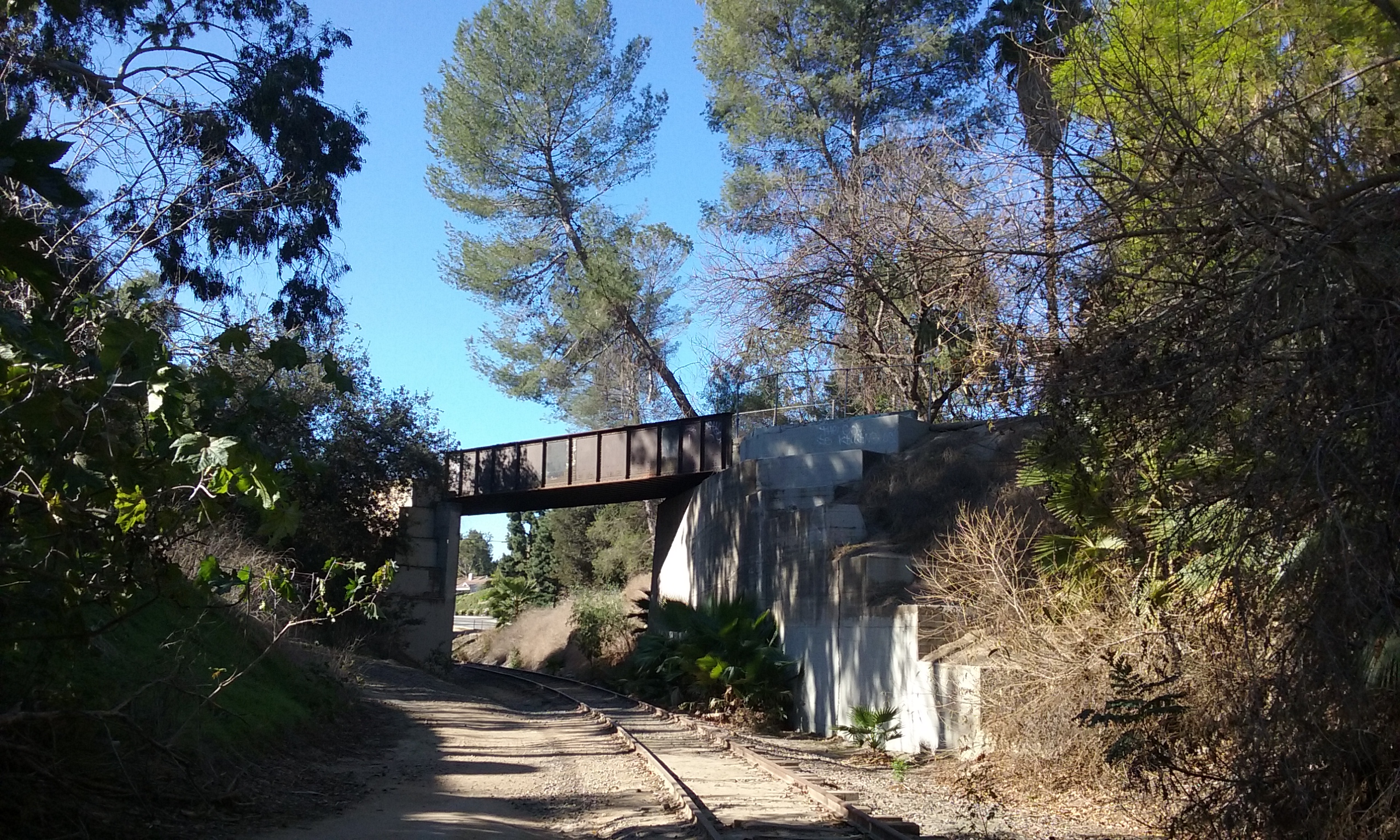
Same (1.9 mi loop) but Starting South from San Juan Park Taking a loop in the other direction is to view the same scenery but obviously in a different aspect. So it is like two different trails. To leave the park and begin the loop going south, you will shortly see Harbor Blvd going over a bridge which you will of course, walk under. (Before you get to the bridge, even before you see the bridge you will have passed the trail to the left which takes you past the dike mentioned above.) About 700 feet beyond the bridge that supports Harbor is another bridge; an old railroad bridge that now supports the Juanita Cooke Trail. You will see the ramp up to the Juanita Cooke off to the left. Once on the upper trail, go over the bridge north. It is a dead straight path north with green on either side and below you. Yes you are on an elevated abandoned rail line. It is something of a coincidence but Juanita Cooke (the old Pacific Electric) is elevated most o the way, while the Union Pacific trail is below street level most of the way. You will come to Laguna Lake in about .6 miles. There’s a nice park bench within sight of Laguna Lake. That’s Cooke’s Corner. You are halfway through the 1.9 mile loop. (Walking around the lake will make the walk total about 2.5 miles.) Get off the trail and walk east along Hermosa Drive ½ mile. You can’t miss the tracks and trail that will take you back to San Juan Park. The walk back to where you parked at San Juan Park is the most spectacular if you like trees. Just where the trees are the highest and the temptation is to walk on, look to your right for the opening to San Juan Park where you are parked.
Out-and-Back Hikes from San Juan Park
The advantage of “out and back” is that it is customizable in length. And don’t forget, the view is completely different going the other way. Because going back should be familiar it will feel safer than a loop. But if you need something of a goal, for going north, how about a doughnut shop on Imperial? For going south there is the Brea Dam. More details to follow:

Starting North (1.7 mi)
The trail that leaves San Juan Park (to the left) that is, going north goes straight as an arrow on past Hermosa Drive, past Las Palmas, past Imperial. It passes Lambert and only then starts curving. It curves around Home Depot heading west to Los Angeles. The trail beyond Hermosa, however, is very uneven with lots of junk and uncomfortable rocks to constantly watch for. (This distracts from appreciating the scenery.) A good place to stop is Imperial where there’s lots of parking and a doughnut shop. Out-and-back (to Imperial) is 1.7 miles.
 Starting South (1.4 mi, 2.6 mi)
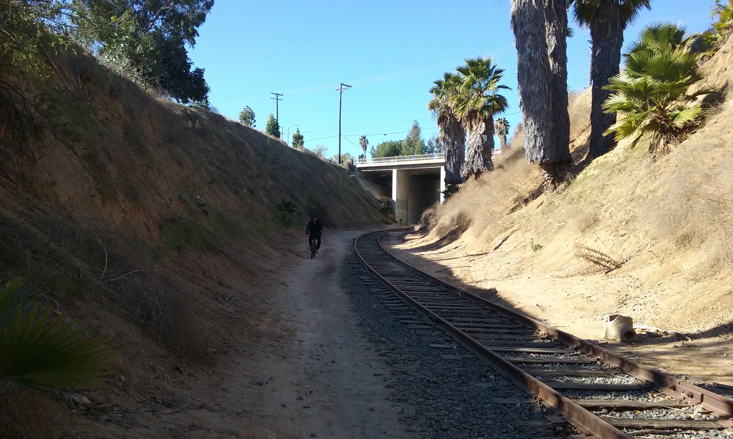
The trail that leaves San Juan Park going south toward the dike is not quite as green, but more interesting. In starting this way for the loop you would go to the right under Harbor Blvd. But for the out-and-back walk, take the trail up and to the left. You are climbing to the top of dike. As a side trip you can walk the ridge of the dike and wander around the Fullerton Golf Course club house. There’s benches to watch golfers at the driving range. (You can also sign up to walk the course. They want you to pay $20 but if you have an old putter, who’s gunna know. It is two miles in length and all sidewalk, if you are into that sort of thing.) The dirt trail next to the fairway is free. It is very interesting walk with the fairway on one side of you and a steep hill on the other side of you. A good place to turn around (1.4 mi round trip) is the tunnels that go under Bastanchury Road. You can go through either tunnel into the Brea flood control area. The two tunnels lead to different trails which parallel the Brea Creek. If you walk clear to the Brea Dam the round trip distance is 2.6 miles. (East tunnel has the better trails.) See the web page Brea Dam Recreational Area for more information about the trails on that side of Bastanchury.
Bastanchury Family Home (a bit of Fullerton history)

By extending the 1.9 mile loops (starting in either direction from San Juan Park) you can see a bit of history by adding a half a mile on sidewalk. In either direction you will go through Cooke’s Corner. To see the Bastanchury Home, pass through Cooke’s Corner heading north for only a block or so. The picture to the left shows a bridge in the background and a trail that goes up and to the right. The bridge is Las Palmas and the trail takes you there. Walk to the right (east) on the Las Palmas for .6 mile. The home is on the north-east corner of Las Palmas and Tunalis Drive. For more on this bit of history click here–> Bastanchury House. The house looks old but not really much bigger than any of the other houses in that neighborhood. This is odd in that Bastanchury at one time was the largest orchard in the world and owned most of the land in Fullerton, Placentia and Brea. This is often the history of very old money; it kind of disappears.
You can of course retrace your steps to make it an out-and-back or to make it a for-real loop by continuing past the Bastanchury House to Sunny Wood Drive. Go south to Hermosa Drive. You can see the school from there and the trail to San Juan Park is on its west side.
The following gallery pictures are what you will see doing the 1.9 mile loop clockwise. (Click on the picture to see it full screen.)
Suggestions
If the restroom is still working at San Juan Park, perhaps you can put up a sign that says call this number to reserve the park and have the restrooms open. Even if no one does, having the sign there removes the stigma of Parks and Recreation being so dumb as to have a restroom and then close it.
Cooke’s Corner is well maintained, shady and beautiful. It is the intersection of four trails and works well as a starting point for adventures on these trails. It would be appropriate to have several more benches perhaps two of which are close enough so people can talk to each other. There is plenty of parking along side the park but it isn’t clear that it is available on its north side. There’s some ambiguous posts that should be removed. This would make it consistent with the reality that all roads that go by parks are OK for parking.