 Most of this trail is in parallel with the sidewalk along Bastanchury between Brea Blvd and State College. It is easiest to understand this trail by starting at the golf course half way along its length. The golf course is also the best place to park. Coyote Hills Golf Course is on Payne Stewart Drive. That street is named after the legendary golfer and designer of the course; Payne Stewart. It is on Bastanchury halfway between Brea Blvd and State College. From this reference point one can go east or west along the East Coyote Hills Trail. A 2.8 mile loop can be made with East Coyote Hills Trail where the Panorama Trail is the south leg. For a better description of that loop click on –> Panorama Trail. It should be noted before you read any farther that this trail was originally built for horses, not hikers nor bikers. The trail is uncomfortable to walk on because of rock used on its surface for the uphill part of journey. It is not at all scenic other than the planted trees right next to the trail. The best thing to say about this trail is that when you are done, you can eat at a fine restaurant on either end.
Fine Dining After a Walk
The hours at Coyote Hills Grill is breakfast through lunch (8:30 to 5:00). The hours at the Summit House Restaurant are lunch (11:30 to 2:30) and dinner (after 5:00 PM). The lunch menu at the golf course is between $9 and $13. The Summit House Burger is $18.95.
 Golf Course Parking Lot to Summit House Restaurant (1.7 miles out and back)
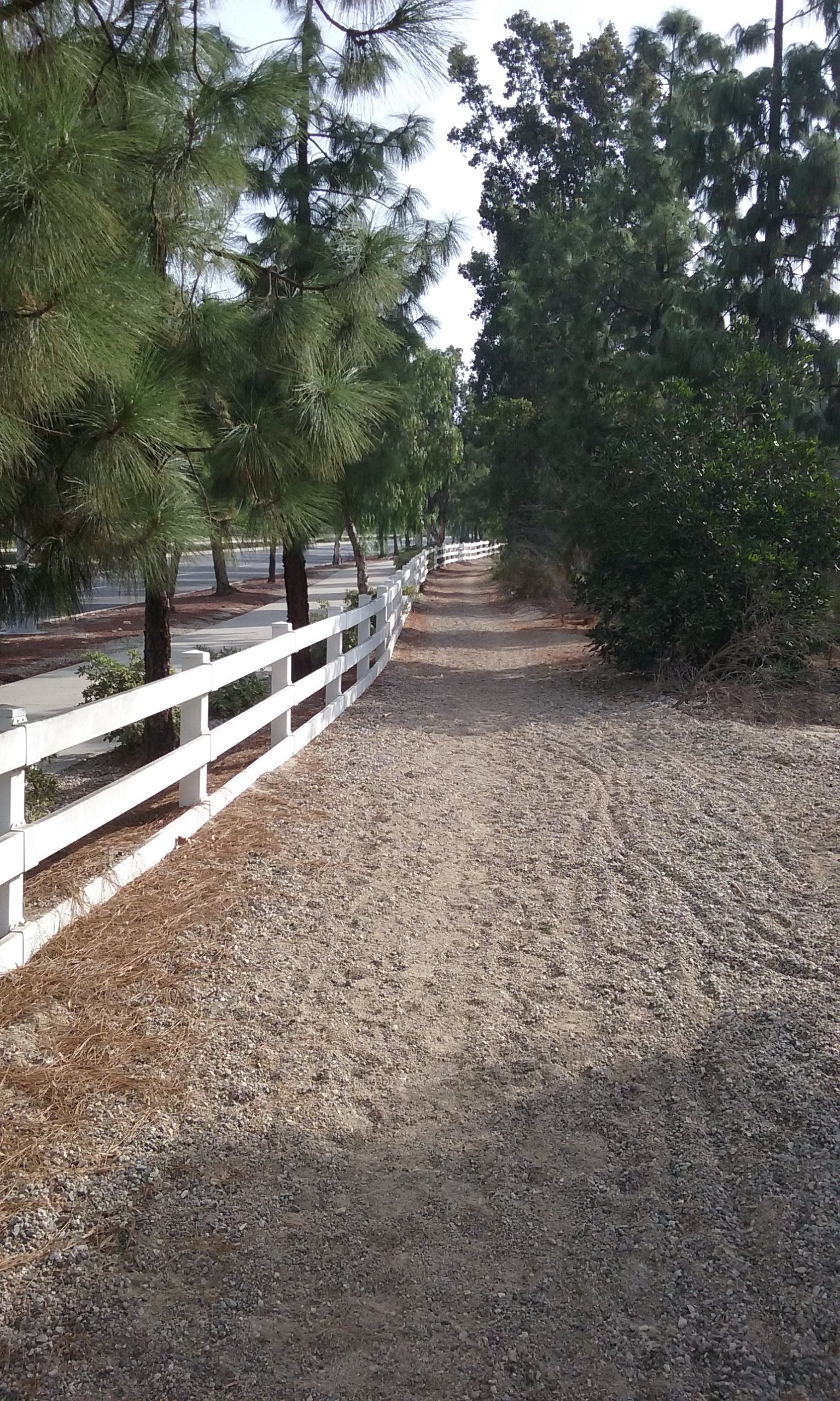
The trail is along side the golf course property. There’s two paths; officially the trail is the inside most path on Bastanchury’s very wide sidewalk. The path is tree lined. In fact three rows of trees. From the walking trail there’s still another 20 feet to where the cars are. There is a choice on where to walk. Walking on rock is not pleasant for most people, but the concrete sidewalk is closer to the cars on Bastanchury and thus noisier. You have to make your choice right out of Payne Stewart Golf Course parking lot. For the entire mile walk alongside Bastanchury there are no openings in the fence that separates the side walk from the rock path. So you can’t take turns walking where it’s noisy and then walking where it is rough. In addition to the two paths, there are three rows of irrigated trees. This expanse is probably a way of preserving space for future expansion of Bastanchury. Another theory is that utilities (water, power lines, telephone, etc.) are under here rather than the street so maintenance won’t disturb traffic.
____The trail in this direction (east) ends at State College Blvd. but a hundred yards before that there’s an informative sign and a trail that leads up past some oil wells to join the Panorama Trail. <–Click there for more on that much more scenic trail. It is interesting to note that the Summit House Restaurant rents their space from the Parks and Recreation Department. The top of the hill which the Panorama Trail goes over is also Parks and Recreation but between the top and the restaurant is golf course and oil company private land. Somehow there is right-of-way for walkers to go through to the Panorama Trail. Panorama Trail goes over the top of the highest hill in Fullerton. It offers an incredible view of the golf course, La Habra and all the way to Los Angeles.
 West of Payne Stewart (out and back to the Sports Complex 2.0 miles)
Walk out of the golf course parking lot and walk west along Bastanchury. The decomposed granite trail turns south following Brea Blvd for a half a mile to an intersection named Ashburn Terrace. Cross the Brea Blvd there and follow the much more rewarding “Lost Trail” into Brea Dam Recreational Area. Notice how wide the trail is. It eventually becomes a normal dirt trail about the time you come to a long concrete sidewalk that leads to the right into the Fullerton Sports Complex. There’s water fountains, and restrooms there. You can see the Sports Complex from far off because of the tower lights over the ball diamonds. For more detail on the trails which start from the Sports Complex click here–> Lost Trail.
Picking Up Trash Along the Way
The East Coyote Hills Trail is very well attended by the maintenance personnel of a home owners association, the East Coyote Hills Golf Course and the city. So there’s no much reward available to you in making the scenery more attractive. But if you have collected some trash, you will find a trashcan when you reach the Little League field. Unfortunately, there isn’t one in Trail Rest Park but a few hundred yards on there’s one where Lost Trail passes the Sports Complex. Click here –> for tricks to make picking up trash more fun than exercise.
East Coyote Hills / Panorama Trail Loop (2.8 mi)
If instead of crossing Brea Blvd, you can continue south past a Little League field where the trail leaves the street (finally) and becomes a nice horse trail again. Right there at the Little League field the name changes to Panorama Trail. (There is very little that goes on at the Little League field that would be of interest to walkers.) This takes you away from Brea Blvd and down into a bowl below street level and alongside the golf course. It eventually takes you into the Panorama Nature Preserve with its fantastic view. Further on, the Summit House Restaurant where the East Coyote Hills Trail can be picked up again in a loop. The loop is 2.8 miles. For more on that loop go to the Panorama Trail webpage.

Trail Rest Park (the virtual park)
Washburn Terrance is the entrance to a gated community. You will come to it as you are walking south on Brea Blvd. Further on is the Little League field mentioned above, but right there you can use the very large crosswalk to get to other side of Brea Blvd and Trail Rest Park. This was mentioned above for getting to the Lost Trail on your way to the Fullerton Sports Complex, but here’s a few more words on what could someday be a very important park. Right now think of it as a virtual park. There’s nothing that resembles a park here but there is something of a grand entrance which is visible from the road. If the Trail Rest Park is to be developed it will have to take into account the lack of nearby parking. It doesn’t need to have a parking lot, to be very worthwhile however. It is very aptly named “trail rest” park because it is the intersection of three major trails. It can be used as a resting stop for each.
- To the north is East Coyote Hills Trail to the golf course and beyond that to the Summit House.
- To the south you will come to the Panorama Trail which goes through the best viewing spot in Fullerton.
- The third trail begins on the Trail Rest Park side of Brea Blvd and goes west to the Brea Dam Recreational Area.
There are other trails in the Brea Dam Recreational Area, including access to a trail that goes alongside a different golf course. The more interesting destination is “Coyote Hills Ranch”. It is private horse stable with direct access to Fullerton’s 28 miles of equestrian trails. For more detail on that goal, see the webpage–> Lost Trail.
Questions:
Why in the heck is the sidewalk so wide on Bastanchury?
Bastanchury is not only wide and fast, but meanders through the city. Why? What ancient river bed or railroad track was there before it?
Is it true that the Summit House Restaurant rents their space from the Parks and Recreation?
Why is the Lost Trail for about 1,200 feet out of Trail Rest Park so wide? You could drive a truck down the lane without disturbing any walkers.
Suggestions for Parks Department
To bring more attention to Trail Rest Park, it should be cleared and a picnic table placed there. Even if the picnic table is not used, it is a kind of sign that says “this a significant place.” To make it even more of a place, an information sign would be useful that describes the three trails available from there.