The the most famous path in Fullerton is the “half-marathon Fullerton Loop”. (Click here–> for map.) If the Fullerton Loop isn’t famous for you then you probably don’t own a bicycle. But just living in Fullerton for a while you learn of the Juanita Cooke Trail as the most famous “trail” in Fullerton. The biker’s Fullerton Loop use the Juanita Cooke in two places. The Juanita Cooke is the first of two abandoned rail lines to be converted from rails to trails. (Click here to read more about –> Rails-to-Trails)


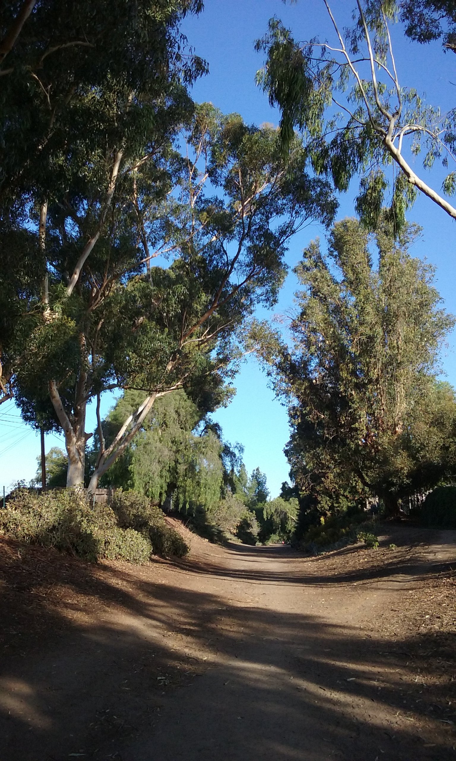
The Juanita Cooke Trail goes 2.8 miles, straight as an arrow, from the county courthouse (Berkeley at Harbor) to the Walmart parking lot on Imperial. Except for about two blocks of sidewalk the entire distance is a wide dirt trail shaded on both sides with tall trees. The trail has been groomed by the Parks Department for a long time which accounts for why the trees along the side are so tall. Along the way (north of Bastanchury) you may see pipes sticking slightly out of the dirt. These were installed when the trees were young. Once established, watering was no longer needed and the pipes were left in place mostly out of sight.
Shaded, and quiet is the most noticeable feature, but the most amazing feature is that there’s only two places where you cross a street. There’s no street in Fullerton that goes that many miles without interruption. That’s because the Juanita Cooke was a railroad built in 1918. More on that below.

Cooke’s Corner
The Juanita Cooke is best known for its starting point at the county courthouse. For bikers it is the principle starting point. But do consider Cooke’s Corner instead, as the starting point for walking the Juanita Cooke.
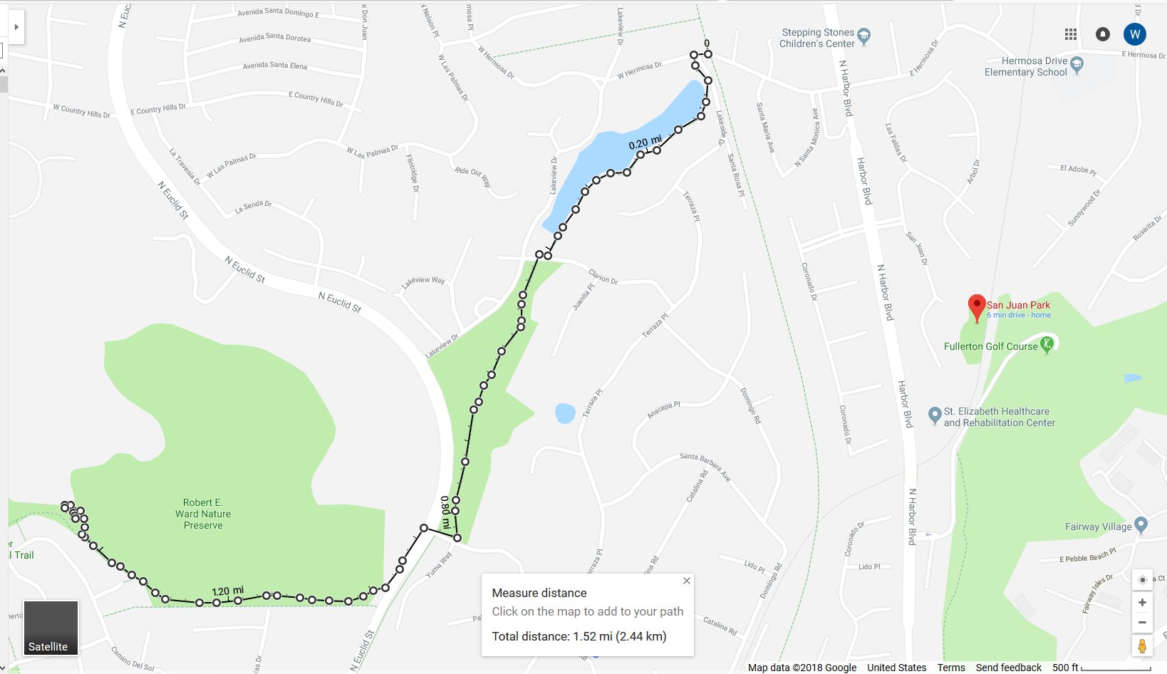
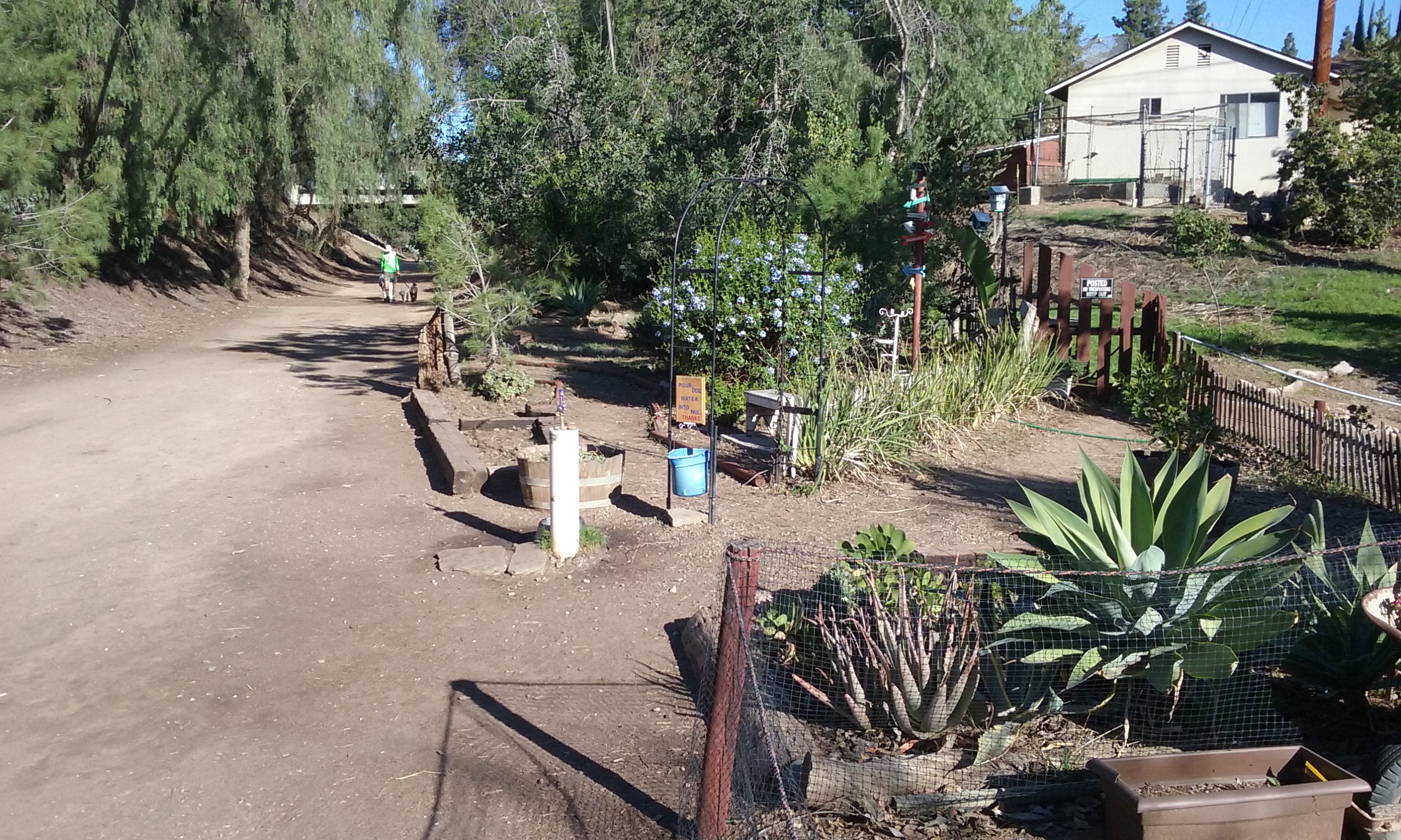
Cooke’s Corner is at the north end of Laguna Lake. From Euclid take Lakeview Drive east to Hermosa and continue east on Hermosa one more block. If you are coming from Harbor take Hermosa Drive west. Parking is on the side of the street that is parallel to Juanita Cooke; Lakeside Drive.
Fullerton Public Works landscapers call it Cooke’s Corner because it is triangular in shape and the main trail through it is the Juanita Cooke. Why it is the best starting point for walkers is that it is easy to drive to and it is the starting point for two other trails. The Bud Turner Trail starts about 100 feet from Cooke’s Corner. The Lucy Van Der Hoff is about 1/4 mile away. These other trails are described in the web page: –> Laguna Lake Park. Cooke’s Corner is essentially, the north end of Laguna Lake which is a reason to make Cooke’s Corner a destination as well as a starting point.
Out-and-Back From Cooke’s Corner (1 mile, 1.5 miles, 2 miles, 3 miles and 4.6 miles)
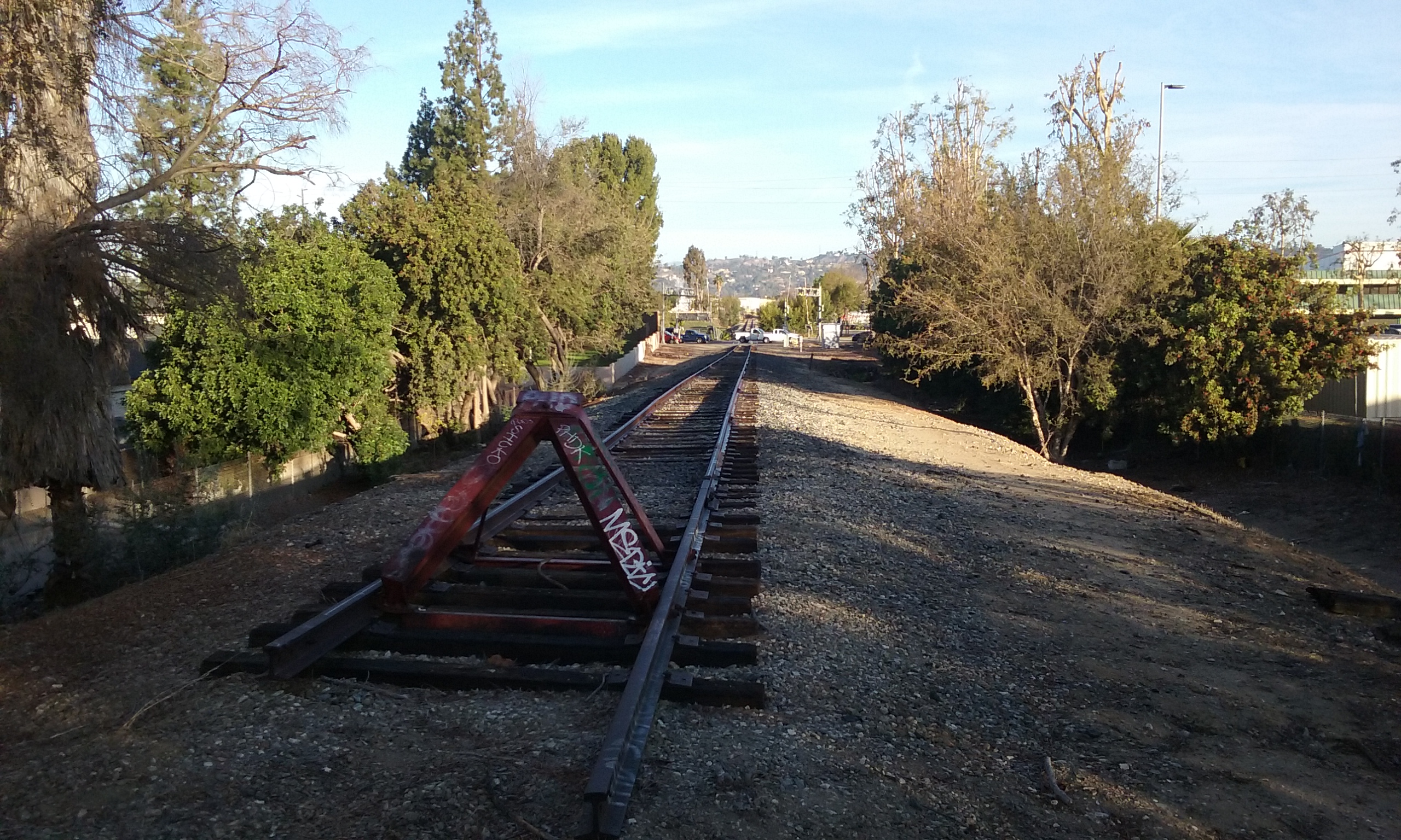
- To give yourself a goal going north there is the very end of the Juanita Cooke at the Walmart on Imperial; ½ mile. (1 mile total). There is actual 1917 rail at the end.
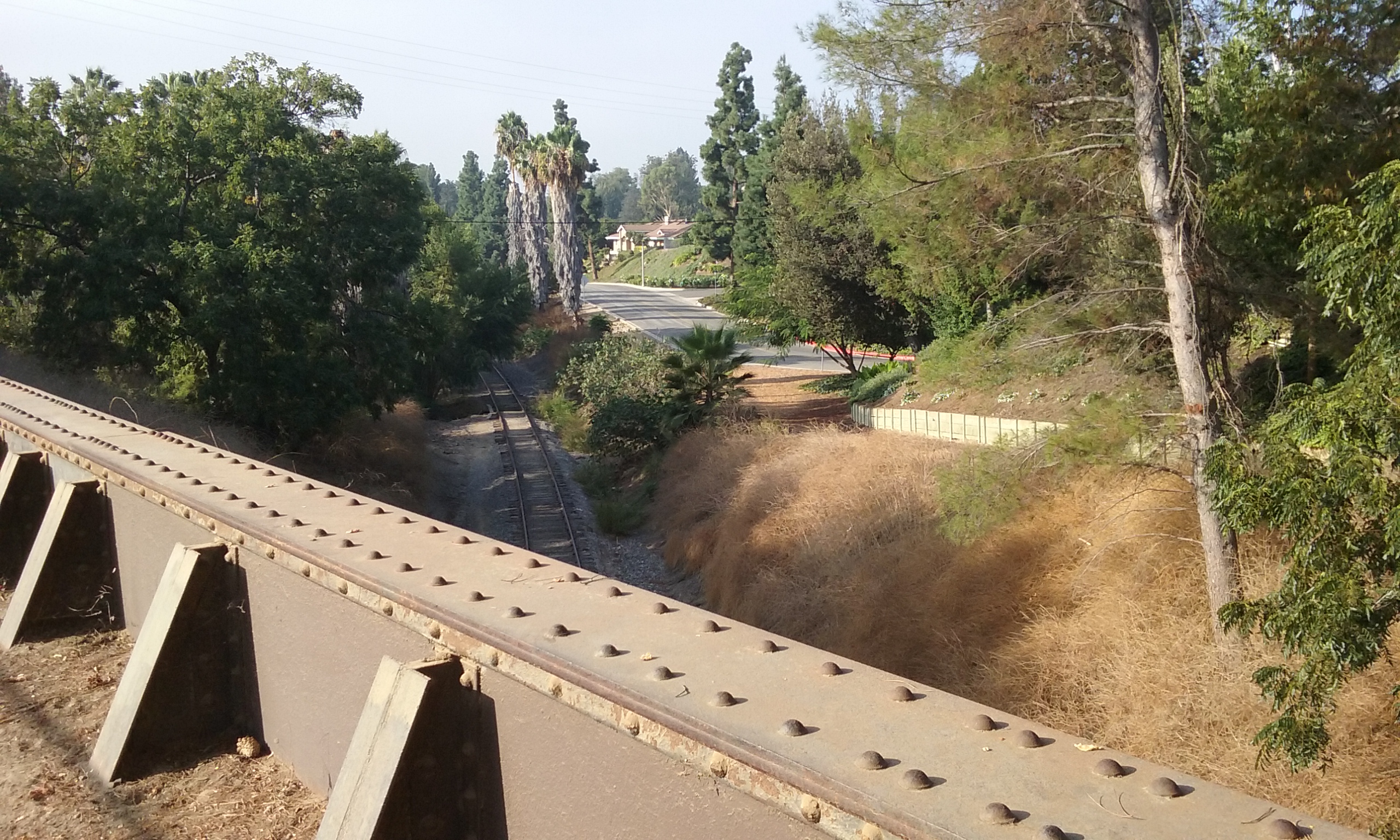
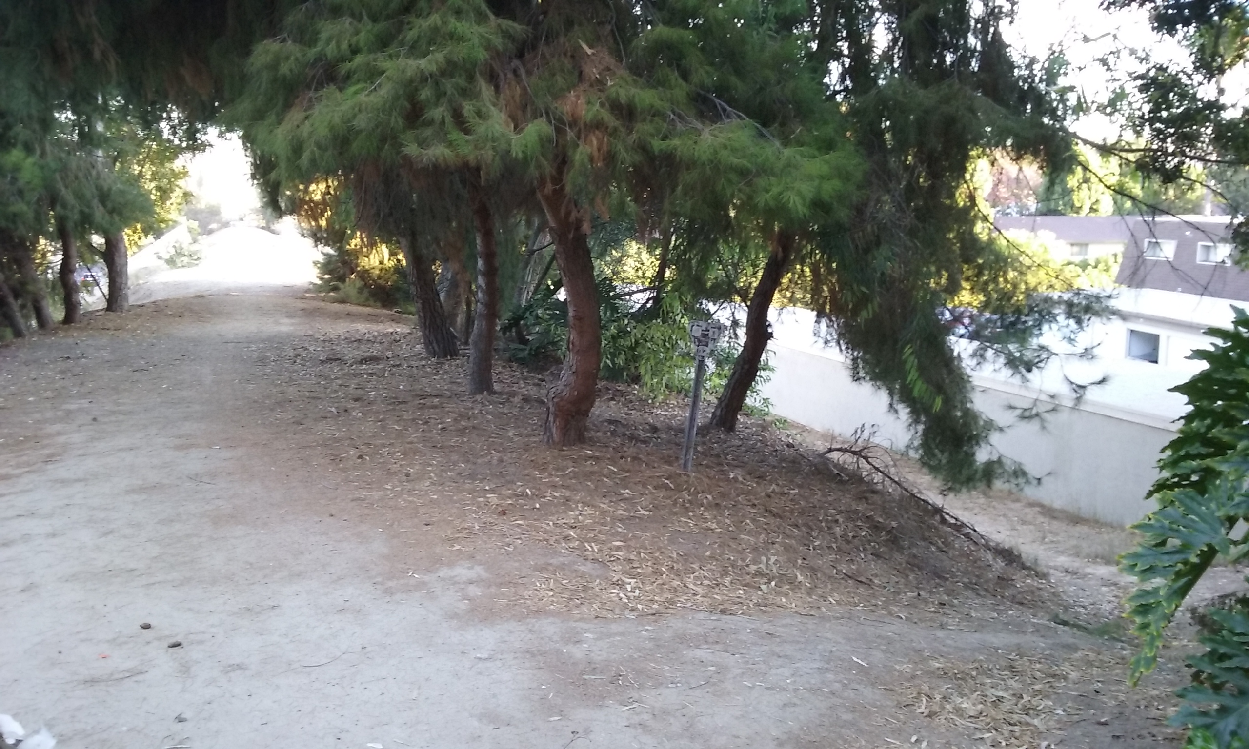
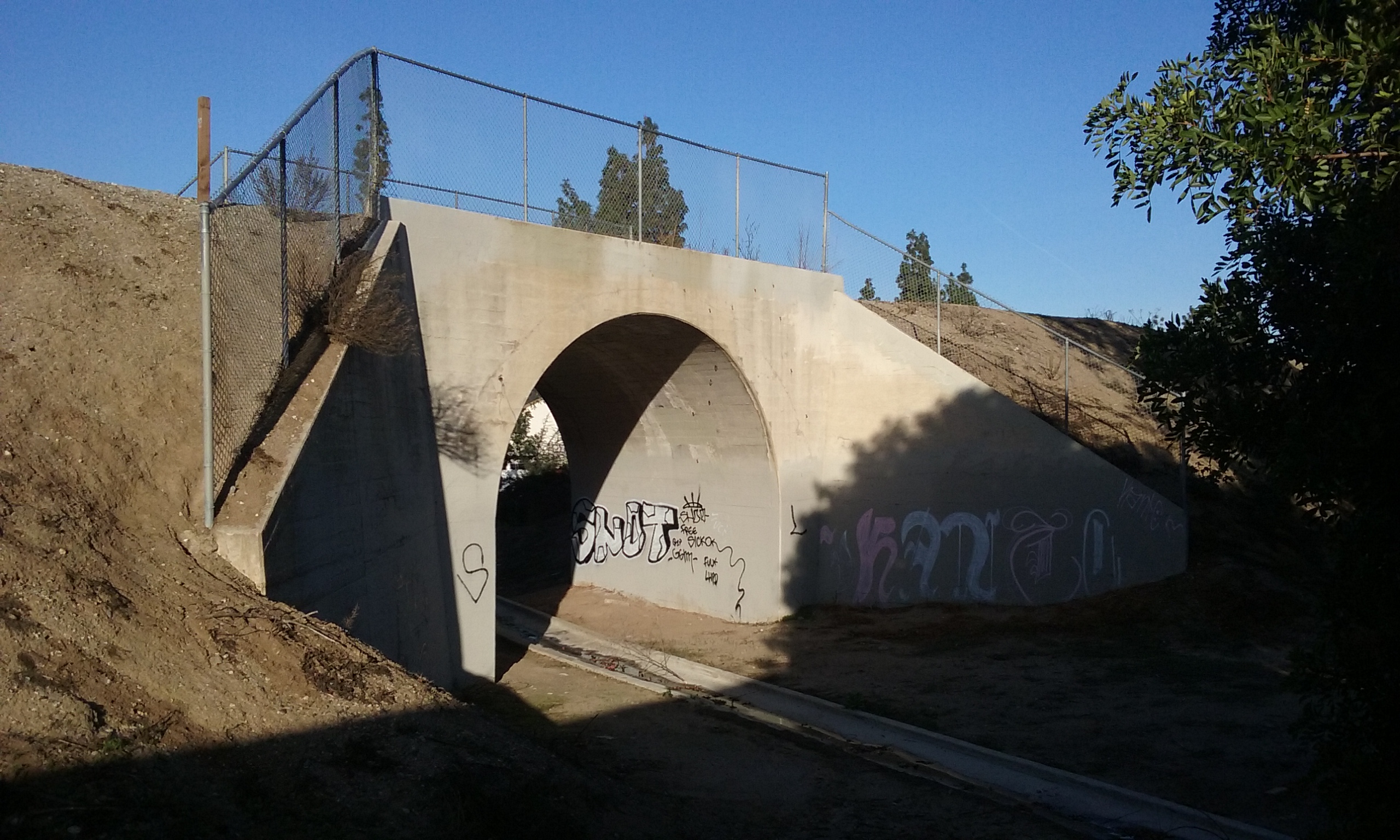
- To give yourself a goal going the other way, there is a bridge ¾ mile along where the Juanita Cooke passes over another abandoned rail line. (1.5 miles total). When going back (north) just north of the bridge is a wide part of the trail. That point also marks where a secondary bike trail goes along, but up above the normal trail. Click here for a picture of that–> Alternate Trail. It should be noted before you go up there . . .
- that this section of the Juanita Cooke is part of the Fullerton Loop so some bikers may be going fast on both trails.
- that the direction bikers are encouraged to go on this portion of the Fullerton Loop is from the north. So the best direction to walk is north so you can see them coming.
- If you do plan on trying that alternate trail, please read –> biker/hiker etiquette.
- If a picnic lunch is the goal, and you don’t want to eat on the bridge find your way down to the abandoned rails going north east. You will see the Fullerton Golf Course on your right but follow the Union Pacific rails a quarter of a mile further to San Juan Park. It’s easy to see the park on your left. (2.0 miles total)
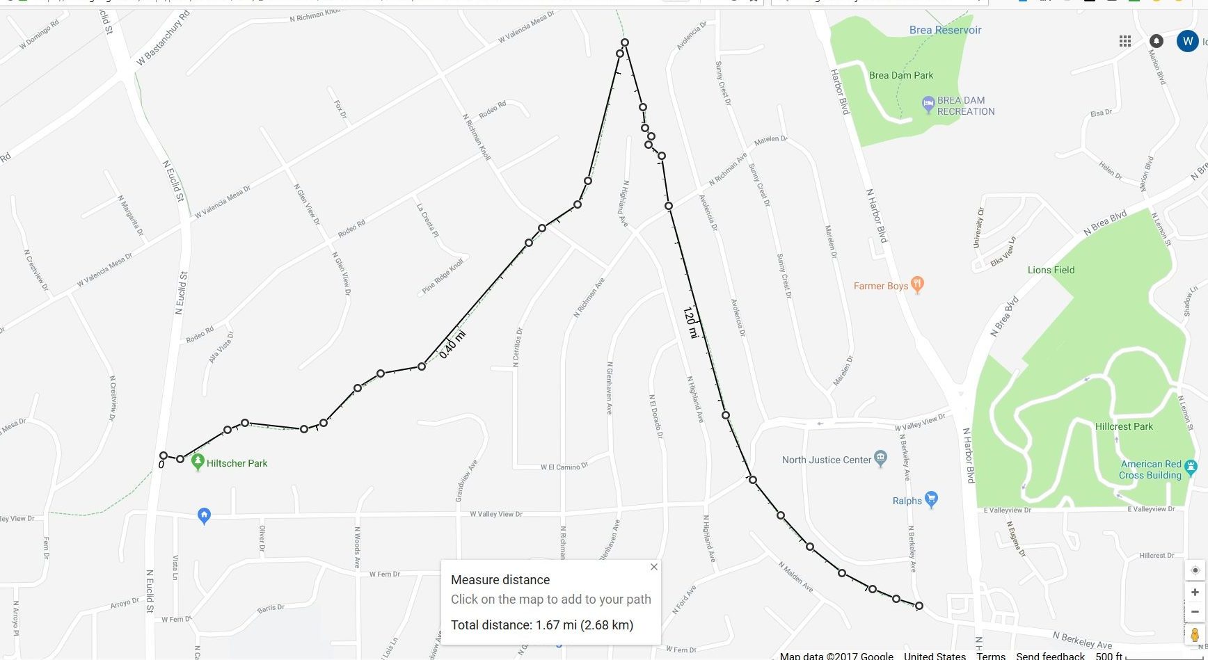
- To give yourself a goal going west from Cooke’s Corner, there is the highest point on the Nora Kuttner Trail. (3 miles total). Landscape guys call it “top of the world.” It takes a bit more in the way of description. In fact you may find the map to Nora Kuttner easier to use. Here it is in words, if you prefer that…
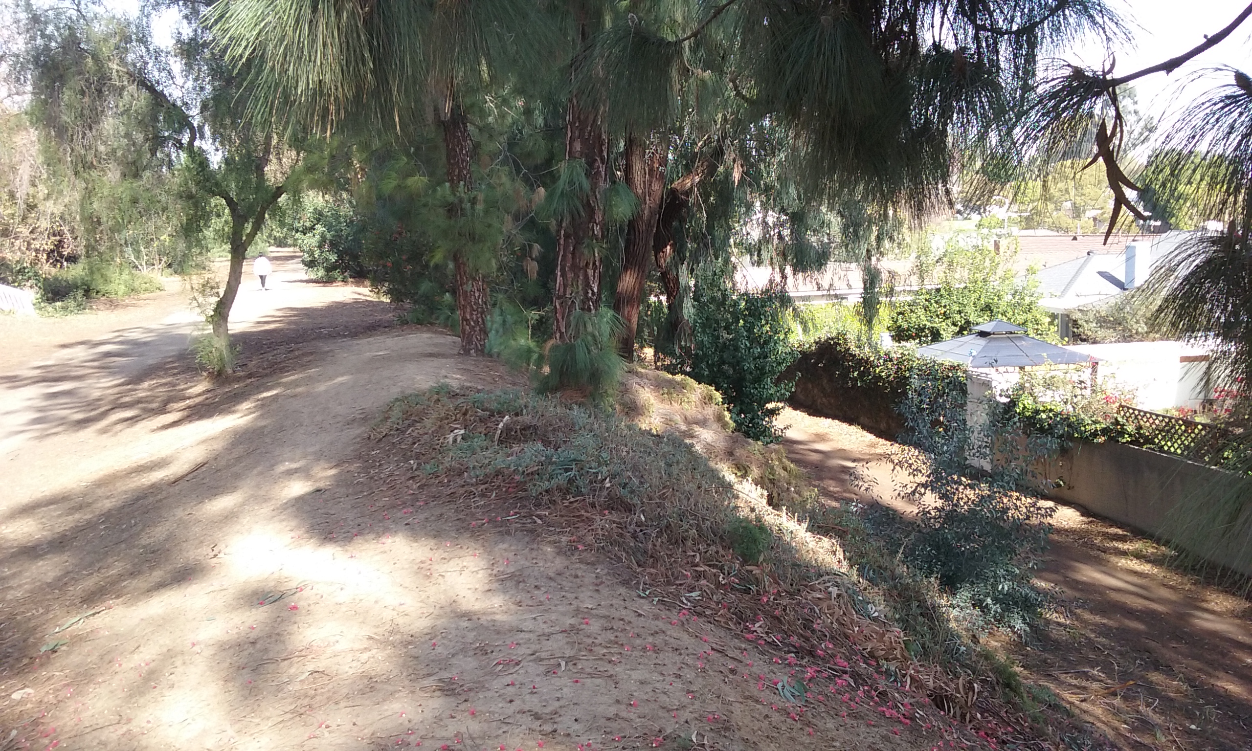
Start by walking along the lake (either side). The lake is not quite a half mile long. Past the dam stick to the left on a perfectly groomed dirt trail through a park that is actually longer than the lake. You will be on the Bud Turner Trail. This park is the Laguna Lake Park. The park itself is actually larger than the lake. Instead of following this perfectly groomed dirt trail, choose the narrow bike trail to the left that takes you to a higher level across the park. It lets you down to street level at Lakeview Drive. Cross Euclid at Lakeview Drive at which point you are no longer on the Bud Turner. Walk south to the entrance to the Nora Kuttner Trail. The best reason to be on the Nora Kuttner is ½ mile further, to the “top of the world” where with a bit of exploration you can find places with incredible views looking east and south. The total distance from Cooke’s Corner out and back to the “top of the world” is (3.0 miles total). - The longest out and back from Cooke’s Corner is the very end (or the very beginning if you are a biker) of Juanita Cooke; the county courthouse parking lot. That is a round trip distance of (4.6 miles total). However, that end is nothing to look forward to. That is, unless you have some place to eat as your south end goal. (See below.)

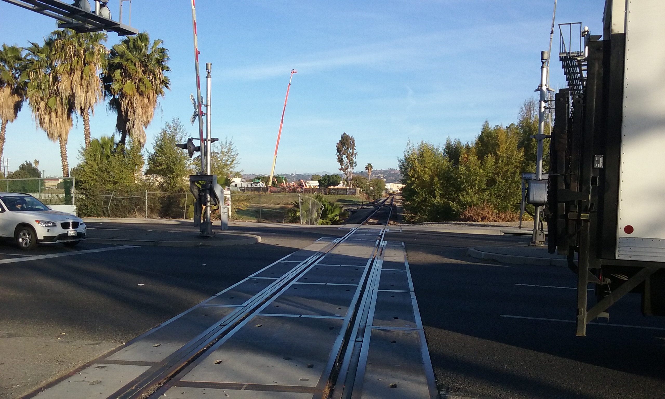
Going The Other Way . . . Making Cooke’s Corner your Goal (4.6 mi total) In this case, start at the main parking lot for bikers who do the 11 mile Fullerton Loop. It is the parking lot of the North Justice Center (Superior Court of California). On Harbor, north of Chapman, turn left (west) on N Berkeley Ave. From there is it obvious where to park. The trail entrance (photo to the right–>) is at the extreme south end of the parking lot. This is about where the billboard (the one on the right) was, in the picture below.
Lunch at the North End
Starting at Cooke’s Corner going north there is the very end of the Juanita Cooke Trail; the Walmart parking lot on Imperial; ½ mile. (1 mile total). Walking along Imperial east there’s a number of places that seem to surround the Walmart. The Pepper Shaker to the north. Wendy’s on the very corner of Harbor and Imperial. To the west of Walmart (on Harbor) is Moro’s Cuban Restaurant and a Mongolian BBQ.
Lunch at the South End
Starting at Cooke’s Corner going south there is the beginning of the Juanita Cooke; the County Courthouse parking lot on Valley View a block west of Harbor. (4.6 miles total) That is a bit of a walk, but then there’s lots of places to eat. The very end of the trail is on Berkeley just a hundred feet of so from Classic Rock Cafe and the Black Bear Diner. North of those two are four lunch places that surround a Subway. Ralph’s has a Starbucks inside as well as Sushi and a salad bar.
_______________________________________________________________________

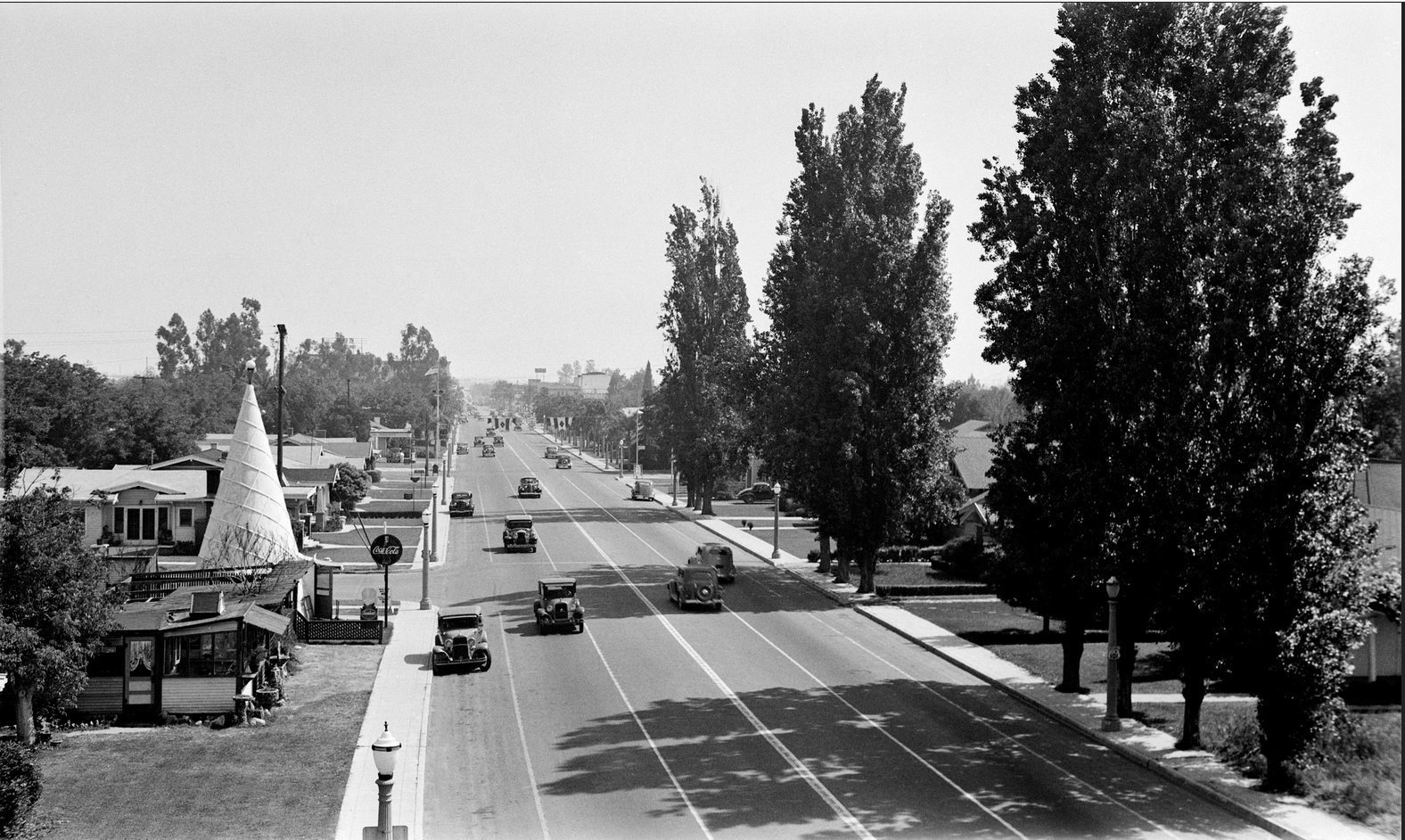
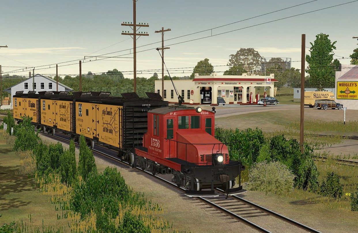
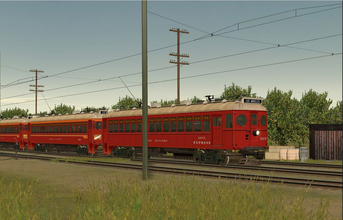
Pacific Electric Line Through Fullerton Yes, the Red Car was in Fullerton. And it went right where you are walking, on the Juanita Cooke Trail. The Red Car was reduced to one car a day by the time the service ended in 1938. (The Red Car between Long Beach and Los Angeles ran until 1961.) The passenger service began in 1918 and the rails continued carrying freight until the late fifties. The picture to the left is about the most famous picture of Fullerton history. The words “Welcome To Fullerton” doesn’t make any sense now, but from where those words were seen then, Fullerton was undeveloped land.

The Pacific Electric passenger service (Red Car) connected Fullerton and Whittier. A short walk to another Pacific Electric line would take you all the way into Los Angeles. But its major use was moving citrus from where St. Jude is now, to the packing houses next to what is now the Amtrak station. Pacific Electric historian Al Donnelly, gives this perspective on how this line was used: “The line was never intended as a passenger service, but more as an invasion of Santa Fe freight territory.” (There was a Santa Fe spur where Bastanchury Road is now.) What you would see on the bridge above, even before 1938, was rarely a passenger Red Car, but instead a small electric engine pulling a few ordinary freight cars. This combination had the strange name: “juice pack” (see gallery below). After 1938 only the juice packs would be seen.
The Fullerton Depot is now the Hop Scotch Restaurant on Commonwealth. Before arriving there, the freight went along what is now Santa Fe street where there was a row of packing houses. The strangest aspect of the Pacific Electric in Fullerton is that before it came to the packing houses, it passed right through the middle of Fullerton College.
For a slide show click here –> Electric Trains Through Fullerton
 Silent Film Director in Fullerton Lois Weber was for a time one of the most famous Hollywood film makers, and the most highly paid director in Hollywood. She may have maintained a home there, but she was for a time a Fullerton resident. She lived on Union Street just a few blocks from where the Juanita Cooke Trail starts. That house is now the home of whoever is president of Cal State Fullerton. Before it was given to the California State University System though, it was owned by Stanley Chapman who bought it from Lois Weber. It is curious that this link to the –> Chapman House makes no mention of what is really the more interesting history of that location. The home and property below it was called El Dorado Ranch. In fact, if you live on Brookdale or Union between Highland and Harbor, your house was built by her and her husband who rented them out as income property. Because of the prestige of the present residence, the house is separated from the street by lots of trees and a high fence, but from the street, you can see the top of the observation tower that was built next to the house and at least you can say you’ve been there. Here’s a map to Lois Weber’s, from the Trail. But before you go there, check out this short review of the book on Lois Weber written by Cheri Pape the history librarian of the Launer Room of the Fullerton Public Library. Here’s a 2018 video from KCET on Weber and other women in Hollywood. The most interesting point of that video is why there were women film makers then and not later. In the early days of film, it was considered art and not a multi-million dollar business enterprise.
Juanita Cooke Trail Mysteries
- One mystery is the steel bridge that goes over the abandoned Union Pacific line. (Sixth picture below.) Why the dates on the rails that pass under the bridge are newer by 5 years than the bridge itself? How can the lower rails be put in after the bridge was built?
- Another mystery is this really –> old vertical pipe near Laguna Lake.
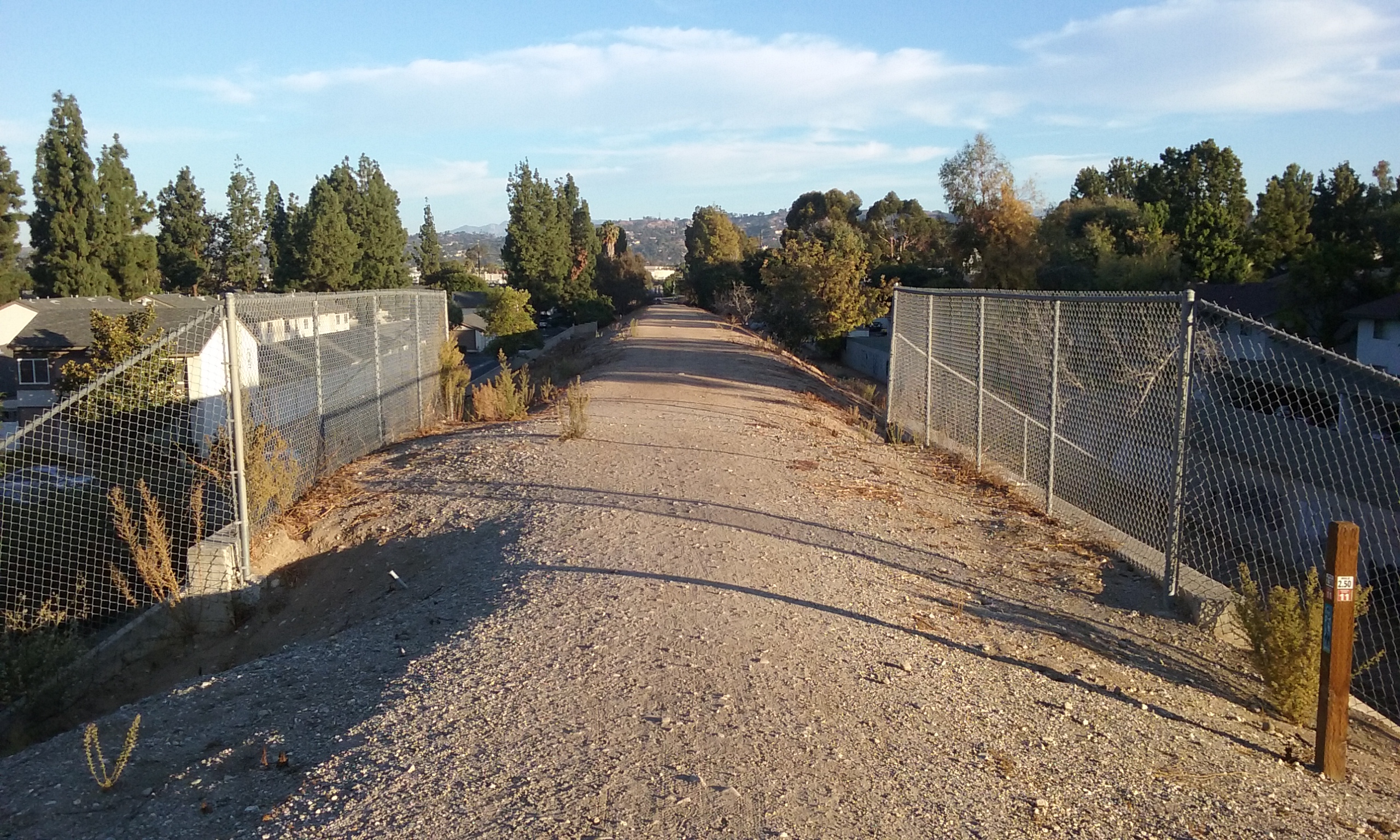
- North of the steel bridge the trial opens up to 100 feet wide. Was there a siding there?
- North of that it gets narrow again but there’s a fence across the trail. What was that to mark.
- The tracks were removed in 1962, except for the last hundred feet. That last hundred feet has a brand new signal. Why?
Click on a picture to see it full screen.


Suggestions
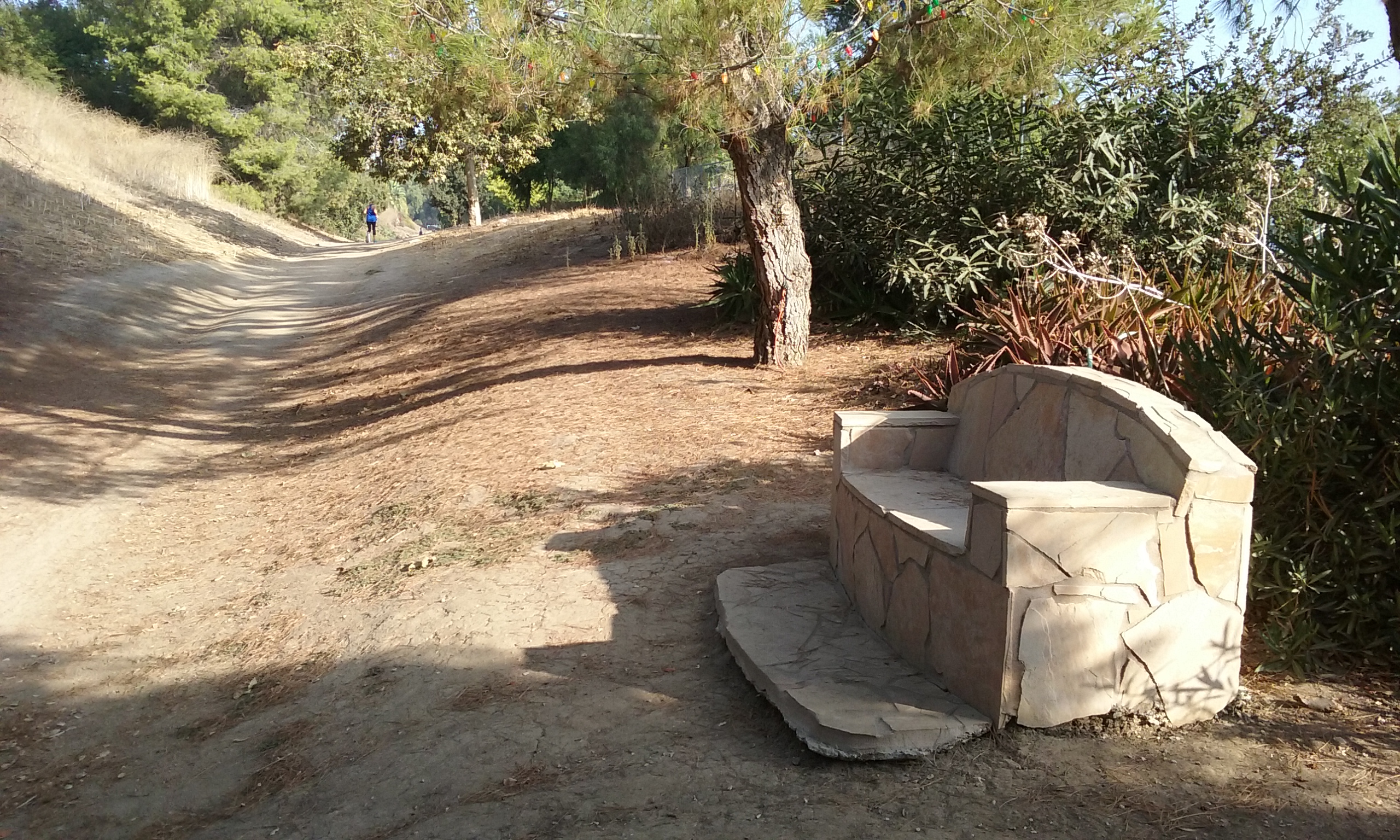
This might be a good trail to put stumps in the ground every ½ mile or so for seniors who need to sit down periodically. It would be good to see how these are used for a year or two before putting them in any other trail. The effort may not be worth it, if they are never used. But if landscaping has to cut down dead trees the cut should be made 19″ off the ground.
Since this trail is most famous and the most perfectly maintained (as far as I’m concerned) I think it should have more of a grand entrance. The reason there isn’t one at the court house end is probably because it’s not clear where to put it. My vote is where it crosses Valley View. There’s lots of traffic there and so it will be seen by thousands. (The reason for making the trail prominent is to advertise that Fullerton is proud of its trails and parks and that they should check it out some day.)
Where Juanita Cooke crosses Valley View on the court house side. . . the ideal spot for a picnic table is on county court house property. It would be nice if some Fullerton official could talk the county into putting some picnic tables and benches there. (The argument would be that court house staff uses the trail, so how about putting a picnic table as their contribution.)
On the zig zag path down to Bastanchury, it would sure be nice to have a sign that says “Trail Continues 2 Blocks Along Morelia” or something like that. This isn’t so much needed but more as a show of being proud of this the premiere trail.
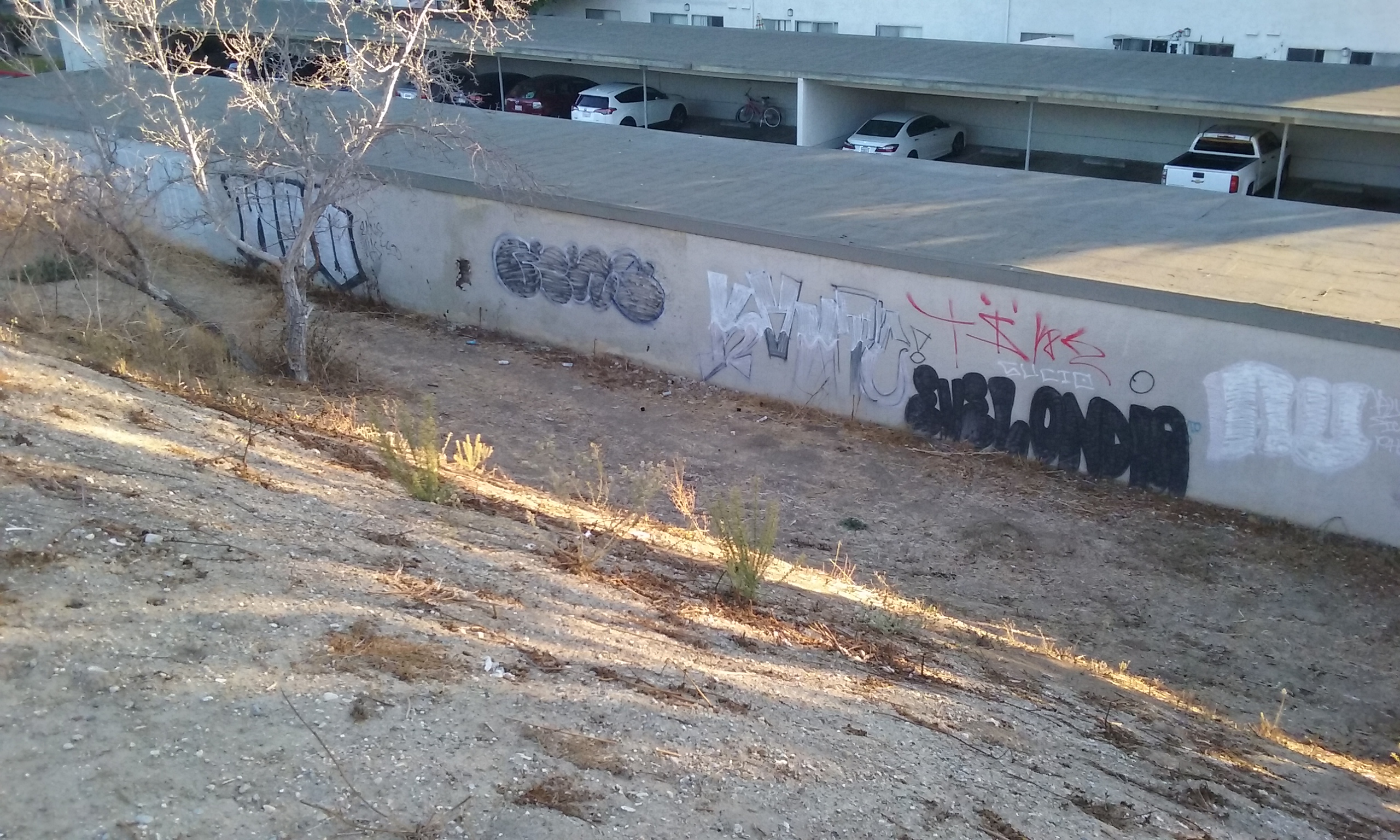
If the city council ever wants a wall devoted to street art, there’s one place that is just begging for that. It’s next to the Juanita Cooke near where it crosses over the Lucy Van Der Hoff Trail. It is ideal because the audience is limited to those who walk on the trail (it’s 1,400 feet from the Walmart parking lot.). But the best reason is that it is used just for purpose anyway. But because it is not “sponsored” by the city, there’s no trashcan there so the spray cans are just get left there on the ground. If it was a “sponsored,” city thing, not only would there be a regularly serviced trashcan, but you could put up a sign that says…
“Once a year this wall will be erased.” Or something that shows sponsorship.
As to the argument that the owners of the wall wouldn’t like that. It used for that purpose now and they aren’t objecting. The difference is respectability. If the wall appeared to be sponsored, artist more than taggers would regard it as theirs. And that means more art and less graffiti.
Next to the iron bridge, on the corner of Santa Barbara and Domingo there is a trail that goes up to join the Juanita Cooke. It does not go down to the other trail, but it looks like it does from the bridge. The way you go down is 100 yards farther south. This is very confusing. A sign that says “Use other side of bridge to go down to the other trail” would be OK, but better than a sign is to make a trail that goes down there from Domingo. A hoe and rake and about about an hour’s work is all it would take.
Would it be appropriate to put a sign at the opening to Horse Alley? Or should we keep it secret. I prefer it be a secret.
There’s some rather large open spaces next to the trail north of the iron bridge. Is there a way that sort of “claims” that excess land for Parks by putting a picnic table there, or maybe a fenced off garden of no-need-to-water native plants.